 |
|
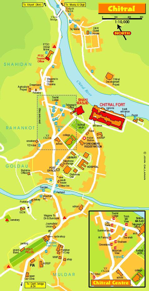
The Chitral Town Map.
The Chitral Valley at an elevation of
1,128 metres, is favourite with mountaineers, ?anglers, hunters,
hikers, naturalists and anthropologists. The 7,705 metres Trichmir,
the ?highest peak of the Hindukush range, dominates this 322
kms. long exotic valley.
Chitral district has Afghanistan on its north, south and west.
A narrow strip of Afghan ?territory, Wakhan, separates it from
Tajikistan. The tourist season in Chitral is from June ?to September.
The maximum temperature in June is 35 C and the minimum 19 C.
In ?September the maximum is 24 C and minimum 8C.
|
| |
|
 Home
| History |
Map Home
| History |
Map |
Copyright
© 2003-04, The Vision2004 Web developers Chitral NWFP. All Rights Reserved. |
|
|