 |
|
|
|
|
|
|
|
|
|
|
|
|
|
|
|
|
|
|
|
|
|
|
|
|
|
|
|
|
|
|
|
|
|
|
|
|
|
|
|
|
Trail 269
Lakeview Mountain |
|
|
|
 |
|
|
|
This trail runs from its trailhead on Highway 57 to Trail 365, the Kalispell-Reeder Bay Trail.
To reach the main trailhead, travel north out of Priest River on Highway 57. The trailhead is located between milepost 35 and 36. Bismark meadows is located directly across Highway 57 from the trailhead. To reach the Lakeview Mountain trail from the Kalispell-Reeder Bay Trail, refer to my writeup on Trail 365. |
|
|
 |
|
|
|
|
|
|
 |
|
 |
|
|
|
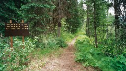
The Trailhead on Highway 57 |
|
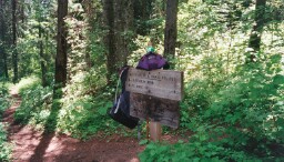
Intersection of Trail 269 and Trail 365 |
|
|
|
The trial begins near Highway 57 at an elevation of 2680 feet and ends at Trail 365 at an elevation of 2600 feet; however, Lakeview Mountain is situated between the two ends of the trail. The maximum elevation on the trail is 4074 feet.
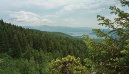
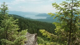
The first view of Priest Lake and its surrounding area are encountered when one takes a short hike to an open hillside on an un-numbered trail that is encountered about 2 miles up Trail 269 from the Highway 57 Trailhead. A metal 269 Trail Marker is posted at the intersection of Trail 269 and the trail to the open hillside. |
|
|
|
 |
|
 |
|
|
|
|
 |
|
|
|
|
|
 |
|
|
|
|
|
|
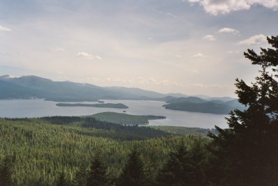
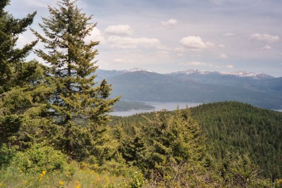
View of Priest Lake and its more prominent islands from a spot near the top (on the Trail 365 side) of Lakeview Mountain Trail |
|
|
|
|
|
 |
|
 |
|
|
|
|
|
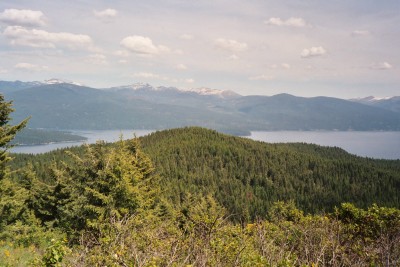
Above - Three Views from the Open Hillside |
|
|
|
|
|
|
|
Right - More views as seen from the same spot as described in the picture (above, right) of the lake and its islands. |
|
|
|
|
|
|
|
View of The Narrows |
|
View of Chimney Rock |
|