Mount.Malepunyo
Brgy. talisay batangas city 1000+m a s l


Mt.Malepunyo - or Mt.Malarayat to others since its located near malarayat golf course and mt.malepunyo is the backdrop, its an inactive volcano located in Brgy. talisay Lipa city Batangas towering at 1000 + m.a.s.l., its slope densely covered by second growth forest it boast a panoromic view of all the

"a glimpse of civilization. town of atimonan quezon is visible at the saddle campsite"
major mountains in southern tagalog region namely Mt.banahaw Mt.cristobal,Mt.maculot, and Mt.makiling on its summit campsite.it has numerous peaks namely manabo, bagwis,malepunyo peak and someothers that are unknown to regular hikers.
Nov. 2,2001 Trek-sierra choose the rugged mount malepunyo as our anniversary climb the plan is to set camp on its summit but unfortunately we got lost in the first face of the climb. cogon grass grows abundant along the trail head virtually covering the trail making trail scouting an ordeal, plus the fact that no one in our group climb malepunyo before we took the trail goin straight to the hut instead of going down to a small creek where the trail going straight to the campsite can be found. we did several backtracking but we cant find the trail we stumble on a saddle 20 to 30 feet wide connecting two unknown peak. we decided to cross the saddle and try the peak south of the saddle...it has less than a feet wide of muddy trail covered with LIpa tree the trail leads us to a buttress more or less 200 meters below the unknown peak. the buttress is densely covered by primary growth forest no clearing to set a camp not even a spot to sit. the time is 5 oclock were halfway of the cliff. this is were we dont want to get caught by the approaching nightfall. bail-out is imposible in this situation the only chance is to directly assualt the peak via a 87 degree angle of dangerous cliff covered with moss and loss boulder.( no trail at all... were slowly inching our way up to the peak.) and hope we can find a clearing that can accummodated our fifteen man group. only to find out that there is no clearing at the peak its basalt rock covered with vines anf thorny plants. the only choice is to go back to the saddle before the buttress its 8:00 in the evening we have to bushwack our way down the 87 degree angle of loose rock cliff with no protection at all. one wrong step and it will send you 200 meters at the bottom of the rocky buttress with our flasghlight running out of battery retracing our way back is a pain in the ass. it really make me kiss the earth. finally by 10:00 PM we reach the saddle everyone is relieve its the first clearing we saw since we enter the buttress 5 hours ago.


SUGGESTED ITINERARY:
DAY 1:

5:30AM - ASSEMBLE AT JOLLIBEE ALABANG(Buy additional probitions in the market)
6:00AM - ETD Alabang for Lipa Batangas
8:00AM - ETA Lipa Batangas.(take tricycle for talisay jeep station)
8:15AM - ETD for Brgy. Talisay
8:40AM - ETA Brgy. Talisay(Jump-off)Register at BRGY. hall
9:00AM - PACKS ON BACK START TREK to Saddle
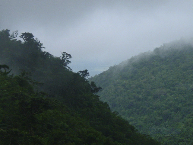
9:45AM - ETA Saddle (take the left trail goin to atimonan Quezon).
11:30AM - ETA Saddle Campsite) fix tent explore the area
6:00PM -Dinner socials
8:00PM - lights-out.


DAY 2:
5:30AM - Wake up call. (Sunrise viewing Magnificent from south east side between the two unknown peaks)
6:00AM - Breakfast, explore picture taking.
6:30AM - Break camp
6:45AM - PACKS ON BACK Start descent.
10:00AM - ETA Waterfalls (swimming, prepare Lunch)
10:30AM - Lunch
11:00AM - Continue Descent
12:00PM - ETA Brgy. Talisay(Depends in team pacing)arrange trip to Lipa
1:00pm - ETA Lipa Batangas.(snack Texas style hehehhe!)
1:30PM - ETD for manila
3:30PM - ETA Manila.....Civilization at last!!

Hosted by www.Geocities.ws

1