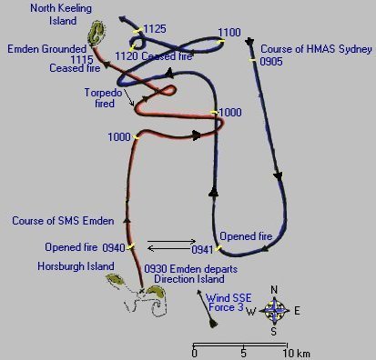
On November 9, 1914, the Emden entered Port Refuge off Direction Island and at
0600 a shore party set off from the Emden to destroy the installations at the Cable and Wireless
Station on the Island. The Wireless Operators at the Station were able to send an SOS before the installations were destroyed by the shore party.
The SOS was picked up by an Allied convoy no more than 55 miles away.
At 0915 Captain von Müller of the Emden realised the presence of the Sydney
and alerted the shore party to return. It was too late for the shore party, and at 0930 the Emden left quickly to join battle which ended just under two hours later with the destruction and grounding of the Emden on North Keeling Island. |