|
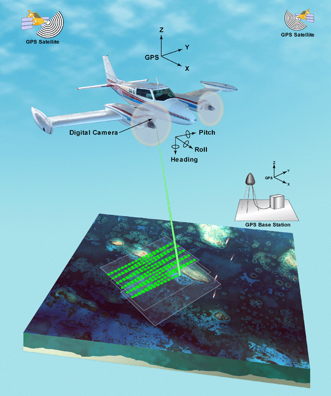
An onboard GPS records the airplane's movements and position, while the LIDAR can track the direction the laser is being aimed. By knowing the grid coordinates and the altitude of the airplane, the angle that the beam is emitted at, and the distance of that particular path, the elevation of the ground at that point can be found.
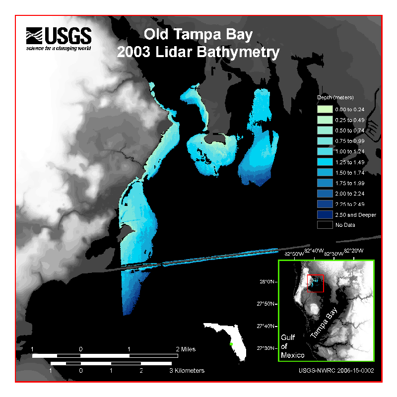
Using LIDAR to create maps can be much more efficient than traditional surveying. In addition to covering a large area quickly, LIDAR can also detect underwater formations. By finding shallow areas and other things underwater, hazards for ships can be mapped out. |
|