![]()
| OS Map Ref SD 794 094 |
Elton Tramroad is something of a mystery. It was built in the second half of the nineteenth century and was in use until the early twentieth century. The tramway started at the side of the canal about 1.3 kilometres (just less than a mile) south of the site of the former canal wharfs at Bury Bridge, and there was a mooring point and a canalside crane for unloading barges. |
|
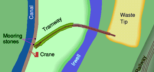
The sketch map to the right shows the location of Elton Tramway. |
|
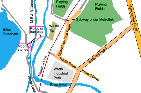
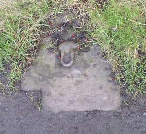
Looking down at the towpath, at the side away from the canal, you will see two mooring stones about 12 metres (40 feet) apart, for tying barges up.
|
|
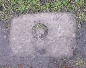
Looking into the field on the towpath side of the canal at this point, a mound is visible where the tramway turned to the right to cross the river. Originally it ran on a low embankment for most of the way across this field, presumably to allow waste to be piled up to a greater height at the other end. |
|
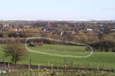
From the embankment of Elton reservoir nearby it is possible to look down onto the route of the tram road, which can be made out as a slight change in surface level, and is shown ringed in this photograph. |
|
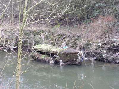
The tramway then crossed the river Irwell on a bridge. Although this has long since gone, there is a large block of masonry in the river, near the bank on the canal side, which appears to be part of the bridge's supporting pier, and has a length of railway track set into it near the top. The riverbank is reinforced with stone walls on both sides along this length. |
|
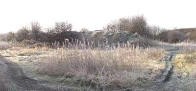
The tramway ended at the southwest corner of this waste heap, reached from Openshaw Fold Road via the tunnel under the Metrolink line. |
|
The drawing below is a larger scale plan of the tramroad, showing how it began on an embankment next to the canal, crossed the field, turned to the right then crossed the river on a bridge before overhanging the waste tip.
|
|
The waste heap is approximately 150 metres long by 33 metres wide by 3 to 4 metres high (500 feet x 110 feet x 10-12 feet). It is flat topped with steep sides and the total weight of material in it will be in the region of 40,000 tonnes. The Ordnance Survey 25" map of 1908 shows it at almost its current extent, though its height is not recorded. |
|