![]()
| OS Map Ref SD 792 086 |
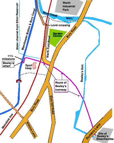
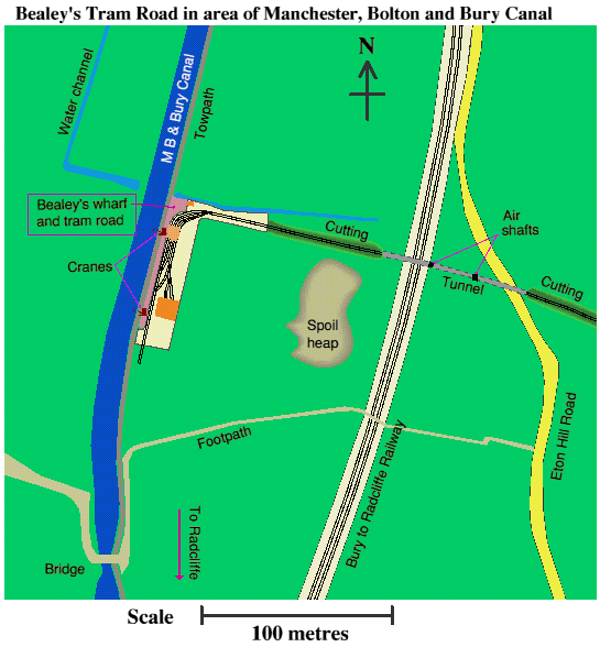
Bealey's tramroad served a bleachworks on Dumers Lane.BleachingBefore cotton fabric can be dyed or printed, or even sold as white, it needs to be bleached to remove its natural beige colour. At first this was achieved by pegging the cloth out in bleach fields or bleach crofts and exposing it to the sun and rain. Bleaching was aided by applying an alkaline solution made from plant ashes, which later had to be neutralised with an acid such as sour buttermilk, or later dilute sulphuric acid. The need for open space to spread out the cloth and water for rinsing meant bleachworks were usually located outside the town centre, close to rivers or streams. The problem with bleaching by sunlight was that it took months, and was only feasible during summer, so as the output of woven fabric increased there was a great demand for chemical bleaching products. The French chemist Claude Louis Berthollet (Napoleon's chemistry teacher!) discovered in 1785 that the gas chlorine, used as a solution in water to form hypochlorous acid, HOCl, was a powerful bleaching agent and this technique was applied to cloth. Originally chlorine was obtained by reacting sulphuric acid with common salt (sodium chloride) and manganese dioxide, but the solution of chlorine obtained was very unpleasant and hazardous to work with. In 1799 Charles Tennant set up the St. Rollox chemical works in Glasgow to make chloride of lime or bleaching powder, which is a mixture of calcium hypochlorite, Ca(OCl)2, and basic calcium chloride, CaCl2.Ca(OH)2.H2O. As a solid material this could be transported and stored easily, and the chlorine can be released for bleaching purposes by treating the powder with a dilute acid: Chemical bleaches whitened cloth in just a few days and allowed bleachworks to operate all year round. However bleaching powder was initially very expensive, selling for £140 per ton in 1800, and some bleach crofts remained in use well into the nineteenth century. Sulphuric AcidSulphuric acid, formerly known as oil of vitriol, has long been a widely used chemical, in bleaching, including manufacture of bleaching powder, and other processes. The first large-scale manufacturing method, the 'lead chamber' process, was invented by John Roebuck in 1746 and involved burning pure sulphur or iron pyrites (iron sulphide) with saltpetre (potassium nitrate) over a shallow depth of water. The fumes of sulphur trioxide which were produced dissolved in the water to form sulphuric acid and the process was carried out in a tank made of lead since lead is one of the few materials not attacked by sulphuric acid. The Bealey FamilyThe Bealey family arrived in Radcliffe in 1732, operating as whitsters (bleachers) from a factory in Dumers Lane and using bleach fields close to the parish church of St. Mary's, next to the river Irwell. Bealey's adopted chlorine bleaching when it became available and opened their own chemical works, where they made sulphuric acid by the lead chamber process from 1791, having six lead chambers by 1799, plus chlorine. It is probable they also made bleaching powder themselves some time later. To support the bleachworks and chemical factory Bealey's needed to bring in salt, iron pyrites, manganese dioxide, limestone, and coal for process heating and raising steam. The canal was an obvious way to transport these heavy raw materials which were offloaded at Bealey's own wharf alongside the canal on the outskirts of Radcliffe, then carried by a private tramway the ¾ of a mile (1.2 kilometres) to the Dumers Lane factory. Surprisingly the tramway was constructed as late as 1870, after the railway line between Bury and Radcliffe had been built and which cut across the tramway's route. The tram road thus entered a cutting and then a tunnel which carried it under the railway and under Eton Hill Road before re-emerging into a cutting and continuing at ground level. The gauge of the tramway was 2 feet 6 inches (0.76 metres) and special miniature steam locomotives called Ferret and Ferret II were built to pull the wagons. These locomotives were designed to be especially low because of the limited headroom in the tunnel. |
|
The route of Bealey's tramway is shown on the sketch map to the right. The start of it can be reached from the towpath of the Manchester, Bolton and Bury canal. |
|
As confirmation, canal milestone 11¼ can be seen hidden amongst the vegetation on the opposite bank. |
|
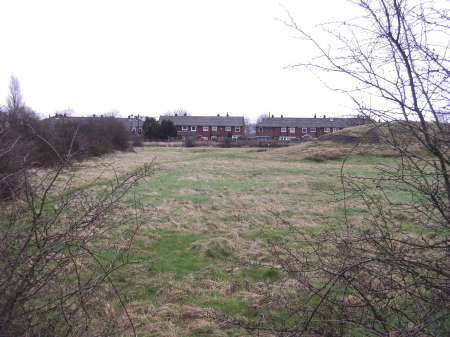
Looking from the towpath just past the water channel, east towards the Metrolink line, the current footpath approximately follows the route of the tramway. |
|
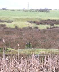
Standing on top of the spoil heap and looking to the northeast, there is a clear depression in the ground in front of the Metrolink line. |
|
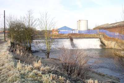
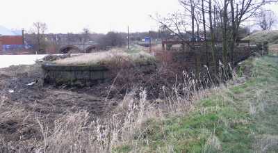
Although the Dumers Lane site was close to the river, it was above the river level. To obtain a supply of water for processing and power (Bealey's had eight water wheels in 1794) a weir (right, top) was constructed further upstream on the Irwell, close to the Bury/Radcliffe border, to provide a constant head of water. A channel known as Bealey's goit (right, lower) was dug to carry the water the 2¼ kilometres (1.4 miles) to the factory. |
|
The map below shows Bealey's wharf and the part of the tramroad nearest the canal as it was in 1908. The tram track runs alongside the wharf where there were two cranes, probably steam cranes similar to the one at Mount Sion bleachworks, with sidings and sheds or covered areas also shown.
|
|
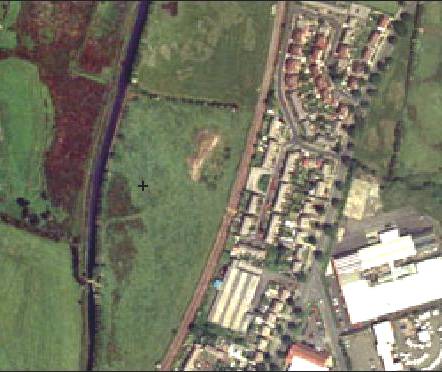
This modern aerial photograph, from Getmapping plc, covers roughly the same area as the map above. The canal and metrolink lines run from top to bottom, and Bury Road is a little further to the right, past the houses. |
|
The tramroad and bleach factory were closed in 1910 and direct archaeological evidence is scarce. The wharf alongside the canal is obvious and there are the remains of bridges where the tramway crossed Bealey's goit and nearby Hutchinson's goit, though these are in fields south of Bury Road and not readily accessible. The line of the tram road immediately after the tunnel has been obliterated by housing (Warth Fold Road) and the construction of Bury Road, while the factory site is now a housing estate, starting at Riverside Road. The Bealey family home on the corner of Dumers Lane and Bury Street, The Close, is now a hospital and the grounds of the house are Close Park. |
|