| April 27, 2003 |
| G 203 Road Log |
| Start �������������� North Plain's McDonalds Parking Lot |
| Mile 0������������� Left the parking lot to head west on Highway 26.� Then we headed north� |
| 9:15am������������ on Highway 47, towards Vernonia.� We will be exploring some exotic |
| ����������������������� terrains that attached themselves to the North American Plate approximately 40 to 50 mya.� We will hopefully find some dentalia shells, which the Native Americans used as a sign of wealth.� |
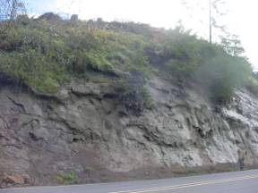
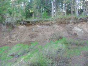
| Mile 17.0������� Highway 47 Keasey Formation |
| 9:36am������������ This is a road cut that show an angular formation of the Keasey |
| ����������������������� Formation.� Keasey formation has been dated to the Eocene or the Oligocene Epochs of the Cenozoic Era, or 36 to 40mya.� The Keasey Formation is presented on an anti-cline, showing alternating thick layers of tuffaceous siltstone and smaller, 8-10 inches, of a basalt sill.� |
 |
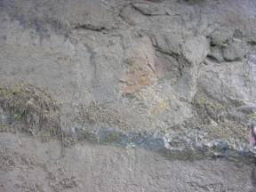 |
| Keasey Formation������������������� ����������������������� Basalt Sill |
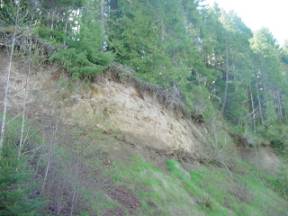
| The siltstone layers were showing "dimple" spots that are calcareous concretions.� This is one of the very common characteristics of the Keasey Formation.� They are product of weathering.� A particle of material becomes separated from the other material and is joined with other particles until it just falls out of the formation. |
 |
 |
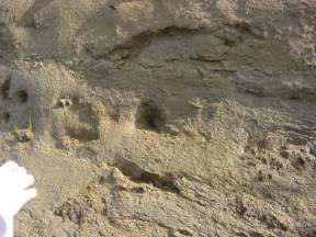
| ��������� Calcareous Concretions������� ������������������ ������Layering of Keasey Formation |
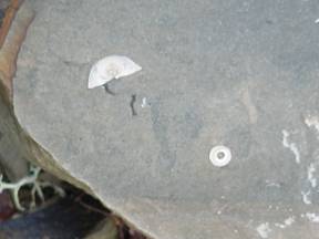
| While we were at this stop, Sara found a gastropod fossil.� Gastropod means stomach/foot.� It lives in the last little chamber of the shell.� To feed, it turns its stomach inside out and pushes it outside the opening at the end of the shell.� This is the same opening in the shell that its foot extends from.� Therefore, it was thought that it moved by "walking" on its stomach. |
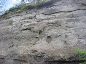
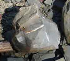
| Mile 17.4������� Highway 47 - Banks-Vernonia State Park |
| 9:55am������������ This area is underlain by Cenozoic rocks that are younger than 50 million years.� |
| ����������������������� We are North of Manning and South of Vernonia near the Horseshoe Trestle.� This is in the Eastern Coast Range.� Keasey Formation 35 to 38mya |
 |
 |
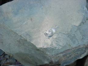
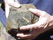
| �This is a top view before the rock was broken up.��� � Side view after rock was broken |
| These fossils are a bi-valve and a Dentalium pseudonyma. |
 |
| Gastropod |
| Fossils found at the Banks-Vernonia State Park. |
| This is a volcanic ash, marine environment that is very close to an island arc of the Oligocene ocean.� The fossils were settled after the death of the animal.� They were probably deposited in very quiet water.� The fossils were probably washed in by the ocean current.� |
 |
| This is probably the actual fossil bed for the fossils we found. |
| It was unfortunate that we were not able to bring the fossils that we found out of the park.� At 10:40am we were notified that we were in an area that has been protected from fossil hunters, by Mike Shannon a State Park Ranger.� |
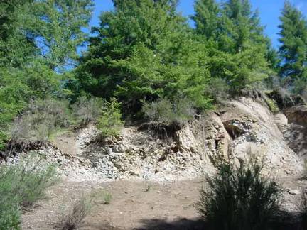
| Mile 30.8������� Timber Road - Nehalem River |
| 11:33am���������� Keasey Formation 38 to 40mya.� Shallow marine environment. |
| ����������������������� Here we found a huge assortment of different marine fossils.� They were found scattered along the edge of the road and in fossil beds in the hillside.� Thyasira fossils were found in a bed.� They were probably living when they were covered up by sediment.� They are clams or bi-valves.� This landscape is made of Arkoses sandstone conglomerate with feldspar and basalt from an Island Arc.� |
| The Island Arc was attacked to the North America Plate through the subduction of the Farallon plate.� The Farallon plate is now three different plates, the Juan de Fuca, the Cocos, and the Nazca plates. |
 |
 |
| Timber Road |
 |
| Dentalium schencki Fossil |
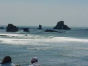
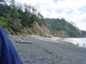
| Mile 84.2������� Ecola Park - Astoria Formation |
| 12:52pm���������� The beach is made of mature sand.� The color is a good indicator of maturity.� The |
| ����������������������� sand is most likely made of quartz and feldspar particles.� The� rocks are the sand for tomorrow.� They will become sand with the continuation of weathering.� The cliff face is the winter beach berm.� The area that is exposed is most likely the backshore.� The water is covering the foreshore.� The logs show where a high tide has been.� The sea stacks and sea arch have been formed by an area of land that jetted out into the longshore current, where it interrupted and absorbed the energy.� |
| The Astoria Formation is a middle to lower Miocene Epoch formation of the Cenozoic Era. |
 |
 |
| ����������������� Sea Stacks and Sea Arch����� ������������������������������Costal Environment |
| The majority of fossils that we located on this trip were all marine animals.� The fossils that were found by most were shells. It is pretty easy to tell the difference between a newly deposited shells from the fossils because of the lack of color in fossils.� Most of these animals have descendants that still exist today. |
| The fossils are replacement fossils.� Replacement fossils are formed through a natural mold being filled with sediment or minerals and then hardening.� The replacement material takes the place of the original |
| Back to School Page |