|
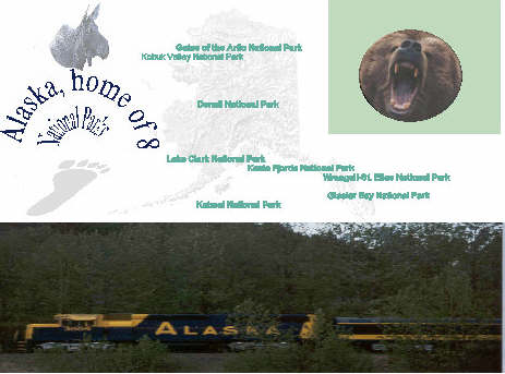
The Alaska region is home to 8 of our 54 national parks.
The Parks in Alaska are the largest in the system and are home
to North America's highest peaks. Due to Alaska's vast size
and relative remoteness Alaska is its own region.
Alaska
leads the U.S. in public lands, national parks and preserves;
95% of all
the United States' public lands are in the western states and the state
of Alaska.
|
The Nation's Last Frontier
|
Alaska Facts
| Alaska is home to 8 national parks,
including the largest national park in the U.S.,
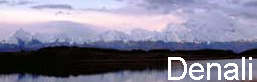
Wrangell-St.Elias. Alaska is home to 17 of America's 20 highest peaks, including the highest peak in North America; Mount McKinley, rising 20,320 feet above sea level. Mount McKinley National Park was established
in 1917, the Park's name was changed to Denali National Park
in 1980. Denali is the Indian name for North America's highest peak
and it means the "Great One"
There are over 100,000 glaciers in Alaska. The
largest glacier is Malaspina, it measures 850 square miles.
More than 29,000 square miles of Alaska is covered by ice. Alaska has 6,640 miles of coastline.
Including islands, Alaska has
a total of 33,904 miles of oceanic shoreline.
Alaska has 70 potentially active volcanoes.
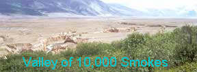
The most recent volcanic activity was the violent
eruption of Novarupta in 1912 which created the Valley
of 10,000 Smokes, part of Katmai National Park.
Alaska has frequent earthquakes, about 5,000 a
year. The strongest earthquake ever recorded in North
America, a 9.2, rocked Central and Southeast
Alaska on March 27, 1964.
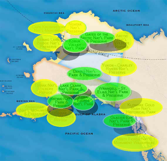
|
Map of Alaska Parks
and Preserves
|
Alaska Parks
How Much Do
You Know ?
|
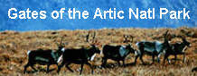
Gates of the Arctic was established as a national park in 1978. Gates of the Arctic National Park covers 8.5 million square miles and elevation ranges from 300 to 8,510 feet above sea level. The Park is not accessible by road and there are no developed facilities within the Park. Most visitors access the Park via small aircraft.
Photos courtesy of NPS
Katmai was established as a National Monument
on September 24, 1918 and redesignated as a National
Park on December 2, 1980. The Park includes 4 million
acres set aside to protect features associated with volcanic
activity. The most recent eruption was in 1912 when Mount
Novarupta erupted and covered 40 square miles
with deposits of ash ranging from 100-700 feet deep. This
eruption created the Valley of 10,000 Smokes,
named for the thousands of cracks in the ash deposits that emitted
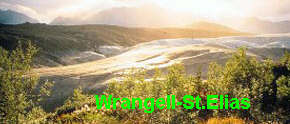
gas and smoke from heated ground water.Kenai Fjords was established as a national park in 1978 to protect coastal mountains and fjords, ice fields, tidewater glaciers and marine wildlife habitat. The Park is accessed by water craft with the exception of Exit Glacier, which is accessible by car via the Seward Highway Kobuk Valley was established as a national park on December 2, 1980 to preserve the Great Kobuk Sand Dunes. Located 25 miles north of the Arctic Circle, Kobuk Valley is a 25 square mile area of sand dunes carved by glaciers. The Park has no roads or developed facilities and is only accessible by small plane or strenuous hike. Lake Clark was established as a national monument on December 1, 1978 and designated as a national park on December 2, 1980. Lake Clark National Park includes 4 million acres of wilderness and the 40 mile long Lake Clark. There are no roads or developed facilities within the Park and is accessible by small plane or float plane. Wrangell-St.Elias is the largest national park in the United States covering 13.2 million acres of wilderness. Wrangell-St.Elias was established as a national monument on December 1, 1978 and designated as a national park on December 2, 1980. Wrangell-St.Elias National Park is home to over 100 major glaciers, the largest non polar ice field, and the largest concentration of peaks over 16,000 feet. There is a single road going into the Park but is mainly accessible by small plane and water craft. There are no developed facilities or maintained roads within the Park. Kluane National Park, home of Mount Logan, Canada's highest peak at 19,551 feet above sea level borders the east side of Wrangell-St.Elias . The two parks together make up the largest preserve on the continent. |


| Top of Page |

|