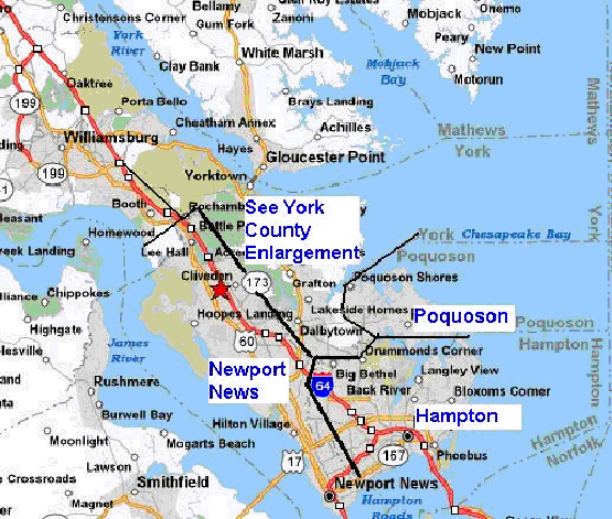
Peninsula posting areas map
This page is for information pertaining to the Peninsula.
(If you would like to change the boundaries, please let me know by e-mailing
me.)
Click on the maps to show a better view.
·
Newport News, Hampton, Williamsburg, and Poquoson
boundaries Within their respective municipal boundaries. There are no divisions within the
city separating communities or North and South.
·
York County is divided into three regions: Yorktown
(Northern area) Grafton (Central) and Tabb (Southern area). Do not confuse this with the upper
part of York County, where parts of Williamsburg are. If it is in the Williamsburg area, it
is classified as being in Williamsburg.
·
Proposed: Newport News is
divided into three sections: North, Central, South. Look at the Newport News Enlargement below. Let me know what you think by e-mailing
me.
Yorktown Enlargement
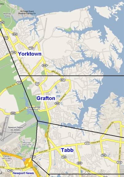
Boundaries in the York County area:
- Yorktown:
From the Coleman Bridge south to, but not including, Denbigh Blvd (VA
Rt. 173).
- Grafton:
From, and including Denbigh Blvd south to the Hampton Hwy (VA Hwy 134)
Interchange.
- Tabb:
From the Hampton Hwy (VA Hwy 134) Interchange south to the Newport
News/York County line. This
includes the two stations near Super K-Mart in Kiln Creek.
Newport News Enlargement
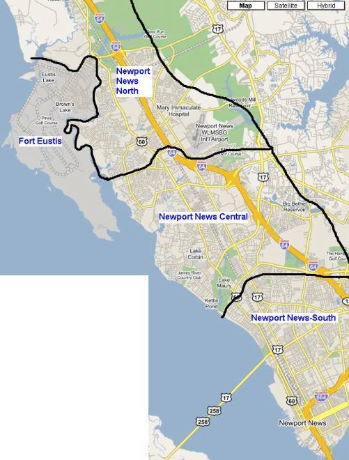
Boundaries in the Newport News Area:
- North
Section: From the northern city limits with James City County to Bland
Blvd. This section of Newport
includes the Shell station on Jefferson Ave near Wal-Mart and the Sam’s
Club Gas station.
- Central
section: From Bland
Boulevard south to Harpersville Rd.
- South
Section: From Harpersville
Rd south to the southern city limits.
It is important that we observe and follow these
boundaries, so that we can correctly classify and identify stations on the
Peninsula. If a station is
posted in the wrong area, it will be removed by another user and posted in
the right area.
Return to the Home Page
|

