<BGSOUND SRC="http://www.geocities.com/nikkyrachit/bckstrtbylrgrthnlf.mid" LOOP=INFINITE>
The National Institute of Ocean Technology (NIOT) was established in November 1993 as an autonomous society under the Department of Ocean Development (DOD), Government of India with the support of Indian Institute of Technology, Madras , (IITM) with its Head Quarters inside the IITM Campus. NIOT is managed by a Governing Council and the Director is the head of the Institute.
COASTAL RESEARCH VESSEL CRV SAGAR PASCHIMI
HYDROGRAPHIC EQUIPMENTS DEPLOYED FROM A SURVEY VESSEL
OVERVIEW OF GPS SATTELITE SYSTEM. The Global Positioning System (GPS) is a worldwide radio-navigation system formed from a constellation of 24 satellites and their ground stations. GPS uses these "man-made stars" as reference points to calculate positions accurate to a matter of meters. In fact, with advanced forms of GPS you can make measurements to better than a centimeter!
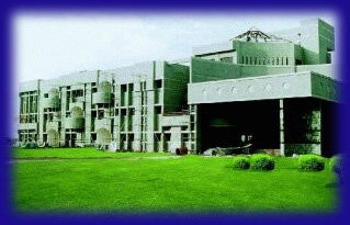
NATIONAL INSTITUTE OF OCEAN TECHNOLOGY CAMPUS AT PALLIKARNAI, CHENNAI.
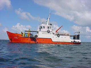
SURVEY VESSEL
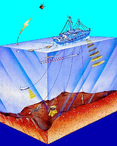
OVERVIEW OF A TYPICAL HYDROGRAPHIC SURVEY. MULTIBEAM, SIDE SCAN, SUB-BOTTOM, MAGNETIC & SIESMIC INSTRUMENTS ARE DEPLOYED TOGETHER
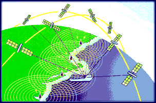
SATTELITES IN LOWER ORBIT AT 22,000KM HIGHT ARE TRANSMITTING GPS SIGNALS USED FOR POSITION CALCULATION OF VESSELS
Hosted by www.Geocities.ws

1