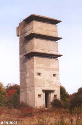
Sisters' Point Base-End / Radar Station - Location 149

This five-story concrete tower was completed in July 1942 on a government-owned 4.71 acre site as a Base-End Station for Fort Foster and Fort Dearborn. The Army station barracks was not attached to the tower. The fifth-story observation level was intended for Battery 205 (B4 S4), the fourth-story level was for Battery 204 (B5 S5), and the third-story level was for Battery 103/Seaman (B9 S9). The fifth level was later changed to the HD OPS 3 station for the Harbor Operations Command. The roof deck/balcony was used for the anti-aircraft intelligence service (AAIS OP 8). Searchlight positions #13 and #14 were located southwest and southeast of the tower. An SCR-296A radar on a 100-foot tall steel frame tower, with an adjoining operating room, was located on the north-side of the concrete tower. An SCR-268 mobile radar unit was set up in 1944 southeast of the concrete tower, adjacent to searchlight #14. The concrete tower was demolished in May 2004.
courtesy of NOAA - Coast & Geodetic Survey Historic Image Collection
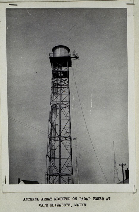
A typical SCR-296A radar tower located at Cape Elizabeth, Maine, 1946.Shown is a post-war NOAA SHORAN antenna array attached to the SCR-296A radar tower.
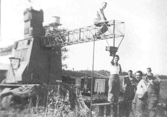
photo by Don MacKenzie, courtesy of Gerald Butler
An SCR-268 mobile radar unit set up at Sisters' Point in 1944.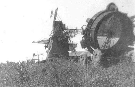
photo by Don MacKenzie, courtesy of Gerald Butler
Another view of the SCR-268 radar, with a 60-inch searchlight.
Located at Sisters' Point, Gerrish Island, Kittery, Maine.
Private Property!

WWII TOWERS HOME