Gairloch High School,
Geography Department
An Teallach
a glaciated
mountain
This piece of work is aimed at 14-18
year old pupils or those interested in developing a knowledge and
understanding of the physical geography of mountain glaciation.
Access to Ordnance Survey Landranger series sheet 19 would be helpful
to further this study and is needed for some of the tasks. Tasks are
set at two levels with those in B being more demanding.
The text is
available on one page
| Top
of page |
Home page |
|
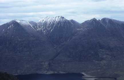
Photograph 1
|
|
|
(032799, northeast)
A general view of An Teallach, a mountain massif
extending over around 50 square kilometres in Wester Ross. The corrie
in the centre of this photograph is less well developed than those
beyond the ridge seen because of the southerly aspect of this side of
the mountain.
Task A
1.1 Make a quick sketch of the photograph and,
using the O.S. map, identify the following locations: Sgurr Creag an
Eich, Sgurr Fiona, Sàil Liath, Loch na Sealga, Abhainn Srath
na Sealga.
1.2 Add the following terms to the sketch:
pyramidal peak, corrie, arête, side of U-shaped valley, ribbon
loch.
Task B
1.3 Explain the final sentence in the
text.
| Top
of page |
Home page |
|
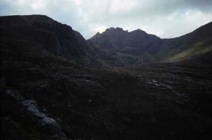
Photograph 2
|
|
|
(096833, west)
Toll an Lochain, the corrie in grid square 0783,
looking from the escarpment below which the glacier moving out of the
corrie would have flowed. The lip of the corrie prevents the lochan
being seen.
Task A
2.1 Label a sketch of this photograph with the
following: deep hollow eroded by a glacier, cliffs of the corrie's
backwall, lip of corrie, corrie lochan (behind lip), direction of
flow of glacier.
2.2 Draw a sketch cross-section from Sgurr Fiona
to 090831 and add the above labels to it.
Task B
2.3 Draw a sketch cross-section from Sgurr Fiona
to 090831, add what this would have looked like during valley
glaciation and add labels to explain the process of erosion.
| Top
of page |
Home page |
|
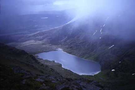
Photograph 3
|
|
|
(069843, southeast)
Loch Toll an Lochain from the highest point of An
Teallach.
| Top
of page |
Home page |
|
Photograph 4
|
|
|
(069843, south)
Lord Berkeley's Seat and Corrag Bhuidhe, the ridge
to the south of Toll an Lochain.
Task A
4.1 What evidence is there on the map that this
would be a dangerous ridge to walk?
| Top
of page |
Home page |
|
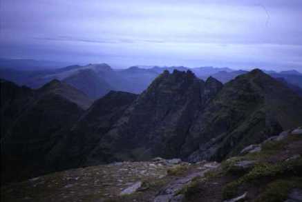
Photograph 5
|
|
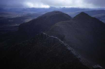
|
(064836, southeast)
Another view of the ridge between Sgurr Fiona and
Sàil Liath. This treacherous arête separates Toll an
Lochain from the deep U-shaped valley in which Loch na Sealga is
found.
| Next
page | Top
of page |
Home page |