Location and Coverage

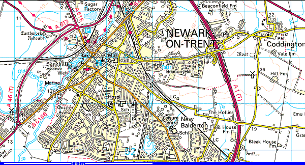
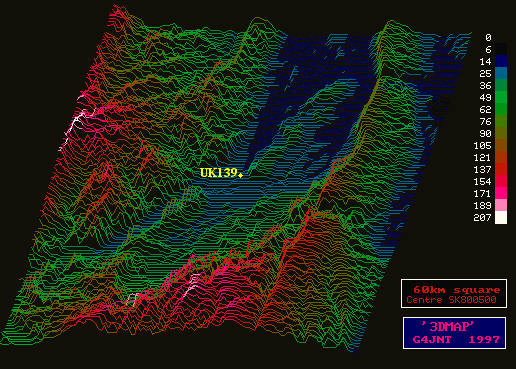
UK139-L is based in the South-Western area of Newark-On-Trent at approximately 18m above sea level. It is not ideally suited to provide the best coverage of the area as can be seen in the terrain maps below. About 1.5 miles to the North-East is Beacon Hill (45m) which would be the ideal vantage point to provide maximum coverage. However since I don't live up on the hill I will have to just accept that coverage to the north will be patchy because of hill and the town centre masking reception and transmission.

However all is not lost since to the South and South-West the terrain is flatter, mainly due to the River Trent and its large flood plain. I am hoping that the gateway can be accessed from the hills to the West, South and South-East. Also there is a opening North between the higher ground again caused by the River Trent flood plain.
Access Reports
To aid identification the Gateway is setup to announce itself every 5 minutes using the following message WAV File generated by http://www.naturalvoices.att.com/demos/
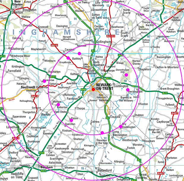
The map below indicates confirmed accesses in to the UK139-L Gateway using unmodified PMR446 handsets. I currently have three types of handset, Oregon Scientific TP326PMR, Audiovox PMRS838 and Telcom TE-200 (see equipment).
The inner circle shows a 5 mile radius from the gateway, the outer circle being 10 miles. The approximate location of the gateway is shown by the red spot. Successful Rx/Tx points are shown by the purple spots.
Some of the 'fringe' accesses were made using one handset to listen with the Squelch disabled (by holding the MONitor button down) and the other handset to transmit. UK139-L has courtesy tones enabled so listening for the Morse 'K' transmission indicates successful access.
If anyone access UK139-L from farther a field or somewhere not shown on this map then please contact me on [email protected] with details, please include handset details, and location (if possible with a grid-reference)

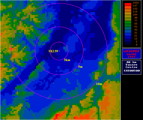
Below is another terrain map, showing the 3km (PMR446 designed maximum range) and the 5 mile and 10 mile areas.

The terrain maps were created using GEOG. Geog is a suite of programs written by Andy Talbot (G4JNT), some of which make reference to a database of UK terrain heights, to provide useful information for radio amateurs (and others interested in point-point working)
The GEOG suite can be downloaded from http://www.btinternet.com/~g8yoa/geog/geog.html
Please note the programs were originally written in DOS and so there may be some problems running them in Windows, however I had no problems running them in Windows NT4 and Windows 2000. You will need WINZIP to open the download file.