| Home | Quickie | Links | Web Design | Music | Adventure | Photography |
Links and thumbnail images below go to large JPEG images 150 - 500 KB in size.
For other photos, see the Adventure
Galleries: One | Two | Three | Four | Five | Six | Seven | Eight | Nine | Ten | Eleven
|
| ||||
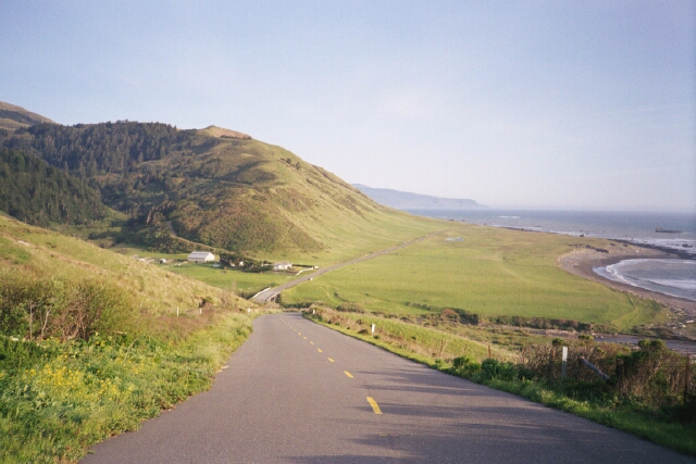
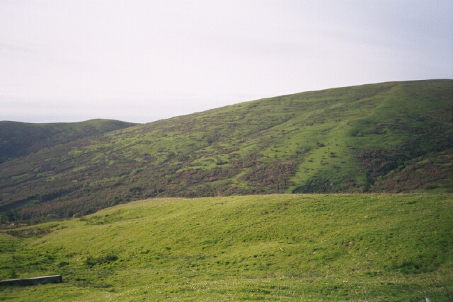
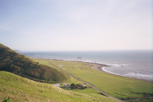
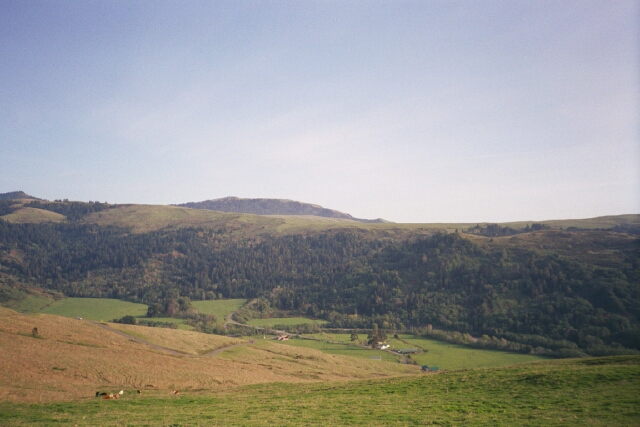
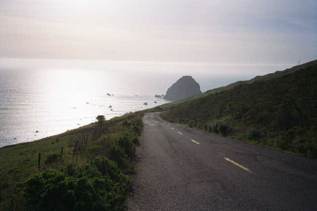
| 1) Lost Coast, North End |
This first row of images are from the
northern end of the Lost Coast, an obscure stretch of undeveloped Northern California coastline, in an area deemed too wild for a coast highway. I can assure you that it's more severe and challenging than the Ventana Wilderness, commonly called Big Sur. I was there in April 1999 with my brother Jeff on our annual spring romp. I returned to Shelter Cove area once already and explored on the south end.
To get there: on highway 101, south from Eureka, turn at the sign for Ferndale (head south along the coast as the highway goes east-west), and then go south along route 211. Ferndale is in the flatlands a few miles from the highway. After climbing up a ridge above that town, you traverse a huge seaside mountain, then descend towards one of the most remote beaches in the entire state. Highway 211 goes along the coast for several scenic miles, then heads inland towards Petrolia, which is on the Mattole River. The 25-mile-long Lost Coast trail begins at the town's Mattole River and heads south towards Shelter Cove. To get to Shelter Cover from northbound 101, veer northwest at Garberville towards Redway, then head west. There are some very rough dirt roads in this area, including the southern extension of highway 211, called Usal Road, which leaves Sinkyone Wilderness State Park, winding through canyons towards the coast highway. |
|||
|
|
|
|
|
|
| |||||
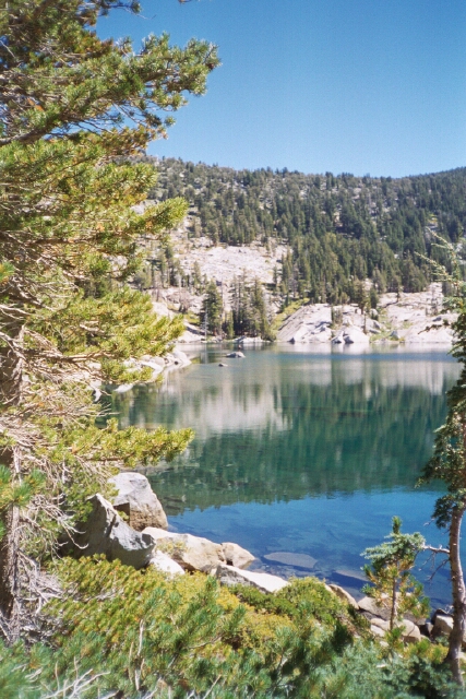
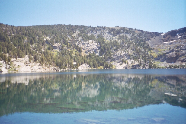
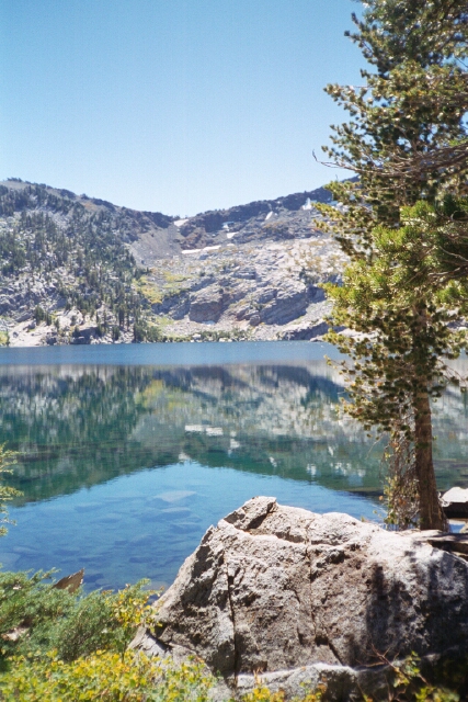
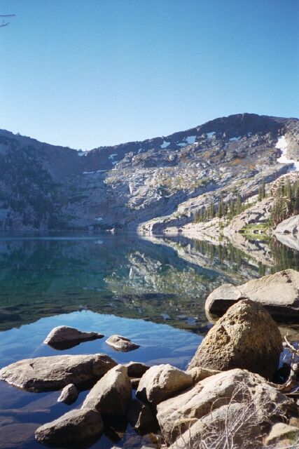
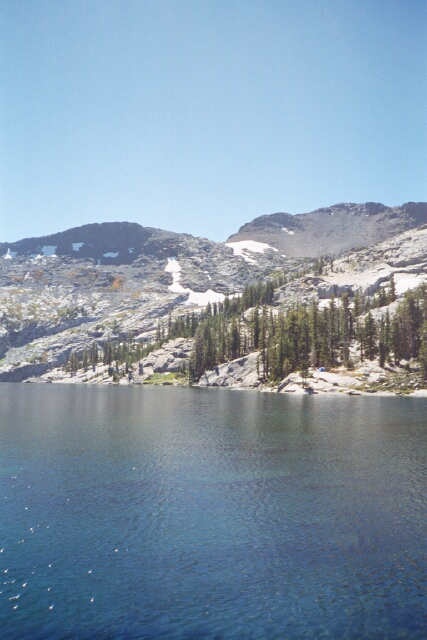
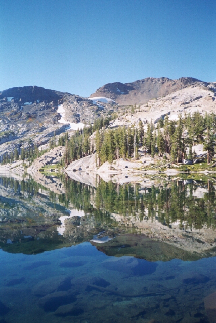
| 2) Desolation Wilderness: Dick's Lake |
The second row of photos are from Dick's Lake, which is approximately 6 miles from Emerald Bay, Lake Tahoe, CA. In July 1999, my friend Randy and I backpacked for three days and two nights, starting from Echo Lake and circling past Suzy Lake, Mount Tallac, and Dick's Peak. Our second night was at a slice of heaven called Dick's Lake. This section of the Sierra Nevadas is the most heavily used wilderness area in the state, and though we saw plenty of people, the Forest Service has a quota system, and we had plenty of solitude.
Our camp was in a pine-needle-soft area, on a crest above the lake. I spent a few hours recuperating from the brutal hills we had been doing, and got comfortable dozing in the peace and quiet of the woods, in the shade, on what turned out to be a very warm day. Taking these photos was my way of warming up for the steep downhill hike out. Photo Gallery 4 contains many more photos from the Desolation Wilderness area; photos from atop Mount Tallac, from Suzy Lake, and the hike down, approaching Emerald Bay. |
||||
|
|
|
|
|
|
|
| ||||
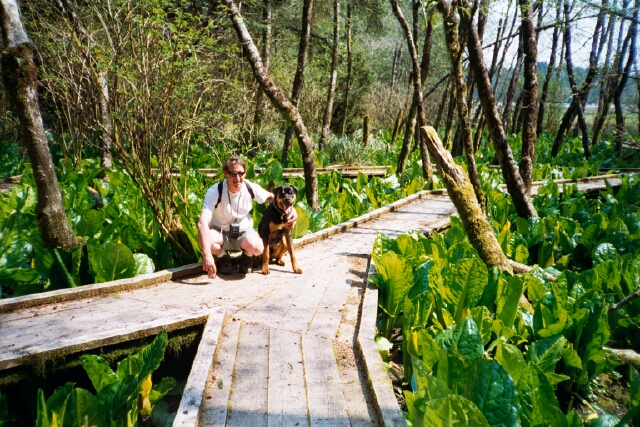
| 3) Central and Northern California |
These pictures are from a variety of locations. The first two are near Central California's Ventana Wilderness area, a dozen or more miles inland from the Big Sur Coastline. The oaks are in a great area called Jolon, which is the gateway to Nascimento/Ferguson, Road, which crosses over from the Salinas Valley to the area near Lucia on the coast. The second is Arroyo Seco, near King City.
The other three photos are from the Mattole River, which runs through the town of Petrolia in the Lost Coast. I once swam in this river many years ago on a hot summer day. Note its turquoise color is similar to the Smith River near the Oregon border, seen on my home page.
|
|||

|

|

|

|

|
|
| |||||
| 4) Lake Berryessa (north of Napa Valley, CA) |
One hot day last summer (1999) I decided to explore a place I once saw from the air; a huge lake north of the bay area about 70 miles. I found out it was Berryessa and headed up to Winters, CA (on Interstate 505) and then drove west. I circled around to the northwest corner, near
Pope Creek
, and took these photos before a heavenly swim in this lake, going out to a small island with a picnic table. It was well over 90 degrees and this was the perfect antidote. Even during peak summer season, this corner of the lake was not crowded.
|
||||

|

|

|

|
||
|
| |||||
This page is: http://www.geocities.com/mountainwalker/2two02.html
Last updated: June 16, 2001