|
Bicycle Camping through France from Bordeaux to Lausanne (May - June 2007) |
 |
|
|
|
|
|
Bicycle Camping through France from Bordeaux to Lausanne (May - June 2007) |
|
|
|
|
Itinerary
|
What was to be a milk run on the Eurovéloroute from Nantes to Basel, along the Loire, the canal du Centre and the Doubs, turned out to be a full-fledged expedition across the hills of Périgord, Limousin and Jura, with an easy stretch on the beautiful canal du Centre bicycle path, as planned. As it happened, a friend talked me into visiting her for a few days in Agen. Because it was too late to change my destination city, I decided to hop on the first train from Nantes to Bordeaux a bold move, as I was to learn, for a single person dragging a fat, airline-abused, 33 kg-bicycle box, crammed with loose bike parts and a complete camping gear. This was my second bicycle trip in Southern France. Then, (see Yet Another Tour of Southern France), I was traveling with half as much baggage, staying in small hotels. I wouldnt have dared to undertake such an expedition had it not been for a last minute upgrade to my trusty vehicle. After a tour of Gaspé Peninsula in 2002 (see A Short Tour of the Gaspé Peninsula), I had made a definitive judgment about our respective and combined capacities: Never again! That bicycle was not a good climber in any case, for a non-steroid user. The fix was straightforward: Cyclo Pop, my bicycle shop, changed the 16-toothed front small gear for a 12-toothed one, for only $30 CAN. That simple change put the long climbs of rural France and the foothills of the Alps within my reach. You dont need a sophisticated or expensive bicycle to go cyclotouring, just an easy one to spin up the long climbs. The loaded bicycle weighed 36 kg, and 13 kg unloaded. |
Summary
- Getting there
- The Nantes-Bordeaux Train
- The Aquitaine leg
- The Périgord and Limousin leg
- The Canal du Centre and Jura leg
- Switzerland
Getting there
|
Air Transat charged me an extra $70 CAN for an excess weigh of 10 kg. My two other pieces of baggage were a 10 kg duffel bag and a small 3.6 kg carry-on bag. I selected that company (a charter operator), because they offer non-stop flights from Montreal to Nantes. Small airports are the best choice when you carry a bicycle in a box. Other cyclists on that flight came in with their assembled bicycles, which were simply wrapped in plastic on the spot. I suppose it is a good idea to inquire about the options and the fares before selecting one. The drawback of an economy ticket on a charter flight is that it will buy you a seat in sardine class, which is all right unless you suffer from claustrophobia. The first problem popped up right here in Montreal, at the Air Transat desk, where the content of my box was checked. The short story is that my camping fuel stove was found. When the attendant asked me what that empty red metal bottle was, I said it was a water bottle. And where is the burner that fits on it?, she replied. Later, a good friend of mine came to pick it up before departure time. He also brought me my digital camera battery charger, which I had forgotten in my apartment. Arriving early at the airport is a good idea if you carry non standard baggage. |
The Nantes-Bordeaux Train
Day 0 Monday, May 21 (376 km)
|
In Nantes, transferring my big, cumbersome cardboard box from the airport to the train station in a taxi cost almost as much as the train fare to Bordeaux (26.5 vs. 40 ), but all in all, the total price was quite reasonable, considering the distance between the two cities. The fun part started around noon, when the taxi left me at the station: there was no cart in sight. I dragged my punched and battered box inside. The kind woman in the information booth told me that obviously, all the carts were all on the departure platforms. I got there and spotted one, but it was on the other side of the track. To save some time, I jumped down the platform, walked across the track and climbed up on the other side. Fortunately, I had the one euro coin required to unlock the cart. While I was triumphantly pushing it back to the waiting room, an incoming TGV slowed down, the window came down and the engineer sternly advised me never to do that again. Soon after, the station master intercepted me, gave me a bad look and casted doubts about my mental sanity. I said I wouldnt do it again. Back in the waiting room, when the platform number of my train flashed on the screen, 15 minutes before departure time, I rushed through the corridors, pushing my poorly balanced cart. Blocked by a flight of stairs, I had no clue about where the elevator might be, so I had to drag my stuff up, heavy duffel bag first. One good thing about that box: nobody would ever think of stealing it. With five minutes left, I asked the chef de gare if there were any special car or compartment for my box. He gave me a horrified look: You mean that huge box? Sir, you will have to sort that out by yourself, I didnt see you! Then he explained that since my box was oversize, I would normally have to go back to the ticket booth to pay an extra 45 (doubling the fare) to the very same creep who told me that there was no extra charge for the box and missing the train in the process. I had a cold sweat. Then, he showed me the bicycle compartment in the last car. On the train, I chatted with a young man who was working in the agribusiness; he had some neat ideas about preserving the environment. When I got down in the St-Jean station in Bordeaux at 6:30 p.m., I faced the same problem: no carts in sight! The SNCF security guard advised me to assemble my bicycle on the platform and leave as soon as I could, that place was not safe at night! The content of my box was almost intact, a small miracle. I had to improvise replacements for a missing strap on the handle bag and a lost bolt on the pannier rack. One hour later, I was leaving the station on half-inflated tires, as loaded as an Afghan bus. In the street, a 12-year old kid asked me for pliers to fix his front brake. Appalled by the sorry condition of his bicycle, I obliged, and advised him to have his brake properly fixed, a sure way to improve his life expectancy. The ride in downtown Bordeaux, with the setting sun in my back, was a cool one, just like a quiet stroll in a small European town which Bordeaux isnt. Soon after, I reached the Studio Hotel, which I had conveniently booked with hostels.com. One last effort to hoist everything to the third floor and that was it: I had made it to Kilometer Zero. I was feeling jet lagged; it was 4 a.m., Montreal time. After a bite in a street restaurant, I fell into a deep sleep. |
Taking a Break in Villandrault
A Balcony in Montcrabau
The Aquitaine leg
Day 1 Wednesday, May 23 - From Bordeaux to Villandrault - 77 km in 6 h; a.m.s. (average moving speed): 17 km/h
|
Early in the morning, the day was sunny and cool, ideal for cycling. I walked to the shopping center to buy a butane heater, but the sports store didnt open before 11, too late for me. I quit the hotel at 10:30. First, I had to get out of Bordeaux, a city with more than one million people; crisscrossed by several bicycle paths, it is reasonably bicycle-friendly. My plan was simple: riding northward until I reached the Garonne River and moving eastward along the south bank. Following the water is a good idea to go through a large city: you can enjoy the ride without having to check your map all the time. Downtown Bordeaux is clean and pretty, with extensive restoration works here and there. Going down the small sunny streets was a breeze. I stopped at a service station to blow my tires to full pressure, but there were no pump nor attendant; it was a completely automated outfit. A little farther away, I found a small tire shop, and the owner kindly adjusted the air pressure. A few kilometers further down, a part of the wide sidewalk is reserved for bicycles, but there are still many over/underpasses and other hurdles. I knew I had made it when I reached the posh suburban towns of Bègles and Villenave dOrnan. Later, I paused for lunch in St-Médard-dEyrans. From there, according to what I had read on Internet, there was no point in following the water; the towpath of the canal de la Garonne is barely cyclable, and only if the ground is dry. So I headed south in La Brède, and then east again on D116, passing through the wooded area of Cabanac. During that day, still jet lagged, I had some energy ups and downs. I stopped in Budos to visit the namesake 14th century castle. Sitting at the top of a small hill surrounded by vineyards, the well-preserved ruins were open for anybody to visit. The only notable hill I had to climb that day was just before Sauternes. I stopped there to fill my three 750-ml bottles; it takes a lot of water to ride on a sunny May day. The small drugstore there didnt sell any, but the lady kindly offered to fill my bottles. As I was browsing in my maps trying to find the closest campground*, an elderly man riding on a light motorcycle stopped by to chat. A Socialist, he was ranting about newly-elected President Sarkozy. He directed me to the Villandrault campground. I got there around 5 p.m., proud of my first day. Its a clean place, less than one kilometer from the Villandrault castle and town. I was the only occupant. There were some mosquitoes there, but they werent that voracious. The only downer was that I had to eat a cold meal but then, I had cold beer. Some time later, the owner came to collect the fare (5 ). He recommended the scenic old road (D110) and told me to make sure that my tent was on a high spot, because a major thunderstorm was due that night. After watching a dramatic orange sunset in the middle of dark indigo clouds, I went to bed. Soon, the dull noise of the rain splattering on the canvas put me into a deep sleep. * As I progressed through the Hexagon, I selected campgrounds with the help of the Guide des campings 2006 I had copies of the relevant pages. France is one of the best organized countries for camping; wherever you are, there is at least one campground within a range of 30 km or so. Most of them are open in June, although there are few campers at that time. The vast majority of the patrons are caravan travelers, typically Dutch, British or German snowbirds back from Spain or Portugal. |
The Baïse River in Nérac
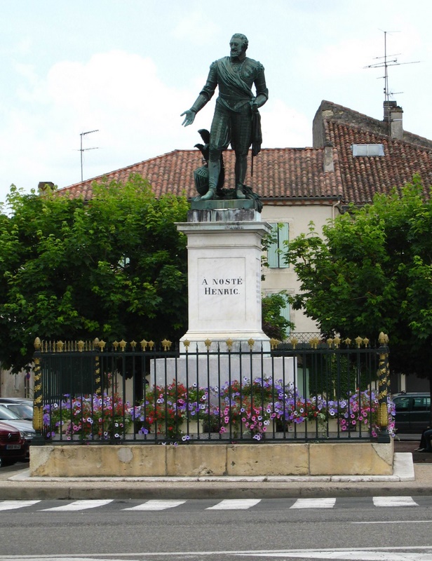
King Henric Statue in Nérac
Day 2 Thursday, May 24 - From Villandraut to Nérac -101 km in 8½ h; a.m.s.: 17.4 km/h
|
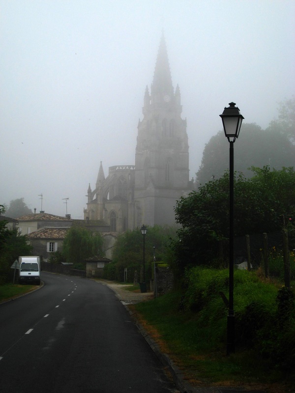
I woke up after some nine hours of deep sleep, my biological clock properly reset. Everything outside was wet and cold. In the last days of May, the morning temperature was 8 10 °C, and as low as 5° one morning. For most Europeans (or normal persons for that matter), sleeping under a tent in those conditions is not an option. Packing my gear in the damp, heavy fog was just one notch above the worse case situation, packing under rain. One hour and a half later, I hit the road and soon I beheld, standing out in the mist, the majestic bell tower of the collegial church of Uzeste. It harbors the tomb of Clement V, the French pope who dissolved the Order of the Temple and prepared the move of the seat of Papacy to Avignon. On my way to Bazas, I got lost in the fog but my luck held on, as I ran into the Mios Bazas bike trail (Mios is a small town on the Atlantic Coast, near the Arcachon Basin). When I reached Bazas, the sun was burning through the mist. I stopped in a roadside café for an espresso and a croissant, but couldnt get anything solid there: the bakery had been flooded the night before. Then, I switched to D655, the main road, which was a bit shorter than the scenic road. Despite occasional heavy trucks, its a nice country road with a convenient shoulder, going through gentle hills covered with green pastures and small woody patches. In Casteljaloux, while I was washing my hands in the mens room of the Grand Café, I saw in the mirror a boy with piercings shooting himself with a syringe. Later, in Fargues-sur-Ourbise, I visited an old 13th century roman church-fortress. Then, I left D655 to climb the Xantrailles hill, to enjoy the panoramic view and have a look at the castle. An elderly man came around, walking his dog Fifi. He told me in his chanting Occitan accent that the castle could be visited on appointment only. Then, I enjoyed a long ride down into the valley, braking to negotiate the winding road. After one last stop in Barbaste to have a look at the Moulin des Tours mill, I took some time to rebalance my load, which was listing heavily to starboard. As I was climbing a steep hill, my bike stopped abruptly and I almost rolled under: a loose bungee cord had got tangled in the speed gears (talk about a stupid accident!). The lady in the coming car saw me and stopped at the intersection. Around 4 p.m., after one last sprint on flat D930 bordered with huge platane trees, I finally reached Nérac. I gave a call to my friend and waited for her in a terrace café, sipping a cold, well-earned beer, under the mocking eye of King Henri IVs statue. King Henric, as he was called before he became the Most Catholic Sovereign of France in 1594, was the protestant king of Navarre, and Nérac was his capital. Because she didnt have a bicycle carrier, my friend picked up my panniers in her car and I followed her to her country house. The next two days, she showed me the area around Agen, the regional capital on the Garonne River. We visited all kind of medieval castles and churches, as well as pretty restored walled towns and Roman vestiges, including a small, sturdy bridge near Fréchou. I used this break to dry my camping gear and to shop for some missing items, such as a small butane heater to replace the one that I had lost at the airport and tooth paste (a no-no on post 9/11 flights; travelers have to shed off all liquids and gels before boarding the plane). That rare and expensive item is to be found in drugstores only, and the same is true for dental floss, if it can be found at all. My plan was to leave on Sunday, but intermittent rain forced me to stay one more day. On the last night, we dined in a Nérac glacier restaurant, on the bank of the Baïse River. The owner offered the specialties of the house, her own unsweetened, no-fruit ice creams an oxymoron? We sampled hot Espelette pimento and Reblochon (a mild soft cheese from Savoie) ice cream, and both were simply de-li-cious. |
A 12th Century Chapel in Agen
The Canal Bridge of Agen
The Périgord and Limousin leg
Day 3 Monday, May 28 - From Nérac to Eymet - 112 km in 9½ h; a.m.s.: 15 km/h
I started off the main leg of the trip at 9 a.m., under a grey sky. Half an hour later, a gentle rain started to fall, then the clouds literally burst on me. I kept riding straight north on D930. When the rain became intermittent in Larvardac, my shoes and gloves were fairly soaked. Just before reaching the Garonne River, I found the nice, paved, Canal de la Garonne bike way. Soon after, the sun came out and I was happily pedaling westward, all alone on the quiet towpath. Bordered by a double row of huge platanes, some stretches offer fabulous water views. In Buzet-sur-Baïse, I had lunch in the nearby marina, near a moored barge manned by white-headed British tourists. I left the towpath in Mas dAgenais and moved north to Fauguerolles. The shortest route to Switzerland is a straight diagonal going through Clermont-Ferrand, but I chose instead an arched one passing trough the low hills of Périgord and Limousin to circumvent the formidable climbs of the Massif Central.
To connect with D641, I had to ride on N113 for some 4 km. National highways should be avoided whenever possible because of the speeding heavy traffic. Past Gontaud de Nogaret, the road became hilly: welcome to beautiful Périgord! A strong cold southwestern wind was blowing from the Pyrenees, without slowing me too much. In quiet Seyches, I turned north on D933, after a break to dry my shoes in the wind and sunshine. Feeling tired, I looked up the nearest campground in the Guide. In pretty Miramont de Guyenne, I just followed the signs to the Saut-du-Loup campground, only to bang my nose on a locked gate. After stopping for food and water, I was ready to camp anywhere, if need be. The next campground was in Eymet, some 10 km away. I was back in Dordogne after nine years. Local people in a bar directed me to the municipal campground (6.5 ). It is located in a bend of the Dopt River, close to an impressive dungeon. The ground was still muddy in some places, and most of the patrons were Dutch or British caravan travelers. It was past 6 p.m. when I got there, but I still had more than two hours of daylight left, because the French set their clocks two hours ahead in summer time. I cooked my first gourmet dinner on the small butane heater a fried veal escalope with noodles and vegetable, in the company of a big white swan and ducks paddling on the river.
Day 4 Tuesday, May 29 - From Eymet to Vergt - 85 km in 8 h; a.m.s.: 16.1 km/h
|
Leaving at 9:15 on a cold, sunny morning, I was back on the D933, heading north. Further on, I turned left on D17 to visit the Ste-Innocence and Monbos 11th and 12th century roman churches. Then, I turned west and climbed up to the heights of Montbazillac. The hazy weather dulled the view of Bergerac, down in the valley. My tachometer reached 55 km/h as I was gliding down the hill on D13. I just made a short tour of downtown Bergerac, without stopping to avoid cooling out; I just didnt have any calories to spare. Heading for Creysse, on the north shore of the Dordogne, I started climbing the northern slope of the valley, taking small connecting roads ending in St‑Sauveur; there is a nice wall-shaped bell tower there. Then I headed north again to connect with D21, in order to avoid N21. The weather was cloudy all day long (15o), with just a bit of drizzle. D21 (which becomes D8 just before Vergt) is a relatively quiet road snaking between wooded hills, some of which are topped by a castle. In Vergt, a large village which looks more like Anytown, Quebec than a Périgord town, the lady at the cash directed me to Lac de Neufond campground (7 ), a few kilometers back. It is a nice, big campground, but then again, I was the only patron, except for a bunch of ducks who flocked around me while I was cooking a hearty dinner to boost my deflated morale. |
Day 5 Wednesday, May 30 - From Vergt to Tourtoirac - 77 km in 9½ h; a.m.s.: 15.9 km/h
|
I got up at 6 a.m. on a cold, sunny morning and left D8 soon after passing Église-Neuve-sur-Vergt, to avoid falling back on N21. After climbing all the way to Marseneix, going down D2 through Atur was a fabulous ride. When I reached Périgueux, the sun had warmed the air and I couldnt resist stopping in a small café terrace for lunch, near the St-Front cathedral. They wont serve food before noon sharp, but that was fine with me. Then, I went for a tour in the Old City, crisscrossed by narrow pedestrian alleys, stopping to have a look at the amazing Vézone tower, another apparently indestructible Roman architecture marvel, and then at the ruins of the 16th century château Barrière. Then, negotiating my way through at least half a dozen busy traffic circles, I headed west on D5 following the Auvézère River. In the beautiful medieval town of Le Change, I bought some confit de canard, a Périgord specialty. In Cubjac, dark clouds were piling up in the sky, but I ignored those telltale signs and went on my way. A small deluge busted on me while I was in the middle of nowhere, forcing me to take refuge under a big tree. I was back on the road when the rain subsided, pedaling through the wet fields and quaint towns like Ste-Eulalie-dAns, brightened by occasional flashes of sunlight. As the ground was hopelessly soaked, I stopped in a small hotel in Tourtoirac, but the rooms werent ready yet. Because the next hotel was at least 12 km away, I went up a short, steep hill to take a chance with the closest camping. Les tourterelles are a classy outfit featuring a campground, a restaurant and a riding school. As usual, the few occupants were British or Dutch caravan travelers. I explained to the owner that I needed a dry spot, and she allowed me to put up my tent under the covered porch of a small, empty cottage. So, for 15 , I had a dry place on a concrete slab, with a table and chair as a bonus a rare luxury in most French campgrounds. Two more days of changing weather were announced; I had better keep moving, if only to keep warm. |
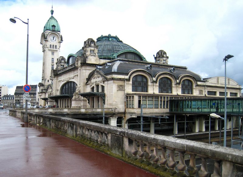
The Limoges-Bénédictins Station in Limoges
Bergerac
Day 6 Thursday, May 31 - From Tourtoirac to St-Yrieix - 55 km in 6 h; a.m.s.: 13 km/h)
|
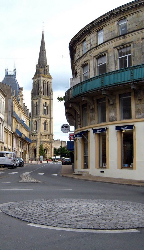
Hitting the road early on another cold sunny day, I went back to Tourtoirac to visit the 11th century abbey, on the bank of the Auvézère River. Then, I moved on to Hautefort, to have a look at the beautiful 16th century namesake castle, whose round towers crowned with turret domes make it look like a chateau of the Loire valley strayed in Dordogne. I had to walk my bike up the steep hill to reach the parking on top. Then, I went down the hills and up again, to Génis. After a look at the small château Anlhiac, getting tired of riding roller coaster roads, I switched to D704 for a long, quiet cruise in the mild rolling hills. There was some traffic, but I felt safe enough on the paved shoulder. I reached St-Yrieix (pronounced «Saint EEreeyay » in the middle of the afternoon. As I was eating a fougasse in the central park, dark clouds were gathering over the city. When the thunderstorm broke out, I took refuge under the awning of a wine merchant. When the owner came back to open his store around 4 p.m., I went in and he showed me his treasures. I bought a bottle of armagnac XO to warm me up. Looking at the cloudy skies, I knocked at a small tourist hotel advertising 26 rooms. The cheapest of the available rooms (31 ) was located in the attic of a half-restored 18th century house, full of nooks and crannies, offering a nice view on the park. As soon as I settled in, a bright sun broke out to scoff at me. I didnt mind, I could use the comfort of a warm bed after camping in cold, damp places for three days in a row. After a relaxing shower, I went for a walk in town around 5. I wanted to check my emails, but the PTT Internet café had just closed for the day, and the private cybercafé opened only at 6:30 p.m. In southern France, normal business hours are from 10 a.m. to 1 p.m., and from 5 to 8 p.m.; in between, everything is closed. So I took a long walk in the charming old city, built around an old dungeon flying the Occitan flag. Later, I stopped in the Internet café (3 /h), full of teens playing games, chatting or just hanging around sipping pops. Obviously, I was the only tourist in town. Back in the hotel, I fell asleep watching a documentary on the making of violin bows with the long tail hair of white Carmargue stallions. |
|
|
 |
|
|
A Charolais Ox |
The Old Dungeon in St-Yrieux |
Day 7 Friday, June 1 - From St-Yrieix to the Dognon Bridge - 98 km in 8.5 h; a.m.s.: 14.7 km/h
|
That morning, it was pouring outside, but I was in a warm, cozy hotel bed! Fortunately, the rain had stopped when I left. The most direct route was northwestern-bound D19, but in order to see Limoges, I stayed on busy D704. That was a bad choice: I had to ride on the white line most of the time because the shoulder had shrunk to some 30 cm. Fleeing from the rain in a café in front of the Solignac abbey, I witnessed a scene from another era: a bar filled with smokers. The bars-tabacs are the last refuge of hard core smokers, but they wont be tolerated anymore after next February 1. Visitors would better avoid France on that fatidic day! Limoges is a big, dull, industrial center, but the central hill, crowned by the 14th century cathedral, a flamboyant gothic mainstay, is worth a visit. Then, I had a look at the medieval St-Étienne Bridge, on the St. James Pilgrim route, before stopping for a pork pie in a cake shop, in front of the pompous Second Empire city hall, as the rain started off. Patisseries are a good option if you want to take a bite when the restaurants are closed, i. e. most of the time. On my way out, I passed by the 1929 Art Deco Limoges-Bénédictins railway station, shining under the limelight of the sun coming out of the clouds. Getting out of Limoges, the City of the Thousand Congested Traffic Circles, is something best forgotten. Soon, I was riding on D29 along the Vienne River. Having to put up with on-and-off rain, I formally swore to avoid industrial areas should I live long enough to see the end of that limitless expanse of suburbs. Soon after reaching the countryside, the sun was back for good. Intoxicated by fresh air, speed and sunshine, I glided down the hills, oblivious of time and distance, until I reached the dam of the Brignac mill. Only then did I realize that I had strayed off my way following the Vienne River. Back in St-Priest, some 8 km uphill, I followed the Taurion River from its confluent. I finally reached the St-Martin-Teressus municipal campground at 3 p.m., down a steep hill, only to find that the place was closed. I had no other choice than to move on and besides, the ground was soaked. Pedaling in an altered state of mind which numbs muscle aches, I was comforted by a beautiful view of the Taurion Reservoir. As I was climbing out of the valley after crossing the Dognon bridge, I ran across a pretty camping surrounded by neatly trimmed laurel hedges (6.8 ). Except for a few trailers and a couple of tents, it was empty. I waited for the sun to dry up the ground before putting up my tent. The only problem was that the closest grocery store was some 7 km away, but there was a restaurant employing disabled persons near the bridge. I had an excellent dinner there for 11. That was one of the most taxing days of the whole trip, and I had a very good nights sleep. |
Day 8 Saturday, June 2 - From the Dognon Bridge to Chambon-sur-Voueize - 106 km in 9 h; a.m.s.: 14.7 m/h
|
That was my first day without rain that week, but due to the overcast sky and the sheer altitude of the Creuse highlands, it was a cold and hazy one. I left at 7 a.m. on the scenic road (marked by a green line on the Michelin), but It was definitely too hilly and I couldnt see a thing, so I fell back on D5 before St-Pierre-Chérignat and St‑Martin, whose small medieval chapels are crowned by peculiar black slate bell towers (looking somewhat like stealth bombers). This is a cattle-rearing pasture region, with a few barley fields here and there. In the haze-laden air, all I could see were vast green expanses dotted with big or small white spots old stonework farm buildings or beautiful white Charolais cattle. A bit frustrated because all these hard-won panoramic views were lost on me, I turned south and went down the hills to connect with the shortest route, which was almost deserted. As I was sipping coffee in Bourganeuf, I heard a loud crash outside: my bike had tipped over. Except for its aluminum rear kick stand which broke under stress, there was no apparent damage; the loaded panniers had cushioned the impact. Later, as I was climbing a hill leaving the city, I heard a telltale scraping noise, which meant trouble. After taking everything off the pannier rack, I found the culprit: a piece of wire replacing a lost bolt had just been sheared off. Back on the road, I took relatively quiet N141 for a few kilometers to connect with D13. Around noon, I passed through Ahun, a small town of another era featuring a church with a plain slate bell tower. Because the municipal campground of Chénérailles was closed, I moved on to the next one, some 20 km away. Id rather pedal than freeze. The last stretch, passing through St-Loup on narrow, flat and scenic D55, was particularly pleasant. Then, as the sun was coming out, I went down a long hill and reached Chambon-sur-Voueize, in the middle of a vast, steep-sided valley. Just before 6, I put up my tent in the municipal campground. My face was red that night because I didnt put any sunscreen that day an overcast sky can let through a lot of UV. Some time after dinner, I went for a ride on my offloaded bicycle to visit the ornate cemetery and the beautiful 12th century abbatial church of Ste-Valérie, which had been a major pilgrimage center. The kids in the street were waving at me, just like in Vietnam. |
The Dognon Bridge
Ahun in Creuse
Day 9 Sunday, June 3 - From Chambon to Saint-Pourçain-sur Sioule - 88 km in 8½ h; a.m.s.: 15.2 km/h
|
When I left Chambon at 7 h 30 a.m., a faint sun was shining over the fog-filled valley. I was in for a very long climb all the way to Évaux-les-Bains. The prize of that climb was a long, endless descent on winding D915. Soon after, I was riding in a green, deserted valley, unsure of where I was heading. While I was resting in the central park of Macillat, an old lady walking an ugly noseless pug dog came by. She told me that her pet was slow because it was getting old, just like she was, and that she chose that breed because it doesnt bark. Later on, I was riding on panoramic D4, up on a crest bordered by green pastures crisscrossed by hedges, going through charming small towns like La Crouzille. As I was passing by Montaigut shortly before noon, my chain got off and jammed at both ends. The gears were caked with mud and oil, and it took some time to clean them. Then, I took green D13-D4. I stopped in Montmarault for coffee, and local people sipping white wine came by for some small talk. Back on the road at 2 p.m., I set out for St-Pourçain, the regional capital, on hilly D46. As I was coming out of a small town, some thirty white cows got up and started running along with me, on their side of the fence. I felt like Buffalo Bill riding in the middle of stampeding buffaloes. Milking time? My red shirt? I am at a loss to explain their behavior. The day before, I had witnessed an even weirder scene in a pasture: a cow was actually covering an ox, giving a rough time to natural law. There is a long descent just before the abbatial church of Bransat; flying at 55 km/h, I must have exceeded my speed record on a loaded bicycle. In St-Pourçain, I settled down in a municipal campground, conveniently located on a small island close to the Old City (3.8 ). Feeling a bit weak due to hypoglycemia, an easily cured disease, I was cooking my dinner when a shower forced me to take refuge under a big platane. Come what may, dinner time is the best part of the day after riding for hours. As every region offers its own cheeses and wines, the possibilities are endless. The fromage du jour was an exquisite Caillou creusois. On that Sunday, though, I had to live off my reserves, because it happened to be Mothers Day in France and everything was closed double tight. The following day, I stayed to enjoy the sun - the first day without any rain since I had left Nérac a week before. I wanted to take my emails, but the towns only cybercafé was located in the book store, and books stores are closed on Monday France is the worst country I know for Internet access. In Communist Vietnam, you will find an open place almost anywhere; people there can tell a business opportunity when they see one. But in France, for better or for worse, closing hours or days are just like sacred cows in India. « Work more, earn more? » Theres many a slip twixt the cup and the lip, Mr. Sarkosy! Feeling a bit spaced out, I was very glad to have nothing to do except visiting the town and the beautiful 11th century abbatial church, or rather, the small part of it that was open to visitors. The town of St-Pourçain, which used to provide the wine for the coronation of the kings of France, was founded during the 5th century by monk Porcinus, and named after him. Porcinus literally means pig herder, which he was before he took the frock. |
The St-Pourçain Abbey
Trézelles
Day 10 Tuesday, June 5 - From St-Pourçain to Digoin - 91 km in 8½ h; a.m.s.: 14.7 km/h
|
Leaving at 8 a.m. on D46, I followed N7 for a few kilometers and then switched to D23 past Varennes. There was not much to see on that foggy morning; the landscape and even the sun had just been erased out. I went through nice towns like Trézelles. On the road, I picked bright red sour cherries on roadside trees and spit out seeds for kilometers. The sun burned through before noon. After visiting a surrealistic-looking cemetery that could serve as a backdrop for a mystery movie, I rolled down to the marketplace of Le Donjon. There, smelling a good occasion, I bought a hot roasted cockerel in a stall and wolfed down half of it in a quiet spot out of town. At 2 p.m., as I was clearing the last hurdles on D898, the Loire River and Canal were in sight. After crossing more than half of France, I was now back on my original Loire Valley itinerary. I had deliberately headed to a point some 20 km south of Digoin to find out if the Digoin Lyon stretch of the canal was cyclable. What I saw was heart breaking. Except for a narrow dirt path, most of the towpath was covered with long weeds. After sitting for a while near the lock, I moved on northward, meeting only a few fishermen. Some of them were watching as many as four lines, which is probably the legal limit. I inched my way at a snails pace (10 -12 km/h) on the dirt path, which sometimes disappeared completely, as some stretches had been reclaimed by greedy residents. Near Chassenard, the condition of the path improved and past the last lock, it connected with the paved, well-groomed Voie verte bicycle trail. I was now in Burgundy. The camping de la Chevrette was soon in sight, on the other side of the Loire River. Though a bit expensive (8.6 ), the municipal campground is well tended and offers quiet sites on the bank, as well as free tickets for the nearby swimming pool. As always, it was almost deserted, so I was allowed to borrow a plastic table and chair from the shelter. After putting up my tent, I thought that having a cold beer would be nice, but the price at the office was outrageous (2 for a tiny 250 ml can!). I went to shop in town on my offloaded bicycle. Digoin is a middle-sized city with a variety of food stores, from small convenience stores to full-fledged supermarket-type stores like the Leclerc, offering cold pops and cold milk, but only shelf temperature beer. Pesting against Burgundy and diehard wine-drinking Burgundians, I finally brought back a large can of warm Belgian beer for only 0.43 , which is dirt cheap according to Canadian standards. But, on second thought, my predicament was hardly tragic, because I had a bottle of Bourgogne wine, which dovetails nicely with Nectaire cheese. I was to learn a well-kept secret some time later: the best places to get cold beer are local fruit and vegetable stores so much for Cartesian logic. I took Wednesday off to visit the town, take my emails and enjoy a rarity, a perfect sunny day. Besides, my bicycle needed a tune up. I even learned how to convert bars to psi using the air pump of a service station. The municipal cybercafé, opening at 1 p.m., charged only one /hour, much less than private operations. At the end of the afternoon, I went to the swimming pool. I was the only adult with a bunch of kids. They were impressed by my self-taught diving figures, which I hadnt rehearsed in years, and asked for some more. Vanity being the motor of most human endeavors, I gladly complied without overdoing it; I felt a bit stiff after riding for 10 days. France is a very friendly country; anybody can strike a conversation with anyone, and there is no taboo forbidding children to talk to strangers, or vice-versa. Just then, a strong wind started to blow: another storm was closing in. I took refuge in the shelter, where the only visitors were people coming to wash their dishes. |
|
|
 |
|
|
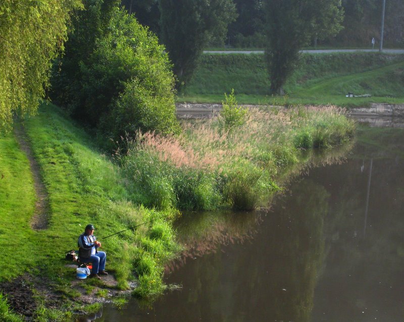
Fishing on the Voueize |
The Canal Bridge of Digoin |
The Canal du Centre and Jura leg
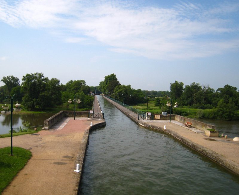
Day 11 Thursday, June 7 - From Digoin to Sautenay - 116.5 km in 10½ h; a.m.s.: 17.2 km/h
|
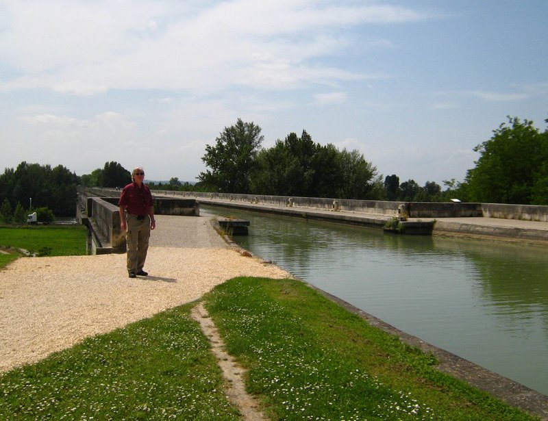
Getting up at 5:30 a.m., I packed my wet tent and hit the road at 8 a.m. I passed through the deserted city center to cross the monumental canal bridge over the Loire River, and soon after, I was riding on the Voie verte a first class bicycle trail by any standard but in the wrong direction. I turned back and headed northward along the canal du Centre. One hour later, I was in Paray-le-Monial, a town featuring an impressive basilica and other marvels like the Saint Nicolas tower and a 16th century town hall. Despite the overcast sky, riding along the canal was pure pleasure. For some time, I played leapfrog with a barge flying the Australian flag. I gdayed the chaps and they waived back. When the trail ended in Volesvres, I fell back on the D974. A few kilometers before Palinges, I climbed the hills to have a look at the 19th century Digoine castle. In Guénelard, I met two French cyclotourists from Touraine who were heading for Zurich. The only large town I crossed was Monceaux-les-Mines, featuring a huge cooling tower overlooking the canal. Then, the sun was back. I didnt stop at the Torcy campground because I missed the sign. As the clouds were piling up in the sky, I raced to reach the Conche campground, but the clouds won. In St-Léger, I joined another cyclist under a bus shelter. He was an engineer working in a nuclear plant, one of my areas of competence as a translator. Nuclear plants, now presented as « green » energy, are making a comeback in Europe and North America. Indeed, they dont emit greenhouse gases, but green (fluo green, to be precise) is also the color people may turn to if that industry doesnt find a safe disposal method for their large volumes of radioactive wastes. After the rain, as everything was soaked and dripping, I tried to find a room in St‑Léger, but both hotels were closed. I decided to forego the wet Conche campground and to move on to Sautenay, some 20 km away, hoping the ground would be dry when I got there. Having missed the beginning of the second stretch of the paved, dedicated bicycle trail in St-Léger, I was back on D974, when I had my first flat. Not a big deal: some 45 minutes later, I was back on the road. I gladly left narrow D974 around 6 p.m. and headed straight for the hills, but on the wrong side of the canal. As I was turning back, I noticed that my rear tire was getting soft again. I tried to reach the campground before it was completely flat. In Sautenay, I found cold beer in a grocery store; not everything can go wrong on the same day. I had to walk my loaded bicycle for the last 300 meters. I chose a spot in an open field with a view on a vineyard, at some distance of the Great Armada of trailers. As expected, the hot June sun had dried up the ground. After straying off course twice and two flats back to back, that was my longest day yet on an otherwise easy road. |
|
|
 |
|
|
Steering a Barge on the Canal du Centre |
Anglers on the Canal du Centre |
Day 12 Friday, June 8 - From Sautenay to Mervans - 62 km in 9½ h; a.m.s.: 16.2 km/h
|
Getting up at 6 a.m. in the wet, dew-covered field, I had two tubes to fix. As both were leaking at the same spot with respect to the valve, it was easy to track down the culprit: a tiny, invisible shard of glass imbedded into the tire. The problem was that my worn down rear tire was getting thinner, increasing the possibility of trouble. I had to replace it or at least rotate my tires to have the best one on the rear wheel, which supports most of the load. Back on the trail, under the shining sun, riding along the canal was a breeze. But all good things must come to an end: the Voie verte ended in Chalon-sur-Saône, a very nice and clean middle-sized city. Circling downtown, I found a bicycle shop right away, and one hour later, I was riding with a brand new rear tire. The owner told me that the easiest way to Lausanne was through Lons-le-Saunier and Geneva. Then, I called Yannick, my stepson, in Switzerland; he told me that I was welcome anytime. Emigrating in that country a few years ago, Yannick married Maryline. They live near Lausanne with Jade and Noah, their adorable brats. Then, as the rain started to fall, I found a cybercafé with a large window, from witch I could keep an eye on my loaded bicycle locked outside. I stayed there for 1½ hour (5 ), long enough for the rain clouds to clear. No doubt about it: the climate in France now has a tropical twist, with daily showers at set times. Then I was faced with my usual dilemma: either I played it safe and found a hotel room in town, or I moved on to the next campground, which might be soaked that night. I knocked at the door of two small downtown hotels, but one was closed and the other one had no available rooms. I would have like to spend one whole day in Chalon to visit, among other things, the Nicéphore Niepce photography museum, but I hate making circles in a city on a loaded bicycle. On impulse, I set out to leave Chalon at 4 p.m., the worst hour for traffic. That proved to be easy, thanks to the directions of that nice lady in the tourist information booth. My original plan, following the canal du Centre along the Doubs River, was not a good one, because for that stretch, the bicycle trail exists only on paper... So, I rode eastward for a short while on N73, then straight east on nice D35 through the rolling hills of Burgundy. Because the St-Martin-en-Bresse campground was closed, I pressed on to the next one in Mervans. I got there just before 6 p.m. The inexpensive municipal camping is located in a field close to the river. As usual, the warm sun had dried the ground just in time. After dinner, I chatted for some time with a couple of elder Dutch tourists in the laundry room. The athletic looking 73 year-old man was still cycling in the Netherlands. |
The Voie Verte Bicycle Path, Canal du Centre
Locks on the Canal du Centre
Day 13 Saturday, June 9 - From Mervans to Pontarlier - 119 km in 11 h, a.m.s.: 14.3 km/h
|
On another foggy morning, I followed D970 and D470 across green prairies dotted with cattle in white coat. Stopping at a café in Lons-le-Saulnier, a grayish industrial center, I asked for the best way to got to Switzerland. Take the bus! said a funny guy. Another one suggested that I take D471, a wide road linking France to Switzerland in all seasons. That suited me fine because that road was leading directly to Cossonay, where I was expected; in addition, it avoided busy highways around Geneva and Lausanne. Soon after, I attacked the first 8-km long climb. Thanks to the large shoulder, the low slope angle of about 4° and my mp3 reader, going up was a zen thing. I was now in hilly Jura. I stopped for lunch in Pont-du-Navoy. The patrons around the bar were involved in an intense discussion. Before leaving, I asked them, as a joke, the best way to Jurassic Park. One of them replied that I should take the Besançon road. Later, Yannick told me that there is a real Jurassic Park in Jura, complete with plastic dinosaurs! When I left, the jolly folks warned me against speeding while going uphill. The second climb, just after Champagnole, was also some 8 km long, but no more difficult than the first one, then I was flying through the green highlands of Franche-Comté, whose churches sport odd bell towers, not the plain Catholic type as far as I know. Somewhere in the middle of a curve, in a narrow gorge, a motorcyclist passed me at breakneck speed, bending very low, engine blaring; I could feel his helmet swooshing close to me a short, but very uncomfortable feeling. Before Pontarlier, I saw another telltale sign that Switzerland was close: the cows now sported black or brown spots. I was very tired when I reached Pontarlier around 6 p.m. I set out to find the municipal campground just outside the city limits, on the western side of mount Larmont. I had to climb one last steep hill to get there. The place was well organized and offered a nice view on the valley, under the warm light of the evening sun. That was my longest day on the road (116 km), the third one without any rain. My neighbors were a young German couple with their three flax-blond kids. They used to do a lot of cyclocamping with their kids but when the third one was born, they bought a VW camper. They invited me for coffee. The kids went to bed without a fuss, and we chatted for some time. The snorting noise of the horses in the field just behind subsided as the sun went down. My last night camping had it all: dry ground and a starry sky. |
Switzerland
Day 14 Sunday, June 10 - From Pontarlier to Cossonay - 52 km in 4½ h, a.m.s.: 16.1 km/h
|
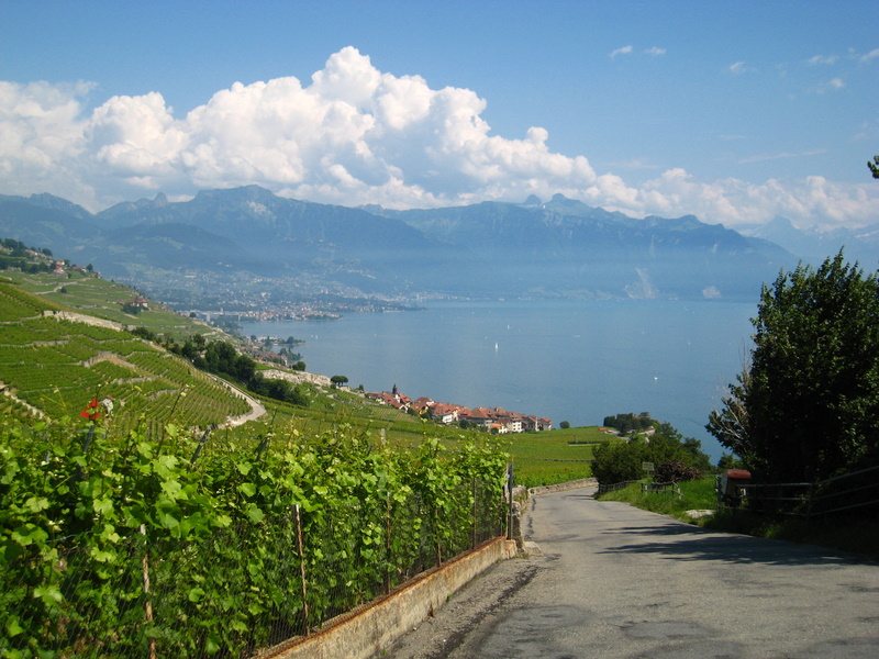
On E23 under an overcast sky, I went through a pass guarded by the Fort de Joux, high-perched on a steep rock dominating the valley temporarily flanked by an unlikely companion, a construction crane. In the Middle Ages, the lords of Joux used to charge a fee for goods crossing the Alps. Just one look at the steep-sided gorge is enough to understand the potential of that business. Then, as a fine drizzle started to fall, I valiantly attacked the last hills before the Swiss border. After a few kilometers of mild rolling hills, to my big surprise, I saw that sign: Col des Hopitaux-Neufs (1028 m), which meant that I was already on top! I pinched myself to make sure that I was not dreaming: the big climbing day was behind me. I was now riding on a high plateau, a piece of cake. At 10 a.m., I reached the border under the drizzle. The French custom officers asked me a few questions, mostly out of curiosity, and they bade me bon voyage. The Swiss officer just waved me through without even asking for my passport; obviously I couldnt carry in a great deal of the cheap French goods he was looking for. I stopped in a crowded Vallorbe café. After getting Swiss francs and a phone card, I was back on Road 9, the Lausanne Road. The rain had somewhat subsided, but the view on the mountains was blocked by hanging clouds. After crossing Croy and Pompalle, I climbed up one last hill and dashed through a plateau covered by various cultures or poppy-studded fallow fields. Around noon, I finally reached Cossonay and found the house of Yannick and Maryline. Semi-exhausted, I put away my bicycle in their garage. The total distance for that trip was 1158 km. I took a few days to visit the region and to hike in the mountains around Lake Leman with Yannick, then I had to go back and catch my plane in Lyon. Since Switzerland is smack in the middle of Europe, I thought it would be a pity to bring back all my gear to Montreal; carrying a bicycle and equipment in public transports is such a pain! With the kind permission of my hosts, I left most of my stuff in Lausanne, in view of another bicycle trip in 2008, probably in Italy or Germany. France is a great place for bicycle camping: this is a cheap and pleasant way to visit and enjoy that beautiful and variegated country. The drawback of cyclocamping is limited mobility, compared to other means of transport, but true bicycle fans will find a lot of compensations, whatever their motivation may be. |
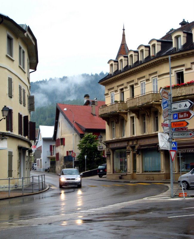
Vallorbe, Switzerland The Beautiful Leman Lake near Lausanne