July 27, 1999 Day 5
Morning was nice enough. The clouds let up and it was time to get out the sunscreen. Not far out of Vik the Myrdalssandur begins. The Myrdalssandur is 700 sq km of sand flats that have originated from jokullaups and volcanic eruptions. In high wind conditions sandstorms can occur and apparently can be quite nasty. The sands are flat enough that ships have run aground not knowing that they were approaching land. Today, there was nothing but a gentle breeze at my back.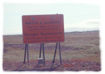
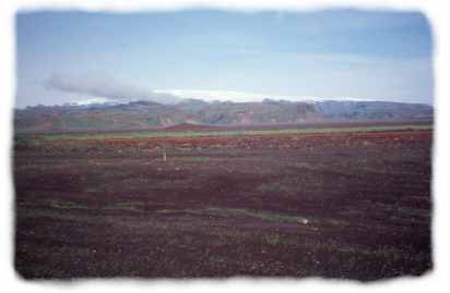
After looking at a map of Iceland and seeing the huge ice caps it is a little weird to see how flat and low the mountains are. But what they lack in height they make up for in size. To the right: Myrdalsjökull seen from the Myrdalssandur. The black lava sand is prone to drifting and in places has taken over farmland.
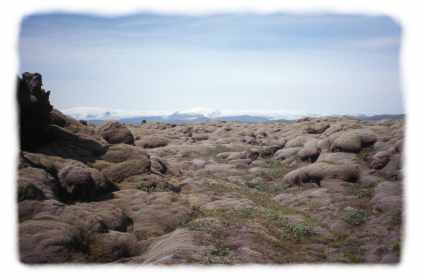
After crossing the Tungafljot river the road enters the Eldhraun, a lava field that was layed down by the Laki eruptions of 1783. The lava field covers 565 sq km and averages 12 meters in thickness. It is the largest lava field from a single eruption. After 200 years the lava is decked over with moss and heather.