So where is Skyline Blvd?

The road going through the red "+" in the map is Hwy 35.
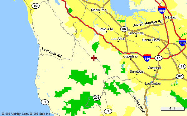
Here's a closeup of the above map. La Honda Rd. on the map is Hwy 84.
Here's a closeup of the above map. La Honda Rd. on the map is Hwy 84.
You should also try Hwy 84 which goes from the Pacific Coast all the way into Livermore. The fun stretches are from Hwy 1 (Pacific Coast) to Woodside (Hwy 280) which is windier but slower than Hwy 35, and the stretch from Fremont (Hwy 880) to Sunol (Hwy 680) called Niles Canyon Rd. which is a beautiful canyon drive (road may closed to mudslides during rainy season). Oh, and Dumbarton Bridge is part of Hwy 84 as well! See above map for the La Honda Rd. section.
If you are going to Santa Cruz from San Jose area, why not take the fun alternative - Hwy 9? You can access Hwy 236 which goes to Big Basin State Park (highly recommended visit), enjoy the small town of Boulder Creek, or just have fun driving on Hwy 9! The highway starts from Los Gatos, but the fun stretch begins in Saratoga and ends in Santa Cruz. It's windy, but slower and safer than the Hwy 17 madhouse. You can see part of this highway in the map above.
| What's New | Main Page | Mini Page | Mustang Page | Monte Carlo SS Page | Race Page |
This page hosted by ![]()
Get your own Free Home Page