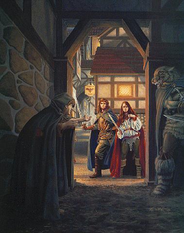
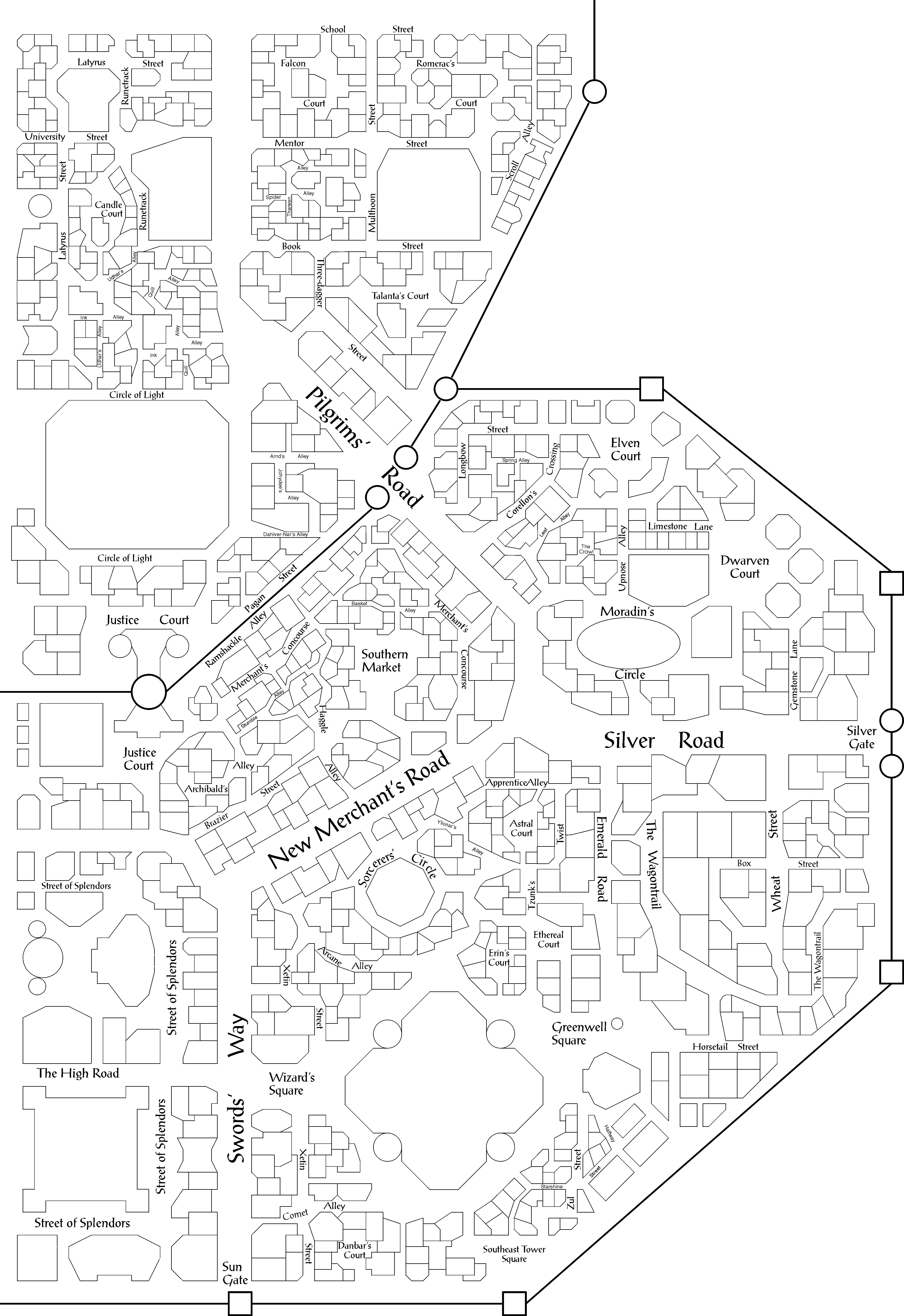
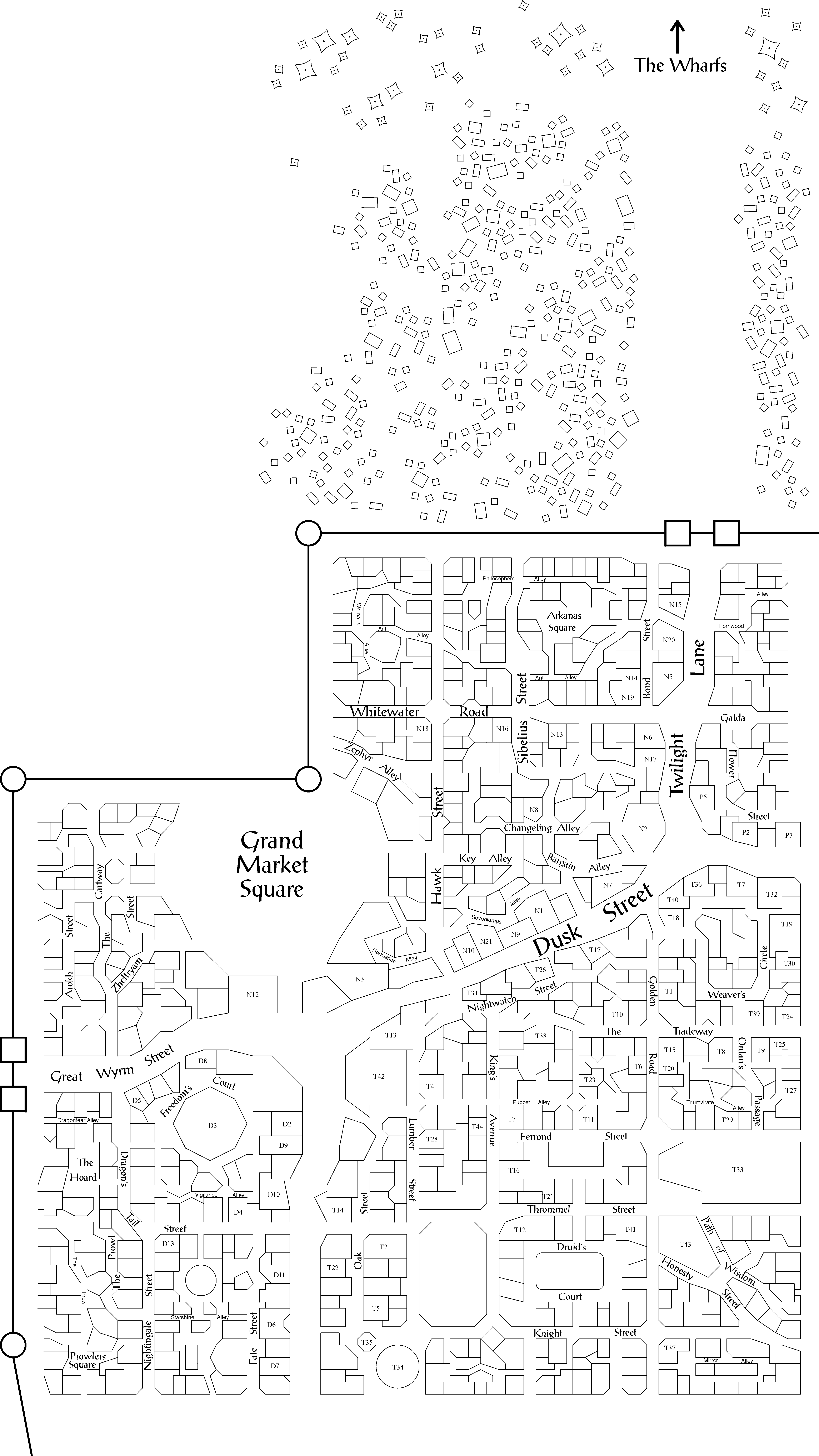
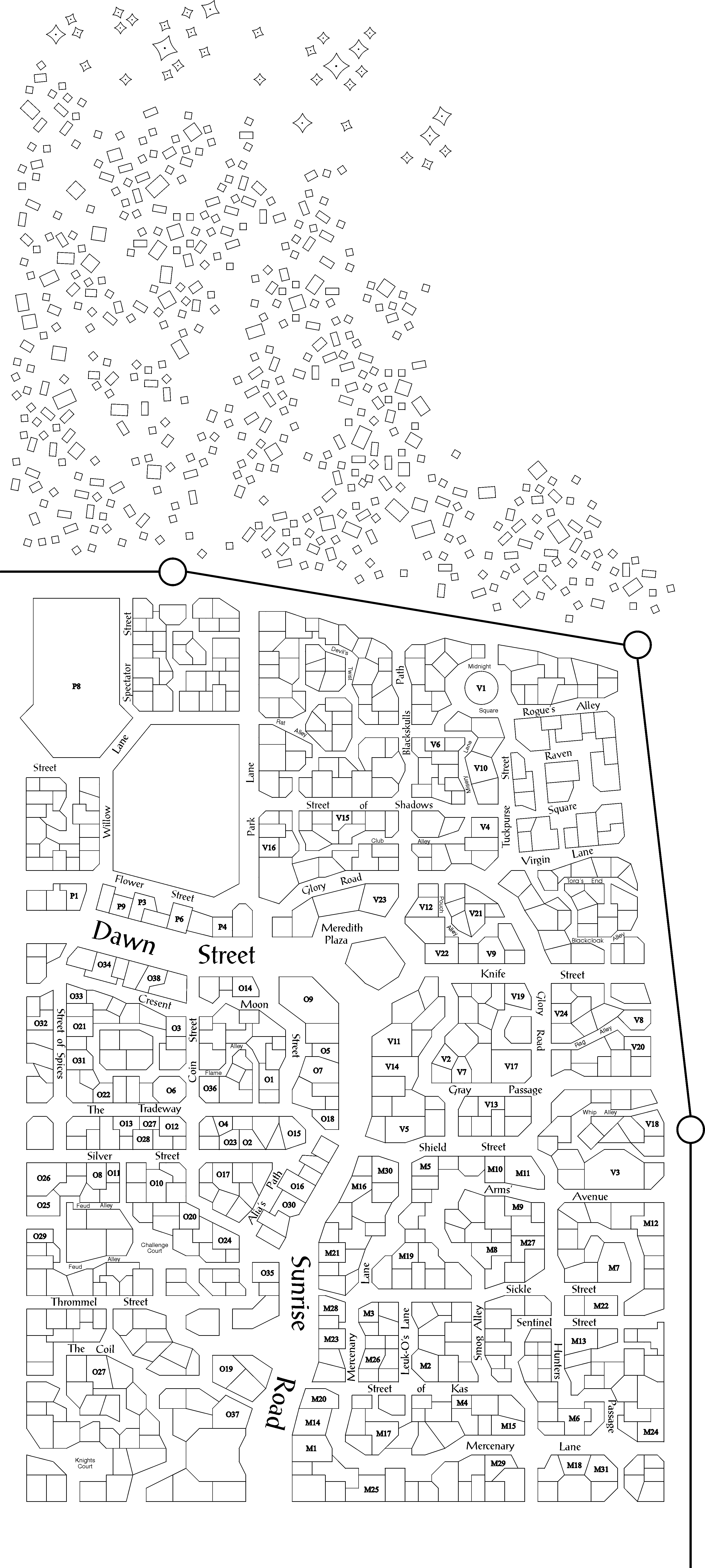
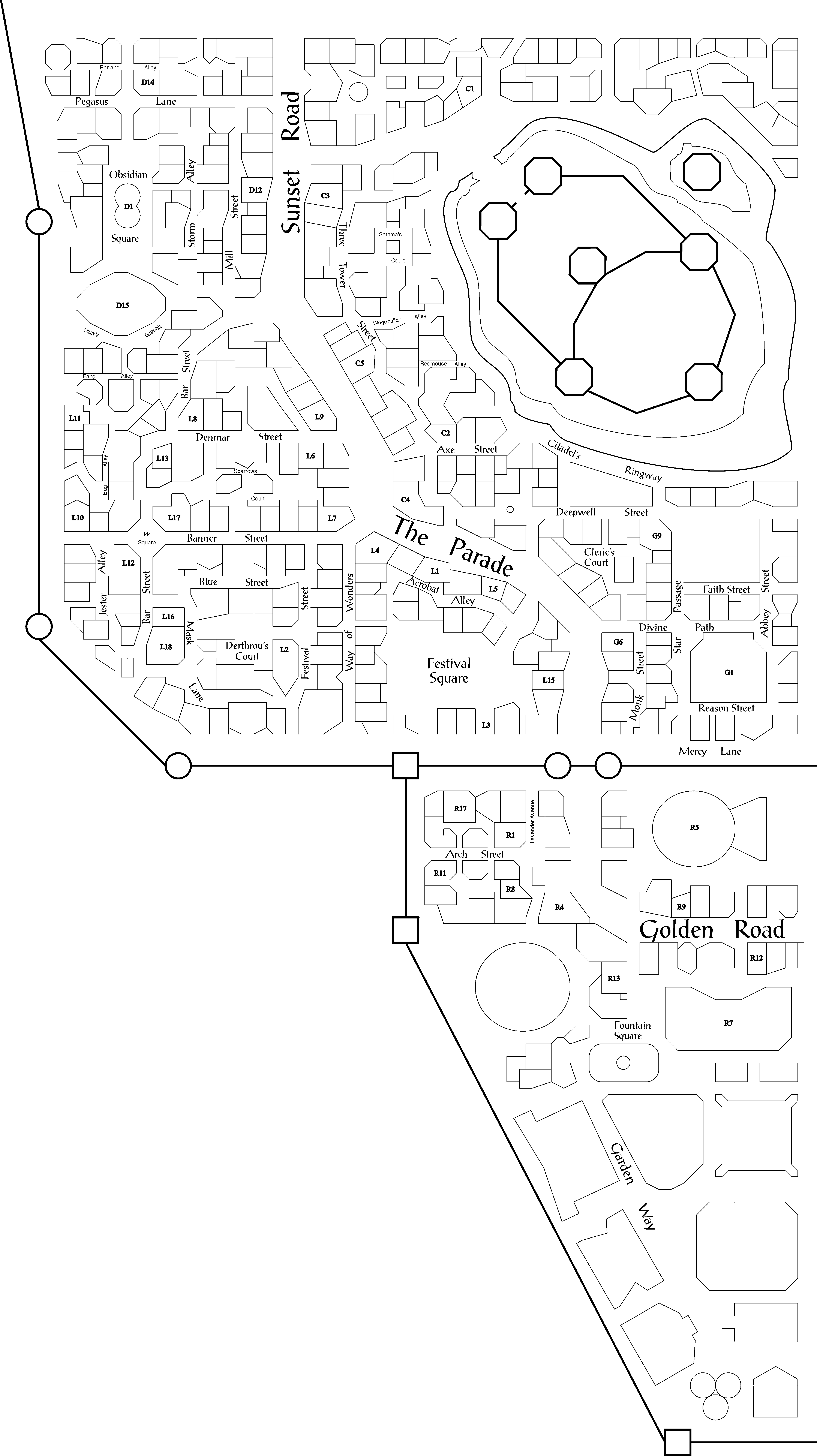
The
maps are the culmination of a lot of intensive work. They are big and
detailed and I mean BIG and DETAILED - I don't know how many buildings I
have drawn, but it must be several thousands. Many years ago (more than 10 anyway) I drew my first city maps by hand. As I
began creating larger cities, I found that drawing it by hand had two distinct
disadvantages. First, it was hard to change things, either as a correction of an oversight
or error, or as the result of a real change in the city (buildings being built or
destroyed, etc.). Second, it was also difficult to include information in the map for my
own reference without the players knowing it, (Gee, that building has a number on it, lets
search that one….) and without drawing separate maps, or copying it somehow. To
overcome these problems I decided to use the computer to draw maps, so I could change and
adapt them more easily, and keep separate maps. I had recently acquired CorelDraw 3.0, and
began the tedious process of drawing building. (I considered using geomorphs, but the
result was not to my liking).
Scale
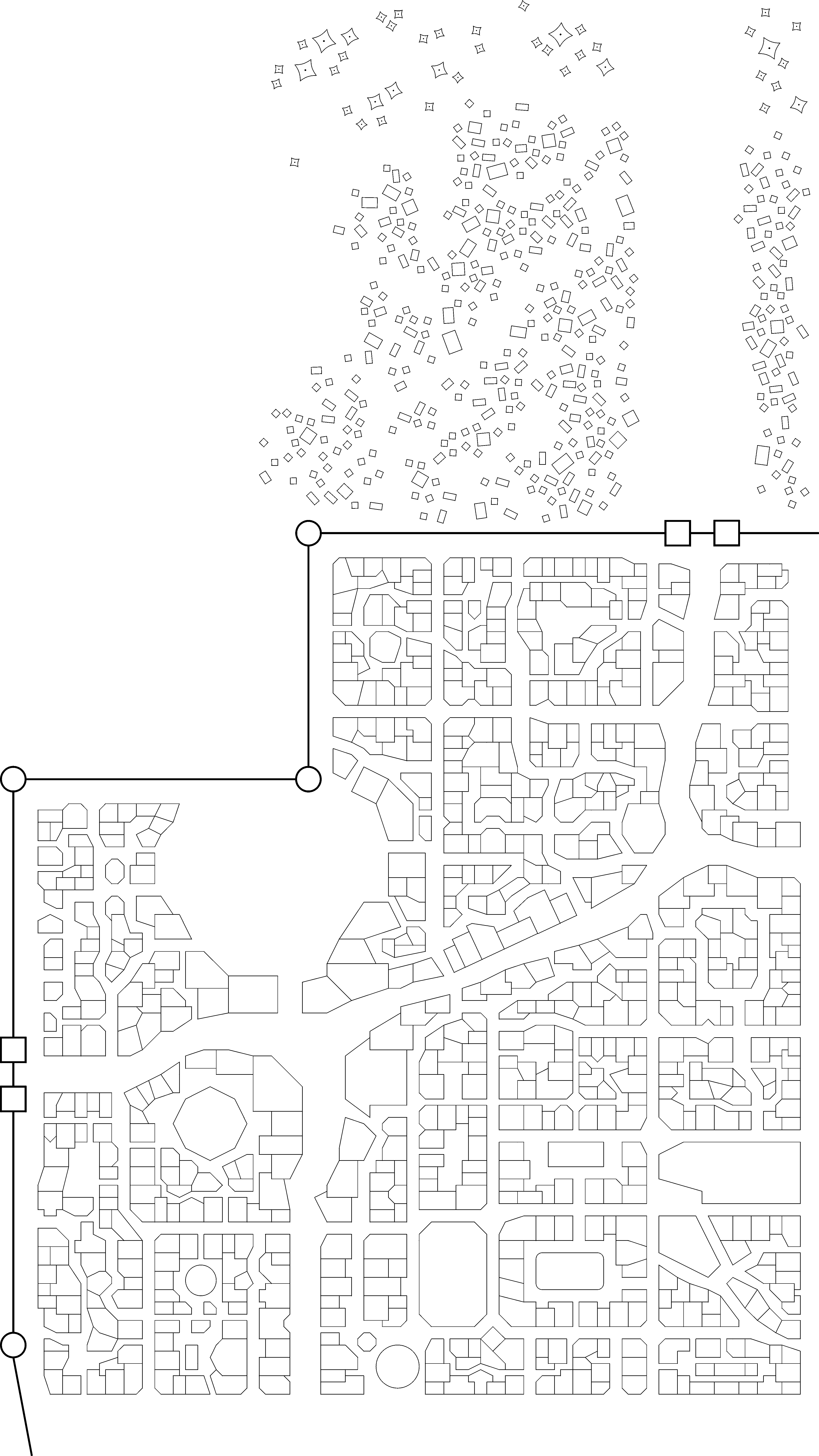
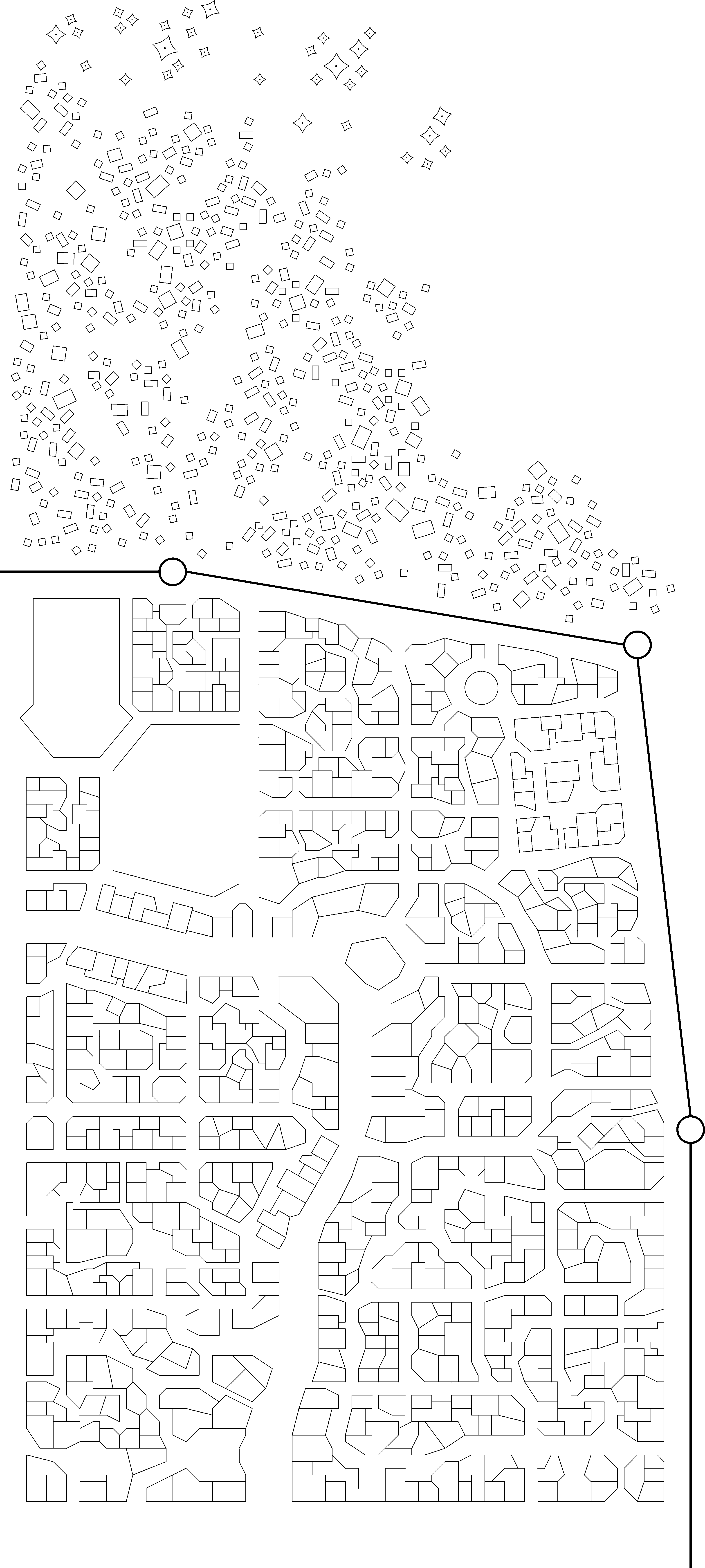
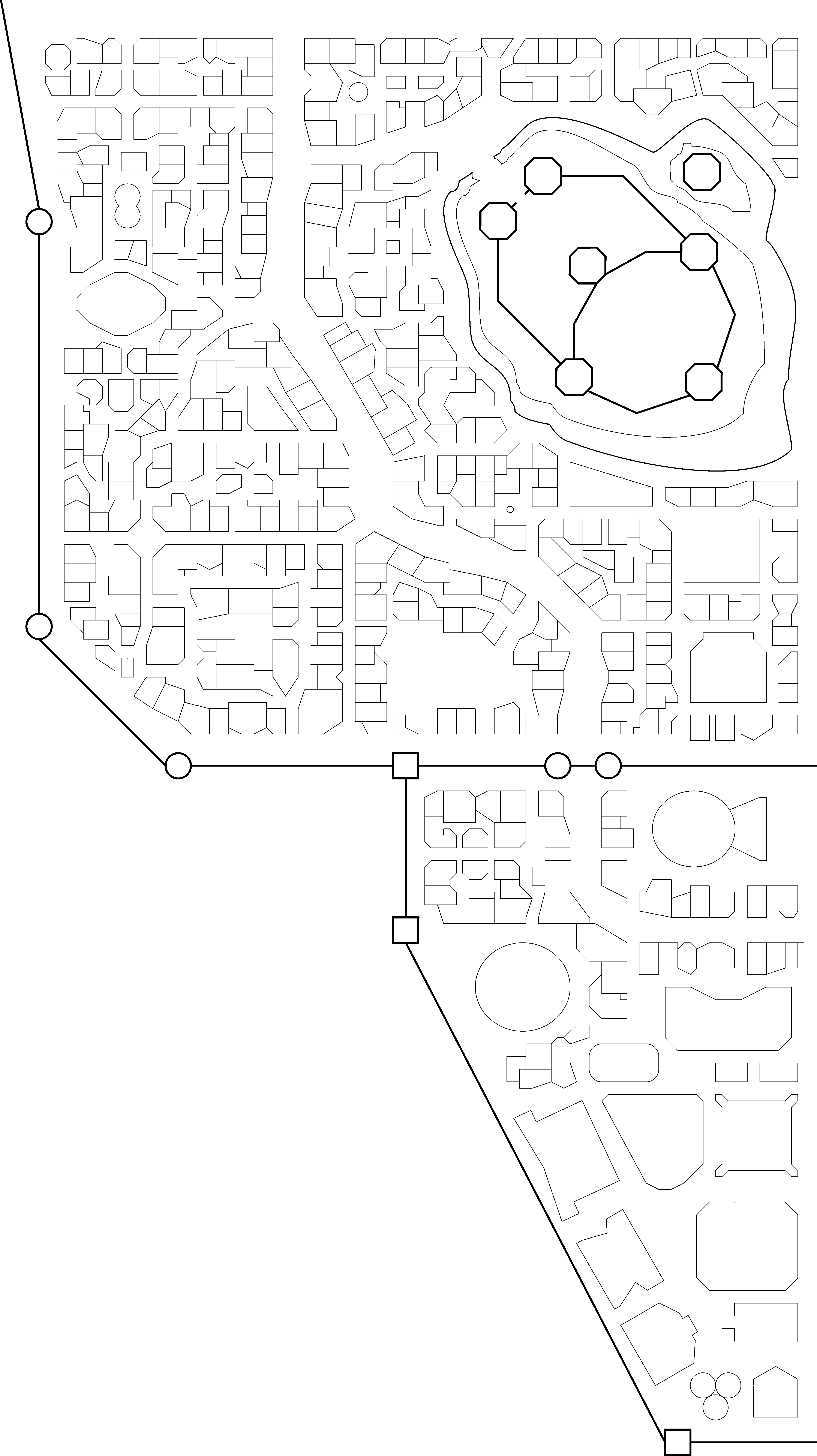
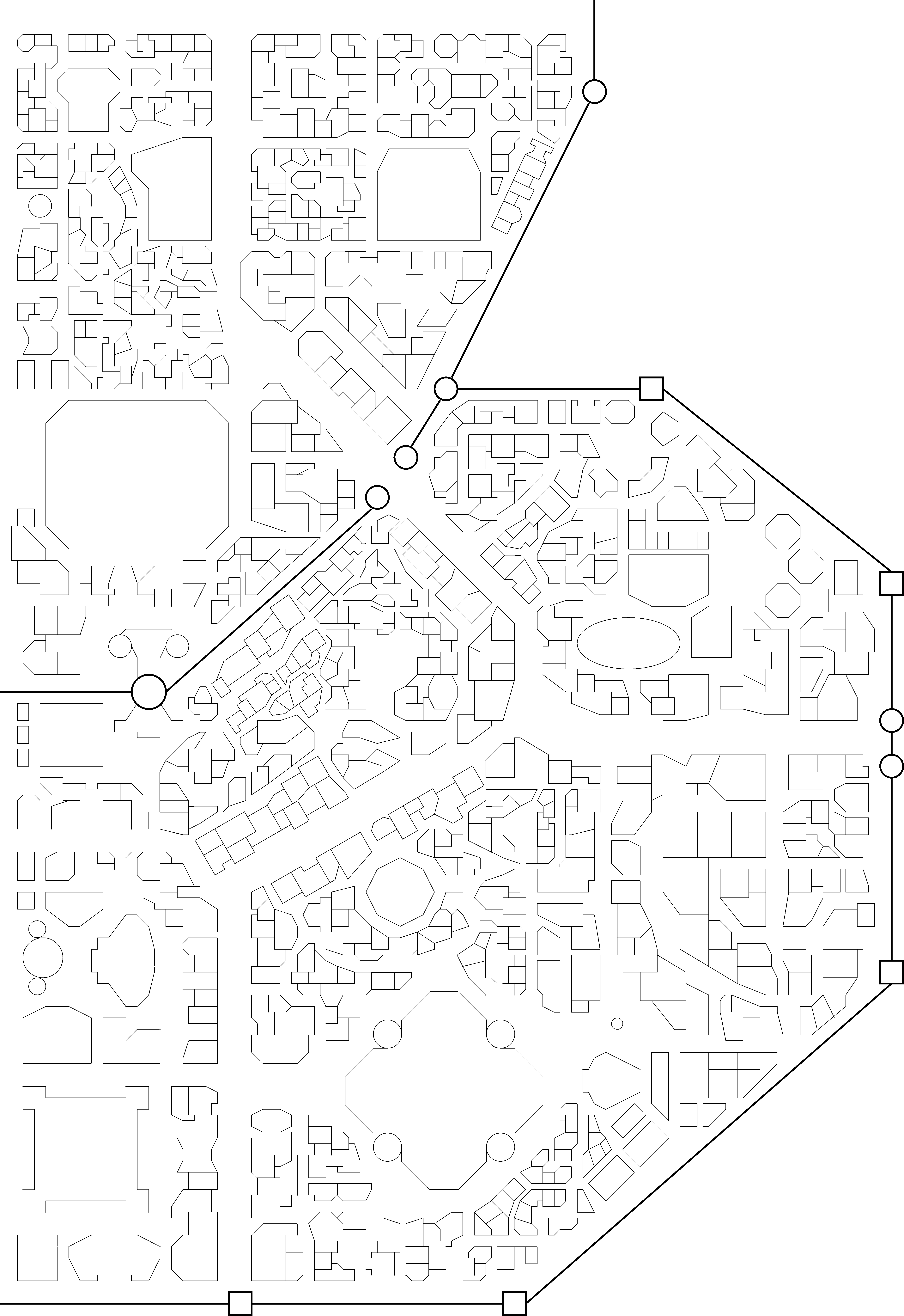
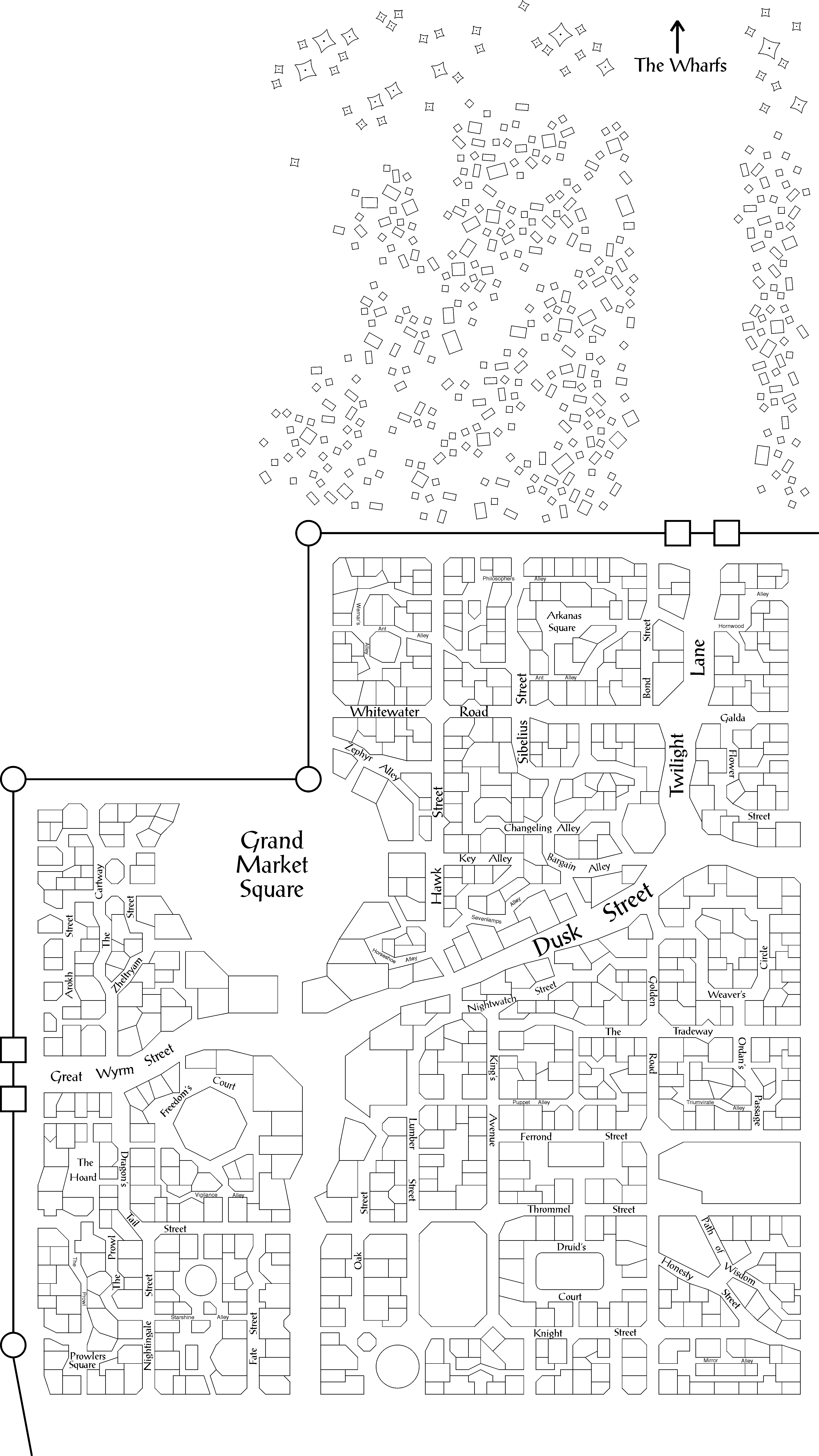
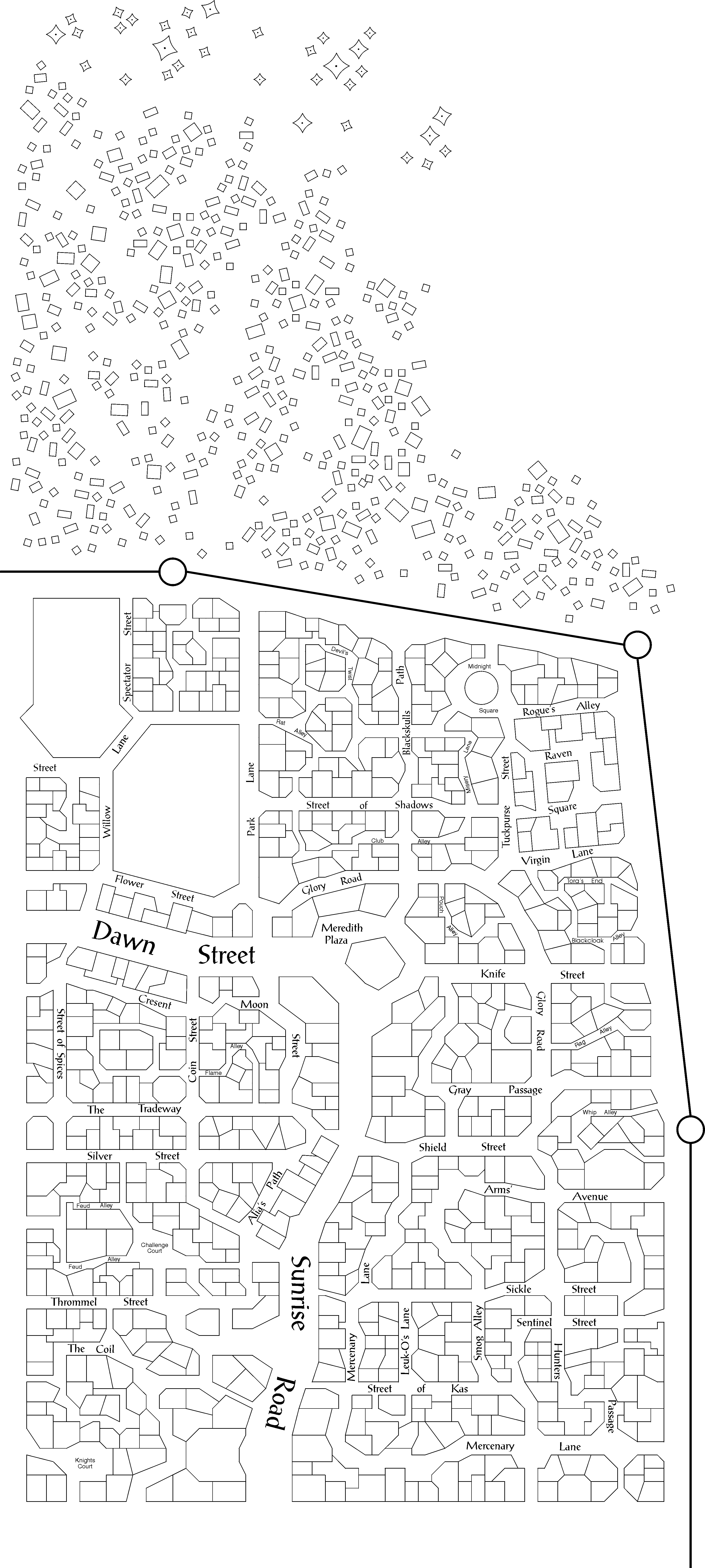
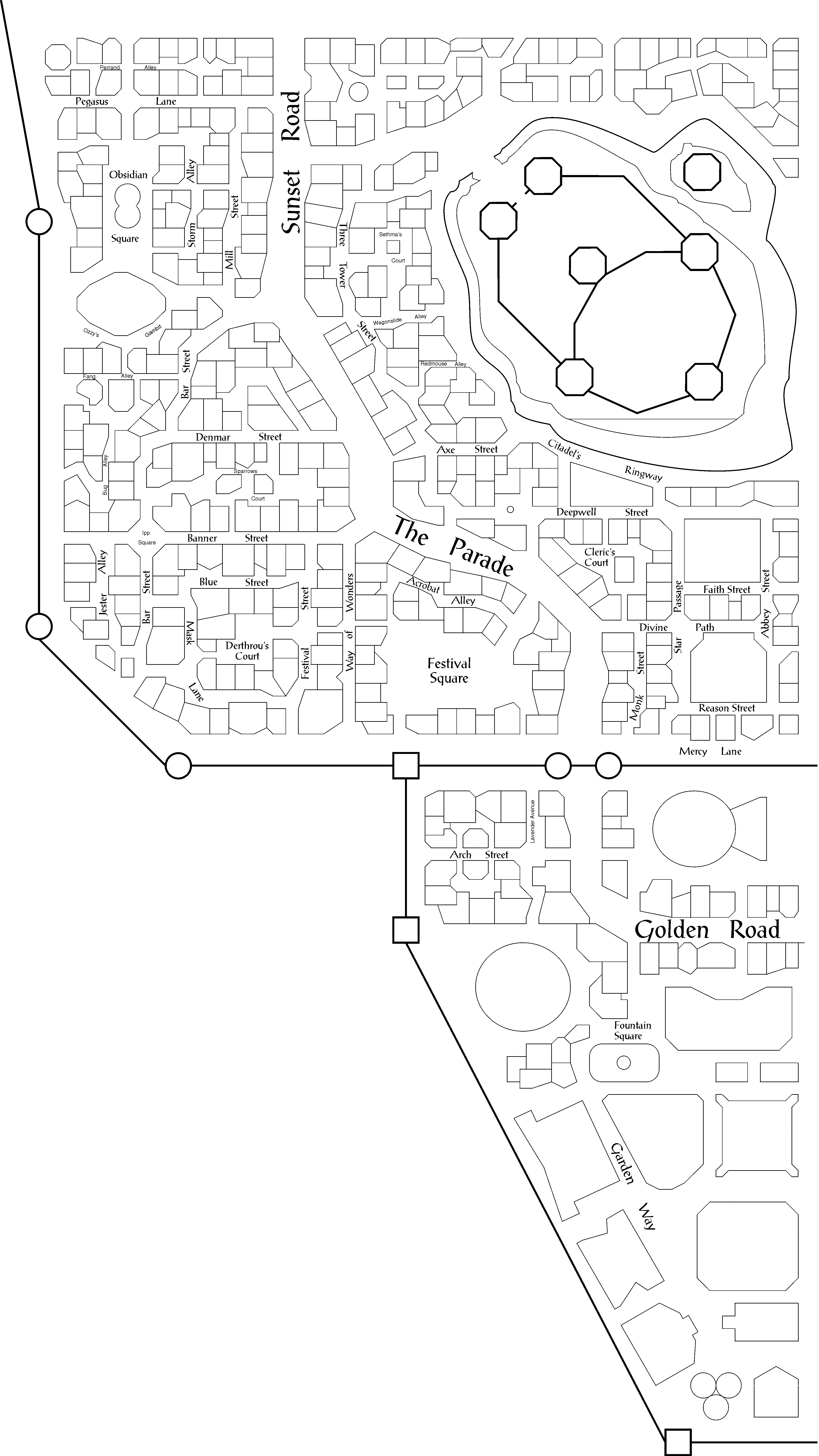
As a result of my drawing technique, the city is divided into four parts: NE (Northeast)
NW (Northwest) SE (Southeast) and SW (Southwest). Each part fits onto an A4 sheet, and all
parts fit together. The scale is of the maps is about 1:1220, which means that each 2.5 mm
equals 10 feet (or 1 inch equals about a 100 feet). For the streetnames etc. to remain
readable, this is minimum scale that I found manageable. Printing
requires at least a 600 dpi printer for good results.
Format
I used three particular fonts with the map, Times New
Roman, Switzerland(Helvetica) and ProseAntique. If you do not have these fonts, the names
might appear slightly larger or smaller, depending on the font type, and may overlap into
some buildings.
The files are now available in Coreldraw 8.0,
Adobe PDF and GIF formats. The Adobe PDF file loses some
quality in terms of resolution
Blank Maps
These are maps without streetnames, numbers or any references. I have included them for
DM’s who just want a map full of buildings to do with as they may.
WARNING - IE5 may refuse to load the gifs (for unknown reasons). Use
Netscape or click your right mouse button on the link to download the
files.
Maps for
the Player
These maps have streetnames, but no other references. They are also useful for DM’s
who want to decide on the location and detail all the buildings themselves.
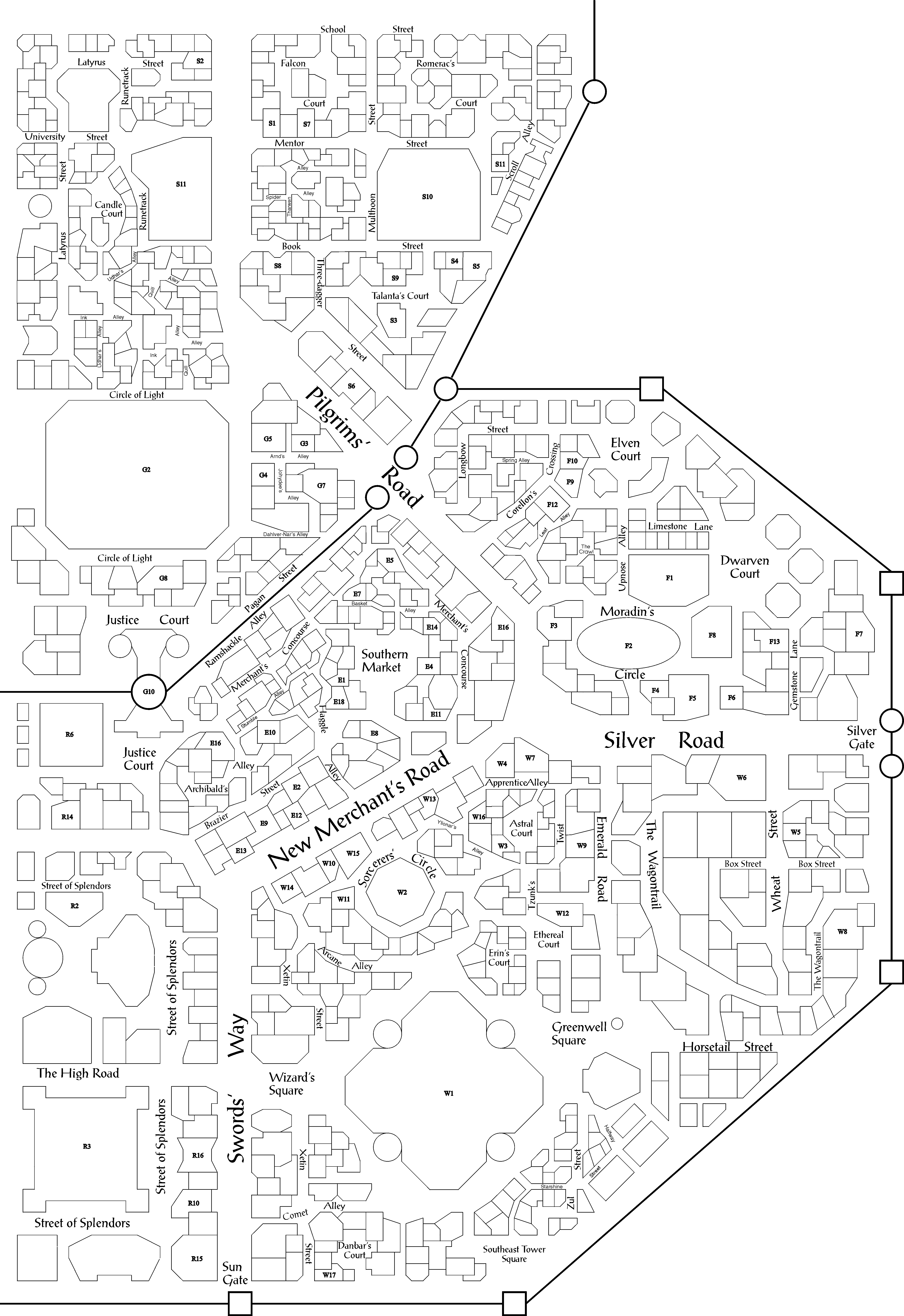
Maps for
the DM
These maps have both streetnames and references to buildings and places of interest. All
references have both a letter and a number. The letter indicates in what section of the
city the location is; the number corresponds to a particular building.
Combined
Map
I have also included a map that combines the four parts of the city on a single (A4) page.
The blank maps are used for this, because most references would become unreadable on such
a scale and it saves space. It shows how to fit the seperate maps
together.
(sorry, only Coreldraw version available)
Map Key
I have included a Map Key which lists the buildings or places of interest
corresponding to the numbers on the DM's maps and a list of all the street names.
The Map Key is in RTF.
|
