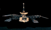
The Mariner Mars Mission
Introduction
Mariner 4 was the first spacecraft to obtain and transmit close
 range images
of Mars. After its launch on November 28, 1964 and a journey of hundreds of
millions of kilometers, Mariner 4 passed within 9844 kilomters of Mars on July
14, 1965. Beginning at a range of 16 900 km, the probe acquired a surface image composed of 200 lines, consisting of 200 pixels each (average
resolution was about 3 km/pixel), every 48 seconds until, at a range of 11 900 km, 22
television pictures of the Martian surface had been stored on the spacecraft's
4-track tape recorder (the last 3 of these pictures were beyond the terminator).
It took 4 days to transmit the image information to Earth and the spacecraft
returned useful data until October 1965, when the distance from Earth and its
antenna orientation temporarily halted the signal acquisition. Data acquisition
resumed in late 1967 and continued until December 20, 1967.
range images
of Mars. After its launch on November 28, 1964 and a journey of hundreds of
millions of kilometers, Mariner 4 passed within 9844 kilomters of Mars on July
14, 1965. Beginning at a range of 16 900 km, the probe acquired a surface image composed of 200 lines, consisting of 200 pixels each (average
resolution was about 3 km/pixel), every 48 seconds until, at a range of 11 900 km, 22
television pictures of the Martian surface had been stored on the spacecraft's
4-track tape recorder (the last 3 of these pictures were beyond the terminator).
It took 4 days to transmit the image information to Earth and the spacecraft
returned useful data until October 1965, when the distance from Earth and its
antenna orientation temporarily halted the signal acquisition. Data acquisition
resumed in late 1967 and continued until December 20, 1967.
Objectives
Mariner 4 was
designed with 3 main objectives in mind. First, the probe was to conduct field
and particle experiments in interplanetary space, including measurements of the
Martian magnetic field, cosmic dust and cosmic rays, and the solar wind.
Secondly, Mariner 4 was to provide close range images of Mars in order to
provide us with the most detailed surface pictures ever obtained of the planet,
hopefully revealing geologic and atmospheric processes. Finally, as
interplanetary probes were still a new technology, the mission would provide
experience in operational and engineering techniques required for long term
interplanetary missions. An interesting spin-off of the last objective was the
development of the radio-occulation experiment which obtained approval only
after the spacecraft was already launched. The experiment took advantage of
radio waves from the spacecraft propagating through the Martian atmosphere as
the spacecraft passed behind the planet. Variations in the amplitude, frquency,
and phase of the returned signal allowed calculations of atmospheric density,
temperature, and scale hieght as functions of altitude.
|
