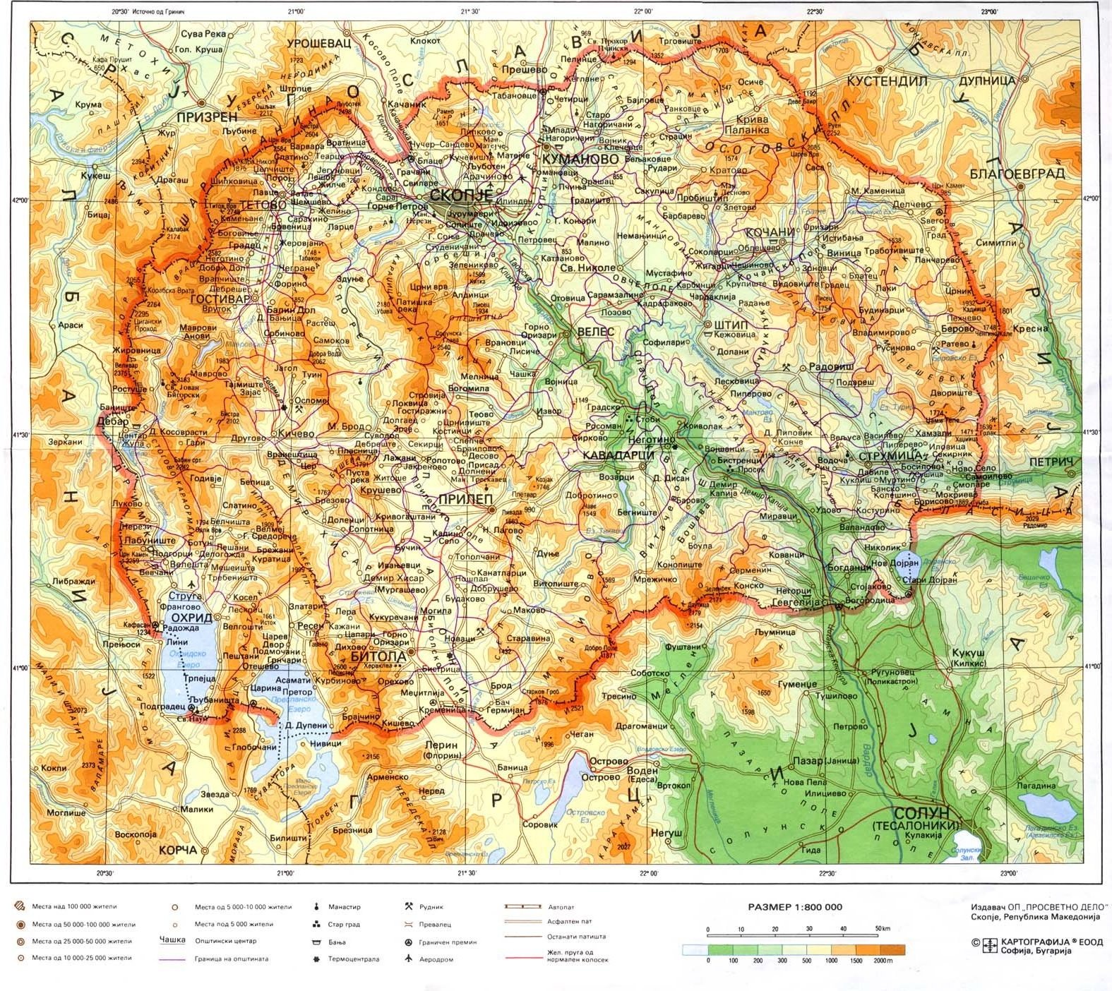
- Geography of the Republic of
Macedonia
Location: Southeastern Europe, north of Greece
Geographic coordinates: 41°50′N 22°00′E
Map references: Europe
Area:
total: 25,333 km²
land: 24,856 km²
water: 477 km²
Area - comparative: slightly larger than Vermont
Land boundaries:
total: 748 km
border countries: Albania 151 km, Bulgaria 148 km, Greece 228 km,
Serbia and Montenegro 221 km (all with Serbia)
Coastline: 0 km (landlocked)
Maritime claims: none (landlocked)
Climate: warm, dry summers and autumns and relatively cold winters
with heavy snowfall
Terrain: mountainous territory covered with deep basins and
valleys; three large lakes, each divided by a frontier line;
country bisected by the Vardar River
Elevation extremes:
lowest point: Vardar River 50 m
highest point: Golem Korab 2,753 m
Natural resources: chromium, lead, zinc, manganese, tungsten,
nickel, low-grade iron ore, asbestos, sulfur, timber, arable land
Land use:
arable land: 24%
permanent crops: 2%
permanent pastures: 25%
forests and woodland: 39%
other: 10% (1993 est.)
Irrigated land: 830 km² (1993 est.)
Natural hazards: high seismic risks
Environment - current issues: air pollution from metallurgical
plants
Environment - international agreements:
party to: Air Pollution, Biodiversity, Climate Change, Hazardous
Wastes, Law of the Sea, Ozone Layer Protection, Wetlands
signed, but not ratified: none of the selected agreements
Geography - note: landlocked; major transportation corridor from
Western and Central Europe to Aegean Sea and Southern Europe to
Western Europe
|