Limpsfield
History
This brief coverage of the history of Limpsfield Parish
is totally insufficient to cover the interests of all those who may read
this. For those who wish to delve deeper please check out the references
at the end of this page.
Limpsfield lies just to the south of a range of chalk
hills now known as the North Downs, some 21 miles south of central London.
The Parish is approximately six miles long, from the top of Titsey
Hill in the north to Staffhurst Wood in the south, by two and a half miles
wide from Moorhouse in the east to the Oxted boundary in the west at its
widest point.
The local geology comprises greensand and clays lying
at the foot of chalk hills (The North Downs) which lends itself both to
agricultural land and to extraction of specialist sands, clays, chalk and
fullers earth and there is evidence of settlements back to the stone and
bronze ages with a number of flint and bronze artefacts discovered in the
area, as well as evidence of old clay workings, ironstone workings and sand
pits. However much of the earlier history has to be derived from
archaeological investigations with the first written records coming from
the Domesday Book in 1086.
Prior to William 1st's victory over King Harold in
1066, Limpsfield was probably part of a private estate thought to have
been owned by King Harold. This presumably followed on from Roman
involvement in the area - remains of a Roman villa have been found at Titsey
(the location of the Lords of the Manor of Limpsfield, although strictly
outside the Parish boundary) and a minor Roman road (from London to Lewes)
crosses the Parish. However, after William's victory over Harold, and the
latter's death, the lands were ceded to the Abbot of Battle. At the time
of the Domesday Book entry the population was around 200, and there was a
mill, a fishery, the church, 2 stone quarries, '150 pigs from pasturage'
and 'three hawks nests in the woodland', possibly suggesting the breeding
of hawks for hunting.
The current parish church of St. Peter was constructed
in the late 12th Century and is presumed to have replaced an even earlier
Saxon church mentioned in the Domesday Book. Old Court Cottage in the
village was built as the Abbot of Battle's courthouse between 1190
 and 1200. Thought to have been
substantially altered around 1400 it still retains a number of extremely
interesting internal features. There are also a number of other houses
(nine) in the High Street which date back to mediaeval times (although
several now have much more modern frontages) having been constructed initially
in the 13th, 14th and 15th centuries. One of these houses was a butcher's
shop from the 15th century up until the early 1970s! There are also
more than 20 other mediaeval houses within the parish.
and 1200. Thought to have been
substantially altered around 1400 it still retains a number of extremely
interesting internal features. There are also a number of other houses
(nine) in the High Street which date back to mediaeval times (although
several now have much more modern frontages) having been constructed initially
in the 13th, 14th and 15th centuries. One of these houses was a butcher's
shop from the 15th century up until the early 1970s! There are also
more than 20 other mediaeval houses within the parish.
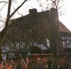
Old Court Cottage
The Hamlets
While Limpsfield village was the principal settlement
in the Parish, there were also a number of hamlets falling within it - and
these mostly retain their separate identities today.
Moorhouse on the Kent border ('moor' thought to have
come from the Old English 'meer' meaning border or boundary), centred round
a mediaeval hall house and a small area of enclosed common land.
The Chart - now relatively densely populated - but
which had only consisted of around ten cottages up until the start of the
20th Century is centred on Limpsfield Common.
Pains Hill is situated on an ancient trackway dating
from the iron age, with three mediaeval hall houses as well as some other
very old dwellings.
Langhurst is a farming area with more scattered dwellings,
but virtually all the farms in the area today retain extensive remains of
early houses - several of which are substantial mediaeval dwellings.
These hamlets are all on the extensive areas of common
land in the area, and the fact that the Lords of the Manor would not contemplate
the enclosing of this common land when they were under pressure to do so
back in the 19th Century is the principal reason why this area remains
comparatively undeveloped in relation to some of the surrounding Parishes.
This in turn accounts for the Parish's continuing rural character despite
the area's proximity to central London and to the railway line through
neighbouring Oxted.
Limpsfield Today
From the earliest records, the population of Limpsfield
remained relatively stable until the beginning of the 19th Century when it
began to rise quite sharply. There was a further strong boost at the
end of the 19th Century with the coming of the railways in 1884 when
the first train arrived at Oxted and Limpsfield Station (now Oxted Station).
The station itself is only a few hundred yards from the Limpsfield
Parish boundary. However even now the total population is only around
4,000 and with most of Limpsfield Common now owned and preserved by the National
Trust and the Staffhurst Wood woodland by the Woodlands Trust and the whole
area lying within the Green Belt around London where development is heavily
restricted, there is relatively little scope for any major increases although
some infill development has been seen in recent years.
The character of the old mediaeval village remains
despite modern amenities, new frontages built on some of the old buildings
and new development on the fringes and the area remains rural in character,
even though a good proportion of the inhabitants now rely on the commute
to London (35 minutes by train) or Croydon (15-20 minutes) to earn their
livings.
Further Information
Much of this summary of the history of Limpsfield comes
from two sources - Limpsfield Ancient & Modern, edited by Peter Gray
and published by the Limpsfield History Group, and from a report prepared
on the 25th Anniversary of the National Trust taking control of Limpsfield
Common by Shirley Corke. Both these publications are out of print,
but a few copies may still be available. Anyone interested in these
or other publications on the area are advised to contact The Limpsfield Bookshop,
High Street, Limpsfield, Surrey. Phone/Fax +44 (0)1883 714034.
Home Parish Council Pictures
History
Amenities
Churches
Titsey Place
Links