 |
 |
| 2007 Possible Conceptual Plan - Street Reallignment 20,000 sq ft in dark blue area up to 25,000 sq ft new construction possible dark blue and yellow combined - 1 story 2.5 Acres on site after street reallignment Copyrighted2007 Roger Doering (Moving the 25,000 sq ft new building as far as possible to the right on the lot and putting the parking in its place between the buildings is another possibility. ) |
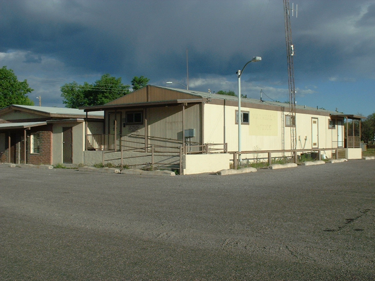
| Present Library Site |
 |
 |
 |
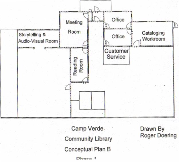 |
| Possible Conceptual Plan at Present Site -- as is without street reallignment. 1.73 acres. Up to 14,000 sq ft new construction possible on a single story. Must meet county flood control requirements as site in floodway. |
| Possible Remodel of porch area |
| 130 Black Bridge Loop Road |
 |
 |
 |
 |
| MEMORANDUM
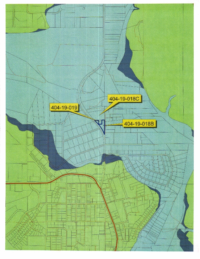
April 13, 2007 Yavapai County Flood Control District Summary of Requirements for Development of APN 404-19-018B (Parcel is within the Floodway of the Verde River) Per the attached Elevation of Floodplain Property completed by Dugan McDonald, RLS and stamped on 2/28/07; the depth of flow across the parcel was determined to be 2.2 feet; therefore the proposed building would need to be elevated 3.2 feet or more above grade. An Arizona Registered Civil Engineer would need to complete a drainage report, site plan and foundation design for the proposed structure in accordance with the Yavapai County Drainage Criteria Manual (Section 4.5). The report need to include the following: No-Rise floodway analysis to demonstrate no changes to the 100-year floodplain water surface elevation or loss of conveyance due to the development. At a minimum, this includes obtaining topographic cross sections and performing hydraulic floodplain modeling. The proposed structure would most likely have to be constructed on piers (open foundation) and be open to flow. Lateral Loading Analysis Impact Loading Analysis Erosion/Scour Hazard Analysis Structural Foundation Design As-Built Survey Flood Insurance would most likely be required and would be recommended for the proposed building. |
 |
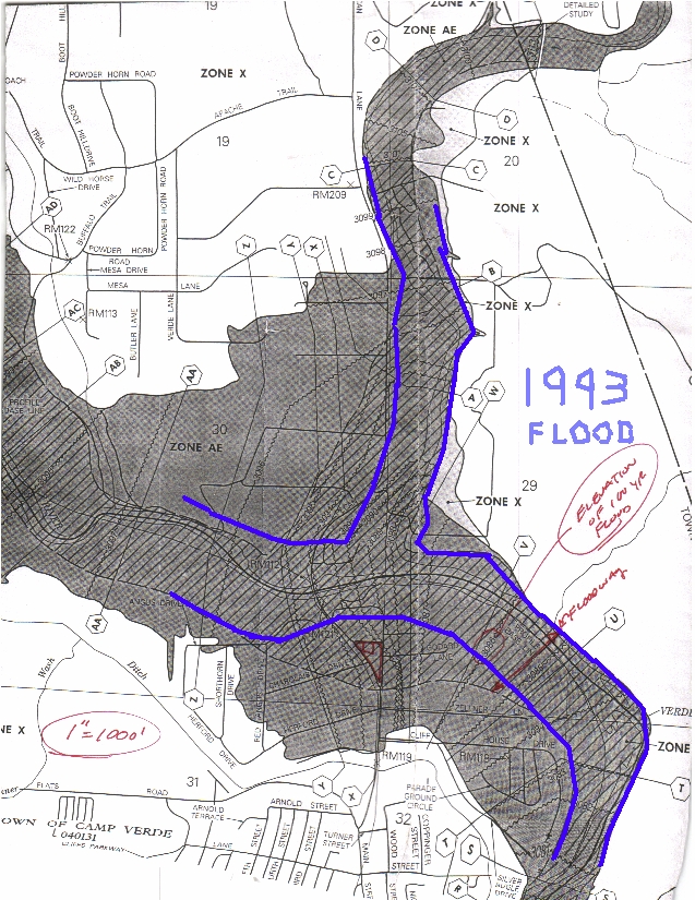 |
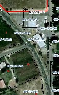
| 100 Year Floodway and Flood Fringe data as provided by Yavapai County Flood Control District I drew in blue where I recall the flood to have come up to in 1993. |
| Present Library is slightly less than 5000 Square feet situated on 1.7 acres of land encompassed by the three streets. |
| The Library now pays $ 2,774 yearly in flood insurance which is for $ 5,000 deductible, $ 193,600 on the building and $ 110,300 on the contents. A new building will have higher value and cost more to insure. Quotations for $ 1,000 deductible $ 500,000 on the building and $500,000 on contents from American National Insurance Co comes to $ 18,597 and about $15,000 with $5,000 deductible . The increase in cost because it is much better insurance coverage than we have now. Cost may be reduced with a certified elevation certificate but this gives an initial indication. The Maximum insurance available through the National Flood Insurance Program is $500,000 on the building and $500,000 on the contents even though the building and the contents are valued considerably higher. A New building is valued at 3 to 7 million and contents are valued at 2 million and up as items are added to the collection. New Information: Preliminary Quotation coverage $ 500,000 on building, $ 500,000 on contents $ 1,000 deductible $ 5,000 deductible With No Elevation Certificate base rate with no plans $ 19,395 annually $17,222 annually Elevation Certificate one foot above 100 year flood plain level. $ 9,151 annually $ 8,127 annually - lowest elevation allowable Elevation Certificate three feet above highest adjacent grade . $ 3,848 annually $ 3,420 annually Quotation will change based upon building design, elevation, and price fluctuations - courtesy of Gail Stern, America's Flood Insurance Service Cameron Park, CA |
| FLOOD PLAIN INFORMATION The Current site is located in the floodway of the Verde River should the water rise to the level of the 100 year flood as calculated by flood estimation software used by county flood control. The floodway is the area of the river where water will actually be moving at relative speed in a flood. The flood fringe is the water to the side of the floodway where it is pudlded up but not much motion. To my knowledge the Verde River has never reached the current site. |
| The Current Library Site has going for it that it is the current site. People are used to coming here. It has as its drawbacks a shortage of land for expansion unless the street is realligned as shown. It also is in the floodway of the Verde River. It has never flooded but it makes elevation of a new building and flood insurance a requirement. It is across the street from a yet to be developed park. It is by itself away from other community events although with the park there some park events might partner with the library. Parking is not a formidable challenge on the site. Look at the information on all the sites. Which site(s) provide the best accessability? |
| FEMA Parking Requirements in flood prone areas. Some have suggested parking be placed under the building in this location. This bulletin has technical information of what can be done. In summary FEMA wants below grade parking under a building to be dry in a walled in basement with a built up area "berm" at least one foot above the 100 year flood plain elevation to drive over to keep water out of the parking area. When you are through looking at the link, Be sure to click the back button on your browser, return to this web page and continue the TOUR. www,fema.gov/pdf/fima/job12.pdf |
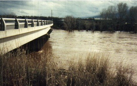
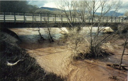
| 1993 PHOTOS In 1993 the water came up just over the black bridge. Looking at the upper left picture the water level was up to the edge of the bridge and flowing over about a one to two feet wide area at the center of the bridge. In this picture the water level had receded (gone down) by about 7 feet. |
| FEMA has created a web site called FloodSmart which includes information regarding flood insurance. These also give an estimate to get started with. Actual rates require elevation certificate and quotation by an insurance agent who sells a policy from the National Flood Insurance Program. Click on FloodSmart Logos above to read the information directly off the NFIP and FEMA website. |
| Building & Contents Premium Building Only Premium Contents Only Premium $100,000/50,000 $1,827 $50,000 $541 $50,000 $881 200,000/100,000 3,581 100,000 977 100,000 1,731 300,000/200,000 5,606 200,000 1,880 200,000 2,822 400,000/300,000 7,370 300,000 2,814 300,000 3,651 500,000/400,000 9,119 400,000 3,749 400,000 4,481 500,000/500,000 9,948 500,000 4,668 500,000 5,310 The table displays three different types of coverage. Premiums vary depending on the amount of coverage you choose and the type of coverage you need. Download a PDF of this page and bring it to a flood insurance agent who can help you choose the right coverage for you! These rates are based on a $500 deductible. |
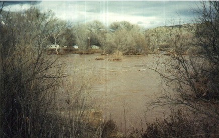
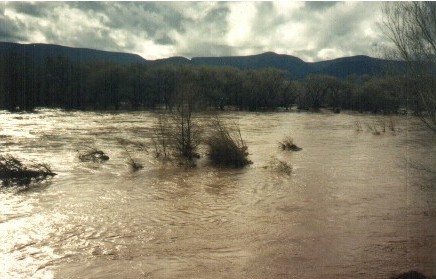
| Flooding of 1993 - after it crested and had receded some. Scroll down. |
| FLOOD INSURANCE |
| PARKING REQUIREMENTS IN A FLOODWAY |
 |
|
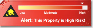
Property Location 130 black bridge loop road camp verde, AZ 86322 This property is located in a high risk flood area. Your property may be located inland, in a low-lying area near creeks and rivers that are prone to flooding caused by torrential rains, spring melt, etc. Or your property may be located in or near a coastal area that is susceptible to flooding caused by storm surge, hurricanes, etc. There are lots of reasons to be insured against flooding. Flooding is the #1 natural disaster Flood damage is not covered by most homeowners insurance. In high�risk areas, 1 in 4 homes will experience a flood over the course of a 30�year mortgage. Disaster assistance � if it's available � is usually a loan you must repay with interest. Flood insurance is mandatory if you live in a high-risk area and have a mortgage from a federally regulated lender. Find an Agent in Your Area! Estimate Your Premium High Risk Zone Find out more about high risk zones. Digital Map Information. The best way of determining your flood risk is by using flood insurance rate maps. FloodSmart.gov uses digital versions of these flood maps to determine your relative risk level. To determine your actual flood risk, go to the Map Service Center to view the latest flood map for your community. Does your community participate? Find out if you are able to purchase federally backed flood insurance. View a list of communities participating in the National Flood Insurance Program. Save Money Talk to a flood insurance agent today. You may qualify for an insurance discount based on your community's Community Ratings System status! Learn more about CRS ratings. More about High Risk Areas Community Rating System (CRS) Frequently Asked Questions about Risk Assessment Note: The risk profile displayed is not a legal document and should not be used in place of a flood zone hazard determination. Risk profiles are meant to be used as advisory tools for general flood hazard awareness and education. Do not use this information to make final decisions about purchasing property or flood insurance. For further assistance, please contact your insurance agent. |
 |
 |
| FEMA Flood Insurance Rate Map with more details around present library. The gray area is known as the Flood Fringe. The area in gray with black diagonal crosshatch lines is known as the Floodway. The library property is entirely within the Floodway where water would be moving with some velocity. Will the Verde River ever flood to this level? I don't know, but FEMA predicts the chances are 1 percent every year or 26% over the live of a 30 year mortgage. The numbers along the wiggly lines perpendicular to the direction of flow are the elevation above sea level of the surface of the water during a FEMA predicted 100 year flood. By knowing the elevation of property in the area, the depth of flow can be calculated. (2.2 foot depth average on library property.) Blue shows waters edge in 1993. Red square is location of current library. |
 |
| Site Presently Selected by Council |
| Council 1st Place Ribbon Public Survey 2nd Place Ribbon |