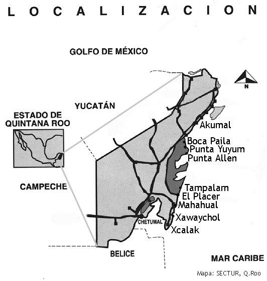
In this page you can find the locations of each sampling site (geographic coordinates) and the map that leads to the graphic results of each site.
Las localidades donde finalmente se tomaron muestras y los resultados preliminares encontrados en este estudio se describen a continuación:
Boca Paila Norte (20º06'51”N – 87º27'23”W)
Boca Paila Centro (20º06'21”N – 87º27'34”W)
Boca Paila Sur (20º05'51”N – 87º27'47”W)
Punta Yuyum Norte (19º58'30”N – 87º27'10”W)
Punta Yuyum Centro (19º58'00”N – 87º27'06”W)
Punta Yuyum Sur (19º57'30”N – 87º26'52”W)
Punta Allen Norte (19º50'30”N – 87º26'15”W)
Punta Allen Centro (19º50'00”N – 87º26'36”W)
Punta Allen Sur (19º49'30”N – 87º26'52”W)
Tampalam Norte (19º09'15”N – 87º32'00”W)
Tampalam Centro (19º08'45”N – 87º32'10”W)
Tampalam Sur (19º08'15”N – 87º32'13”W)
El Placer Norte (18º54'48”N – 87º37'03”W)
El Placer centro (18º54'08”N – 87º37'24”W)
El Placer Sur (18º53'35”N – 87º37'36”W)
Mahahual Norte (18º43'24”N – 87º41'56”W)
Mahahual Centro (18º43'01”N – 87º42'09”W)
Mahahual Sur (18º42'30”N – 87º42'20”W)
Xahuayxol Norte (18º30'55”N – 87º45'02”W)
Xahuayxol Centro (18º30'25”N – 87º45'13”W)
Xahuayxol Sur (18º29'55”N – 87º45'22”W)
Xcalak Norte (18º13'43”N – 87º49'51”W)
Xcalak Centro (18º13'09”N – 87º49'54”W)
Xcalak Sur (18º12'39”N – 87º49'47”W)
In the map below you can look at the sites studied by LEEAC-CINVESTAV-IPN.