|
|
|
|||||||||||||||||||||||||||||||||||||||||||||||||||||||||||||||||||||||||||||||||||||||||||||||||||||||||||||||||||||||||||||||||||||||||||||||||||||||||||||||||||||||||||||||||||||||||||||||||||||||||||||||||||||||||||||||||||||||||||||||||||||||||||||||||||||||||||||||||||||||||||||||||||||||||||||||||
|
Laser
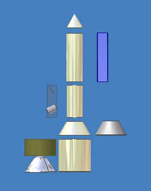
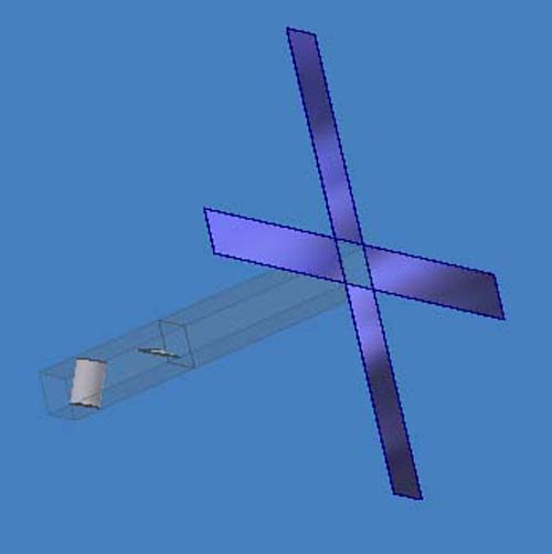
Rocket We think about the following? Size: Diameter to height ratio 1:5 Solar panel Telecommunications Electronics Telemetry (control) Vision system Transmission and receive Stability Propulsion in space Combustion in space since there are no oxygen Shielding Security & encryption?
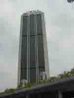
- Laser Rocket Launch site
The first micro satellite was launch in 1998. Three major consortium were involved.
I was involved in the high power laser propulsion system. The satellite was put into an orbit of 300 to 800 km above sea level. This is the first technology of its kind ever developed in this world.
- Satellite Our state of art technology, The ANGKASA
The base is detached before Angkasa go to outer space and into orbit
In orbit, the satellite spanned the solar panels to receive maximum power from the sun.
- Vision system The telescope and satellite dish face the earth control system. This high resolution power telescope could easily capture an image size of 100m X 100m over the earth's surface. With enhanced digital image capability, the image of a car could be seen clearly and interpreted correctly. Not only that, the infra red capability could track any movement such as tanks, ships, air planes and many others with absolute clarity as long as it produces heat. We also transmit in the C and Ku band frequencies for audio video of more than 60 channels and radio telecommunications of more than 100 channels.
- Telemetry & control
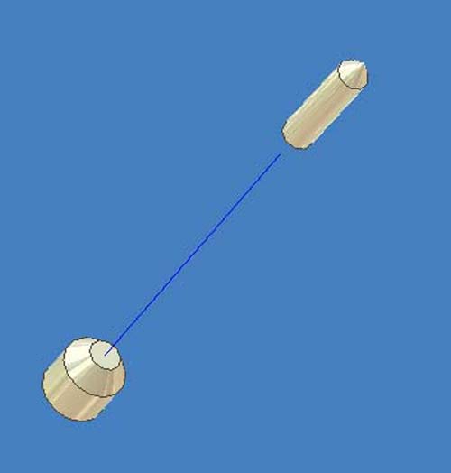
The software were developed by us to control the satellite intelligently in geostationary orbit at 300-800 km above the sea level. The position is guided by a low power laser on earth.
Controller 1 Guidance system to ensure the satellite is in the correct orbit and position. Any deviations, a smart error corrections are activated automatically, thus keeping this satellite in the exact position in orbit.
Controller 2 The images are sent back to earth base station at a resolution of 100m X 100m. Using digital images techniques of picture enhancement, the image of a tank could be seen clearly and interpreted. Not only that, our infra red and night vision capability could see any objects even in total darkness. The images transmitted back to earth base station is in G bits per second.
A helicopter was used to transport expensive items and lorry for big bulky items
Weather is monitored day and night
Visibility is important
Radar to monitor any movement in the sky
Selection of frequencies Frequency allocation chart (pdf) Frequencies selection are based on the allocation chart. Note there are only a few suppliers for this electromagnetic spectrum in the GHz range for satellite communication. Examples are: Transponder specifications Frequency band: uplink 5925-6425 MHz 13.75-14.5 GHz downlink 3700-4200 MHz 10.95-11.2, 11.45-11.7, 12.2-12.75 GHz Bandwidth: 12 X 36 MHz 12 X 54 MHz Power : TWTA 112 Watts SSPA 12 Watts
Mobility in design The design is mobile, as such you need only TWO 20 feet container load to put all the stuffs in. Launching could be done ANYWHERE in this world. With a fiber optical cable connected to the rocket, the control transmit millions and billions of data per second during launching until it is put accurately into orbit.
Applications 1/ Normal, night and infra red vision - resolution 100m X 100m Further enhance image using digital image picture enhance 2/ Payload of multiple 50kgs can be assembled in space to meet most design. This design can be in modular form 3/ Laser weapon for offensive to shoot any object flying in the sky. The laser source could be on the ground 4/ Anti missile laser guidance system 5/ Radio audio frequency jamming 6/ Transmit audio, video, data, internet and telecommunications system 7/ With multiple satellites could form an offensive weapons against enemy anywhere in the world 8/ Enemy is sitting duck as laser is shot from outer space 9/ Invincible for enemy to attack (no missile could reach outer space) 10/ Monitor what our neighbors are doing? 11/ Monitor terrorist activities 12/ Monitor illegal immigrant movement within country borders 13/ Accurate weather forecast 14/ Topography mapping 15/ Minerals search and geological surveys è Virtually there are no limits …
The satellite is tilted at 14.6 deg and the compressed air purges the height between 300 and 800 km above sea level. Navigation is controlled using global positioning system (GPS) and the earth's magnetic field. However the more accurate control is using earth laser similar to the police radar detector.
The control system is by using a single pc that automatically correct the coordinates of the location. This position can be moved slowly as to conserved the energy.
The images is captured using the high power telescope that can take pictures day and night. There are two modes, 1/ Visual daylight photography and 2/ Infra red vision. Upon captured by the ccd, the the images are transmitted back to the earth's control center or ground base control. These images are processed using enhanced digital image technology. Even a car plate number could be read.
We also transmit in the C and Ku band frequencies for audio video of more than 60 channels and radio telecommunications of more than 100 channels.
The life expectancy of the satellite is guaranteed at 10 years. We have actually calculated that Angkasa will stay in orbit for more than 15 years.
|
1 |
||||||||||||||||||||||||||||||||||||||||||||||||||||||||||||||||||||||||||||||||||||||||||||||||||||||||||||||||||||||||||||||||||||||||||||||||||||||||||||||||||||||||||||||||||||||||||||||||||||||||||||||||||||||||||||||||||||||||||||||||||||||||||||||||||||||||||||||||||||||||||||||||||||||||||||||||