|
Rock Garden????
|
| Trail Description: | Road (maintained), Trail well maintained | |
| Best During: | July to mid-September | |
| Trip Distance: | 8.7 | |
| Ride Time: | 3 to 5 hours | |
| Elevation Gain: | Unknown | |
| Overall Rating: | Advanced |
|
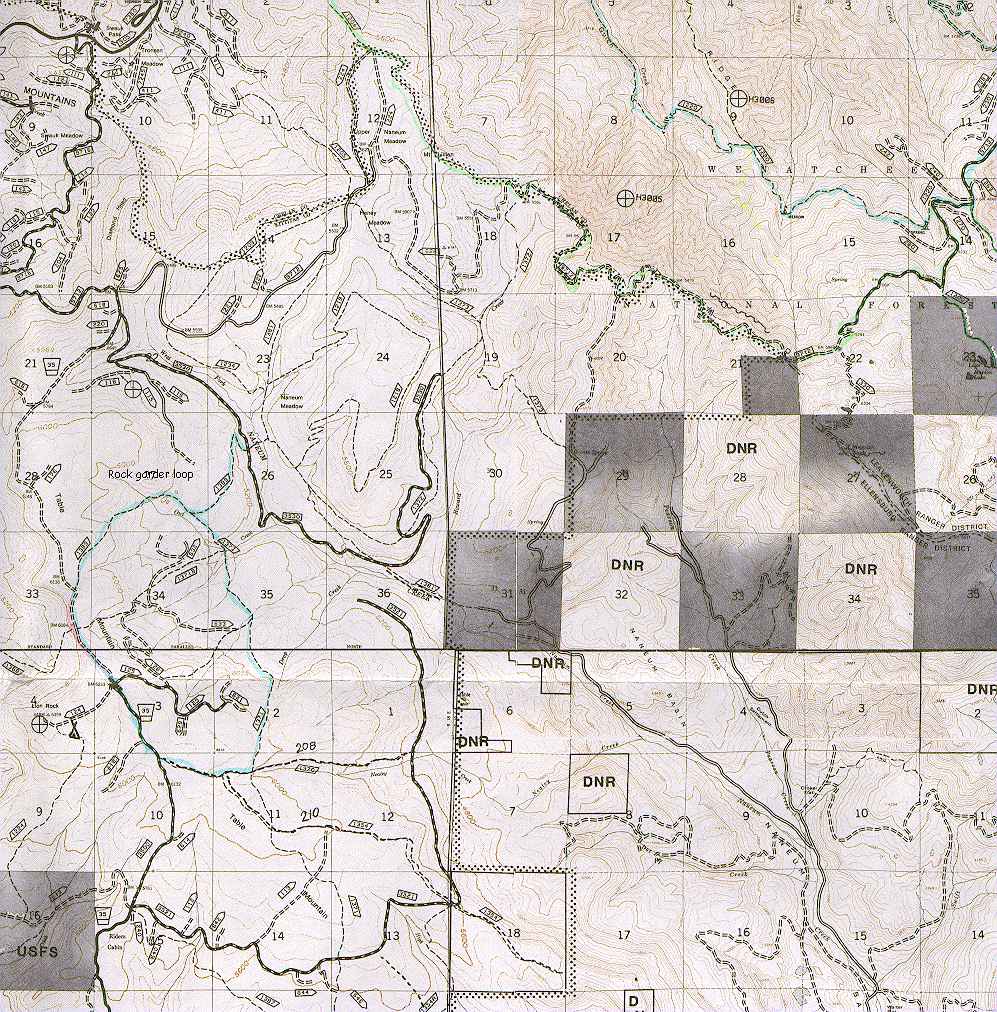
Drive to Swauk Pass on US Highway 97. At the summit go east on Forest Road 9716 for 3.7 miles, then turn left on Road 9712: After ].6 miles turn right on Road 3500. Drive 0.] mile, then take a left on Road 3530 and follow it down for 2.3 miles to the trailhead, at the south end of Naneum Meadows (elevation 5,040 feet). |
| 0.0 | Start the route by cycling up Naneum Meadows Trail (No. 1389). | |
| 0.2 | Go left at a "T" intersection. | |
| 0.5 | Stay right at the "Y" intersection and continue the very steep climb, which has occasional views east over the Naneum Creek drainage. The trail on the left is your return route. | |
| 1.0 | Junction with the Naneum-Wilson Trail (No. 1371). Stay to the right and continue up. | |
| 2.6 | Trail ends. Go left on Road 3500, a well-graded logging road that traverses the crest of Table Mountain. | |
| 3.0 | Stop at the small roadside turnout for a view west over the Wenatchee River Valley and north to Mount Stuart. Owl Creek Irail, No. 1371B (an altcrllatc route back), is on the left. | |
| 3.7 | Junction. On the right is a spur Road 124 to Lion Rock Campground; on the left, Spur Road 125 descends to Drop Creek Spur Trail No. 1371C (an alternate route back). The loop route continues straight ahead on Road 35, descending through open grassland. | |
| 4.0 | Turn left and head uphill on Nealy Creek Jeep Trail (No. 1370). The trail makes a short, rough climb followed by a descent through heavy forest. | |
| 4.4 | There is a spur road on the right. Pass it without a thought. | |
| 4.6 | Junction with Regan Jeep Trail (No. 1354). Go left, still on Nealy Creek Jeep Trail. | |
| 4.8 | Junction with Naneum-Wilson Trail (No. 1371). Go left. The single-track trail starts out nice and easy for the first 0.5 mile. then makes a sudden Dr.-Jekyll-to-Mr.-Hyde transformation. | |
| 6.4 Bottom of the first descent and junction with the Drop CreeL Spur Trail. Stay to the right and descend another 75 feet, t. where the trail joins a logging road. Continue straight ahead. | ||
| 6.5 | When the road bends and heads uphill, go right on an un signed but well-traveled trail (the junction was marked wit! yellow tape in 1988). Cycle through a couple of small meadows, then prepare for an elevator drop to Owl Creek. | |
| 7.3 | Cross Owl Creek to reach the Owl Creek Trail junction. Gc right and push up a very steep slope. | |
| 7.5 | At a "T" junction, go right and follow the trail across a marsh, then north along the edge of the cliffs. | |
| 8.2 | Junction with the Naneum Meadows Trail. Head right, down along the forested hillside, following the trail back to the start. | |
| 8.7 | Back at your car, check your brakes and see if you have and rubber left on the pads. |
Or back to the top.