| Trail Description: | Road (maintained), Trail (good condition) | |
| Best During: | July to end of September | |
| Trip Distance: | 22+ miles | |
| Ride Time: | 4 to 5 hours | |
| Overall Rating: | Skilled | |
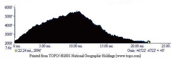
| Elevation Gain: | 6722 ft |
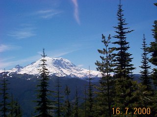
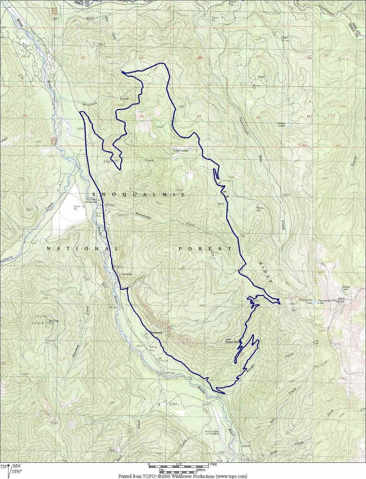
| A steady climb, incredible views and great single track make this ride one of the state's best, with Nachess pass. The trail log describes a loop that climbs road and decends trail. However, if you enjoy riding single track, up as well as down, then follow the directions to the Skookum Flats trailhead and pick up the Dalles Ridge Trail log at mile 17.5 and work you way backwards (up the mountain) to mile 10.2. This ride can also be done using the shuttle system if the gate at the bottom of road #72 is open. |
|
Drive Hwy 410 about 6 miles south of the town of Greenwater. Turn left on road
#72 and park near the gate. Park well since there is not much space and no
parking lot. Do NOT block the gate.
The trail log bellow is with aproximate mileage. Mine was from my Garmin 12 Map GPS, but most of my friends had different mileage (+ or - 0.5 miles) displayed on their cyclo computers. Don't forget to print out the map (300k) and
the trail log, they can be useful... |
| 0.0 | Elevation 2,080 feet. Follow road #72 from the gate heading uphill. This is a heavily logged region so be prepared to pass several spur roads on the way up always staying on the better road. |
| 7.4 4769 ft | Leave road #72 before it decends down to 28 Mile Creek. Turn right onto road #7250 and continue going uphill. Again, you will pass a few spur roads, always staying on the better road (FR72). |
| 8.5 4984 ft | Road #7250 decends to the right. Turn left on spur road #210. |
| 9.8 5296 ft | Road #210 ends where Dalles Ridge Trail begins. The beginning of the trail may be difficult to located. Just keep heading south, climb a bit and you should pick it up in the trees. |
| 10.5 5543 ft | You are at the highest point of the ride. |
| 10.6 5496 ft | Ranger Creek Trail #1197 decends to the right. Turn right a start your decent on Ranger Creek Trail. |
| 11.3 4989 ft | Reach a shelter. Stay to the left of the shelter and pick up the trail as it continues to decend. |
| 16.7 2747 ft | Ranger Creek Trail runs into the White River Trail #1199. Turn right and follow this trail as it parallels Hwy 410. The trail is mostly flat but it has enough twists, turns and obstacles to make it entertaining. You will cross a few other marked trails always staying on White River Trail #1199. |
| 17.5 2621 ft | Continue Straight. The trail on the left decends to Hwy 410. |
| 17.8 2619 ft | Go straight and continue. |
| 18.8 2493 ft | Reach Camp shepard, turn left and decend out to Hwy 410. |
| 19.10 2296 ft | Reach Hwy 410. Turn right and ride on 410 for next 3+ miles. |
| 22.20 2080 ft | Turn right onto road #72 and find you car. |
Back to Western Washington's trails.
Or back to the top.