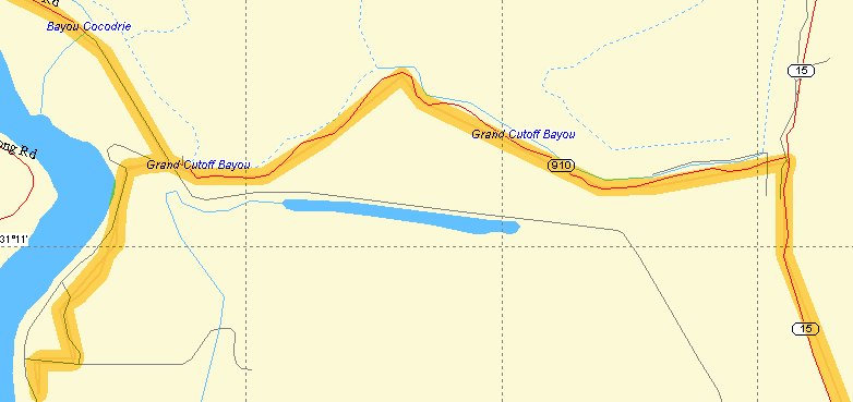
I had been pulled over at the intersection of La.910 and La.15 when a fella stopped and asked if I needed directions. I asked him what was down 910. His reply was, "Nothing down there".
I've heard that before and what is one man's nothing can be another man's something. Such was the case, especially to one who finds anything new, something.
I putted down the levee onto 910. The road seemed a very normal blacktop road going through a very normal wet woodsy area that was being cleared. Then I started seeing signs which said not to enter because this was a restricted area. These were not the signs that hunting clubs would use. These were official "govenment" signs. I saw no clue as to what was the secret or reason for exclusion. I proceeded and saw the road go up the levee, usually a sign that things would change, usually for the wilder. Levees are often the end of civilization.
I descended into what can best be discribed as a "Hunter's Village". The large number of camps were more ramshackle than most I've seen. It definitely did not look like a place where the wives had had an influence. A deer hung from a rope, head down and skinless. I gave an obligatory wave to the group of camoflaged dressed men who gathered around the corpse. I did not look to see if the wave was returned. I was feeling a little out of place but reassured myself that I was on a public road. The village thined out and I was back into the low forest again. I checked the gps and sure enough I was headed south, not where I wanted to go. La. 910 had ended at the levee and the only way to the roads I wanted to be on was to return to the levee, a route I had suspected from checking it at the house.
Home route planning and on the road application can get a little out of synch sometimes. Especially when the planning is stored in my memory instead of actually being loaded onto the gps.
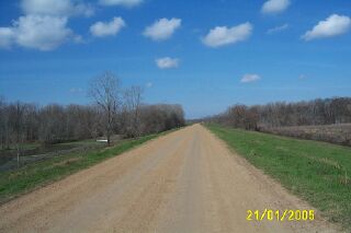
Back up on the levee I turned west onto the Red River Levee Rd., an actual named road, which is a good thing. It was mildly wash-boarded for about 14 miles. There were camping areas along the way which are sponsored by the Louisiana Department of Wildlife and Fisheries. There are no facilities, these are primitive camping spots which are right on the scenic Red River. I stopped at one, ready to stop vibrating for a few minutes. I continued on the levee, going west, and saw roads going into the gray forest, some with sign in stops for hunters. I saw a paved road appear on the north side of the levee. I went down the side and onto the pavement. Was I in civilization? Not yet. It went back to the top of the levee and I continued on. What was that paved strip doing out here?
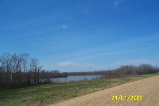
I finally came to a real highway, La.129, that ended at the levee. I was at the confluence of the Black River and the Red River. I don't find places of this magnitude often and it was exciting. Here I was where water coming from
as far away as West Texas was joining water coming from Western Arkansas and Louisiana. At this point the Red River becomes much larger. Other small bayous would join the Red before she becomes the Atchafalaya which carries the additional load of one third of the Mississippi's volumn. That third comes through the Old River Control Structure.
I turned north on 129 looking for the next road that would follow the Black's levee. Remember, in Louisiana, if you want to see history and have "good" roads, stay close to the water. |