 |
 |
 |
 |
 |
 |
 |
 |
 |
 |
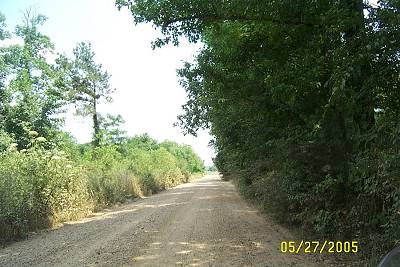
| Here is one of those tantilizing, probably dead end, roads. It is lacking one thing that would have tilted me down its ruts to see what was in that tree line back in the distance. A tree line out here means water, a bayou, a coulee (small stream). That one thing is a stop sign. Stop signs say "public road" to me. If the public paid for the sign then the road must be public or at least that's my story if approached by some possesive type. I have really stretched that reasoning past its usable limits, I fear. |
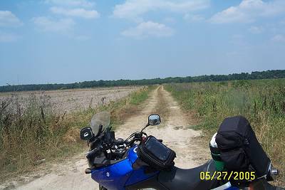
| I pulled out following the tire marks of a previous puller outer. Enough sky for you? I love the Prairie. See any driveways besides this one? There are just enough people out here to help in case of problems. |
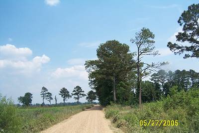
| How can you pass this one up? I couldn't. And, yes it was a dead end. Oops, I punned. |
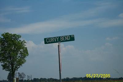
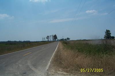
| The road started with two distinct curves and settled into a straightened curve simulating a bend. |
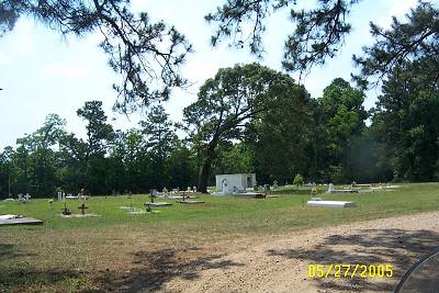
| This large cemetery was on a little side road, visible from Curvy Bend. There were no warning signs so I went in to investigate. I don't linger at these family (guessing) cemeteries. I saw no church associated with the cemetery and felt uneasy about walking the graves in search of dates (birth and death dates) They are a real insight into the history of the area. I let "feelings" guide me a lot. I'm still around and still riding. |
| Curvey Bend was in the "cradle" of two bayous, Pine Point Gulley and Bayou Des Cannes, with no exit. I retraced my ride back to the main road eating the dust of a slow moving pickup whose driver was obviously looking at me and no doubt wondering who the heck I was. I stayed behind him signaling my intended turn well before the intersection. You don't pass on a gravel road or if you do you stay away from the car you are passing for a long ways. Rocks break windshields and breaking a local's windshield is not the best introduction you can have. I don't blame the curiosity. I wasn't UPS, the postman, neighbor or family. |
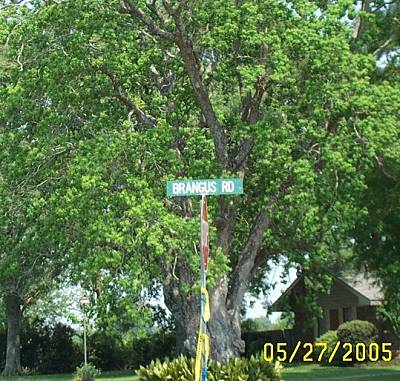
| At the next highway junction sign, Pine Point Road which zigzags back north to Chataignier Rd, turn left or south on Brangus Road, an unnumbered paved road. It will take you to La. 95 where we continue zig zagging through rice country. Of course at the first chance I got off of Brangus Road. "Brangus" is a mixture of two bovine families, Bramer and Angus. This assumption ends my foray into bovinial expoundation. It is also where I should stop making up words. Like you, Dell. |
| Yes, this sign gets the Best Ranch Sign Award for this article. Hard to read, but it says underneath "Brangus", "Black & Beautiful". The numbers are both phone numbers, I believe. The words around old Dirty Boots I couldn't read. I was in a hurry to get off the pavement and there was a heavily weeded ditch between me and it. I think one of the words was "mule". Maybe mules are also available at the Dirty Boots Ranch. If you start doing this riding around wondering about everything, you'll have to realize that it is not a perfect world and there will be questions unanswered and questions that produce questions, even more unanswerable. Choose your battles. |
| I was now on Bayou Des Cannes Rd. Cannes means "canes", as in slender pole shaped plants, "reeds" Thanks John for the French lesson. The bayou is a very important bayou in Southwest Louisiana. I just noticed the road is shaded. In planning outings during the summer note which roads provide morning and evening shade. A cool ride home smelling the honey suckle along the bayous is a pretty neat experience. |
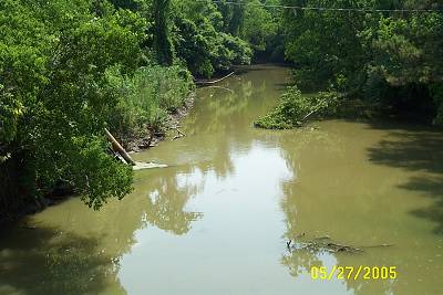
| Seeing a big cement bridge makes the road a bona fide through road sometimes. I saw the bridge but was more excited about looking down another bayou than the possiblity of the road going through to La.95, my next destination. I had put this picture in the farm equipment grouping because, if you look closely, mid-picture on the left, you see a pipe dipping into the bayou. It is the intake pipe for a pump that was running wide open producing a loud whirring sound. We have had no rain for a long time and irrigation is a must. I looked to see where the pipe emerged. It was buried. It probably led to the next crawfish pond. Almost forgot, Bayou Des Cannes is important because it joins Bayou Plaquemine Brule which joins, soon, Bayou Nezpique to form the mighty Mermentau River. Nezpique is spawned around Turkey Creek and runs through Miller's Lake. Bayou Plaquemine Brule was crossed just after leaving US 190 on La.104 early in our trip. Its cradle is just north of Opelousas, possibly receiving some water from Bayou Carron near Washington. Well you asked. |
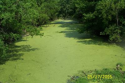
| This is the other side of the bayou bridge. I would say this is the up stream side. The bridge has caught surface floaters and allowed algae to build its floating city. Louisiana is home of the most beautiful and varied greens in the world. |