Turkish

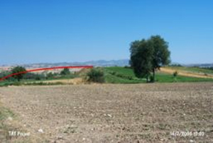
Type: Mound

Altitude: 272 m

Diameter: m- Direction:


Region: Marmara

Province: Bursa

District: Yenisehir

Village: K�pr�hisar


Destruction : Agriculture


Highways, roads, bridges etc.:  Attention


TAYEx: Visited - 16/7/2000


Registration State: Bursa KTVKK

Location:

Geography and Environment:

Destruction Details:

The mound (5000 Year Old) is severely damaged due to agricultural activities. Its upper, eastern and southern sections are planted. The northern slope has been cut by a road.

At the end of the 60's, earth was removed from the mound and piled to the bank of the stream in order to prevent it from flooding. (TAYEx 16.7.2000)

Konumu
www.KOPRUHISAR.com
KOPRUHISAR
YENISEHIR
BURSA

TANITIMI
KONUMU
NUFUSU
REHBER
TiCARi
TARiHi

SAGLIK OCAGI
KOOPARATiF
DUGUN SALONU
DiNi/SOSYAL
iLKOGRETiM
SPOR

MUHTARLIK
DUYURULAR
iLANLAR
ONEMLi TELEFONLAR
TC KiMLiK/VERGi NO
JANDARMA/POLiS
KOMSULARIMIZ
ULASIM

BiZE ULASIN
.
.
.
.
exsen.net
.
M.E.B.
.
.
TurkUSA
.
.
.
.
KENT HABER
.
Yenisehir
Belediyesi
..
..
,
.
.
.
,
..
..
-
-
-
1