 |
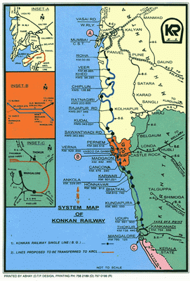
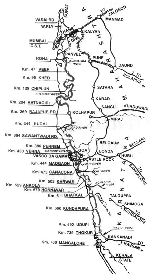
This map is
the official map of the KR, and is featured in all timetables. The
three inset maps of Mumbai, Madgaon and Mangalore have been
separately edited and magnified later on this page.
Click to view enlarged version
of this map on a new page |
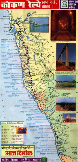 |
Aaj Dinank, a popular Marathi daily, released a wall calender for 1996, with the KR Map as its theme. The Konkan Railway was already running in sections and the opening of the whole line generated tremendous interest and enthusiasm among the Konkani Community. Since the map is quite old, launched prior to opening of the entire line, many stations bear their older names, and some stations which were proposed are actually not existant today. Similarly certain stations not on the map are in existence today. Despite these, this map was the most exact map ever published on the KR. No other map has covered all stations extensively as this. Click to view enlarged version of this map on a new page |
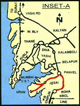 |
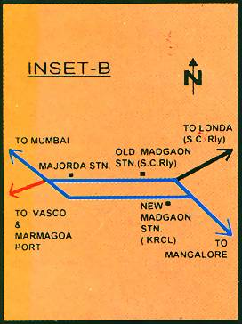
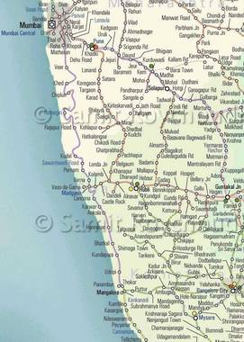
Inset
Map - Mumbai (Left) Inset Map - Madgaon (Right) |
 |
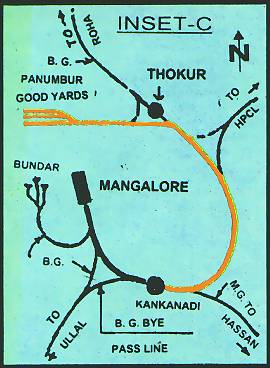 |
The
Inset Maps illustrate the points where the Konkan Railway cross/join
other railway routes. These maps were made when the KR was newly
commissioned. The lines marked in red were the lines which the KRCL
had proposed to be incorporated into the Konkan Railway Zone. The
only line to be under the direct admin of the KRCL is the Madgaon -
Majorda Line, as shown in bright blue. Governmental policies have
not allowed this to happen and thus the present day maps just focus
strictly on the KR line between Roha and Thokur. Inset Map - Mangalore |
|
 |
Samit Roychoudhury, an Indian Railway Enthusiast and also a Graphic Designer with a special interest in maps, has worked hard and researched to create his version of the Indian Railway Atlas. The Atlas is an excellent companion to a Indian Railway Traveller, both for real and 'armchair' travel, with an attractive colour scheme, clear typography and attention to detail. Click to view enlarged version of this map on a new page |
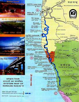 |
KR System Map Scanned and enlarged as in July 2002 timetable. The KR throws light on its key expertise of Technical Consultancy and new solutions (such as Tunneling, Project Execution, RO-RO Services between Kolad and Verna, Tourist Packages and the Sky Bus Metro). Only the Roha - Thokur section is highlighted here. Click to view enlarged version of this map on a new page |
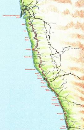 |
KR System Map featured in KR website earlier and appearing in the book 'Konkan Railway - A Dream Come True'. This map is feature-rich yet empty thanks to the limited use of text. All stations, states, rail routes of other sections and rivers all appear, but not being marked leaves the map incomplete. Yet basically a colorful map. Click to view enlarged version of this map on a new page |
 |
KR System Map appearing in the book 'A Treatise on the Konkan Railway'. Click to view enlarged version of this map on a new page |
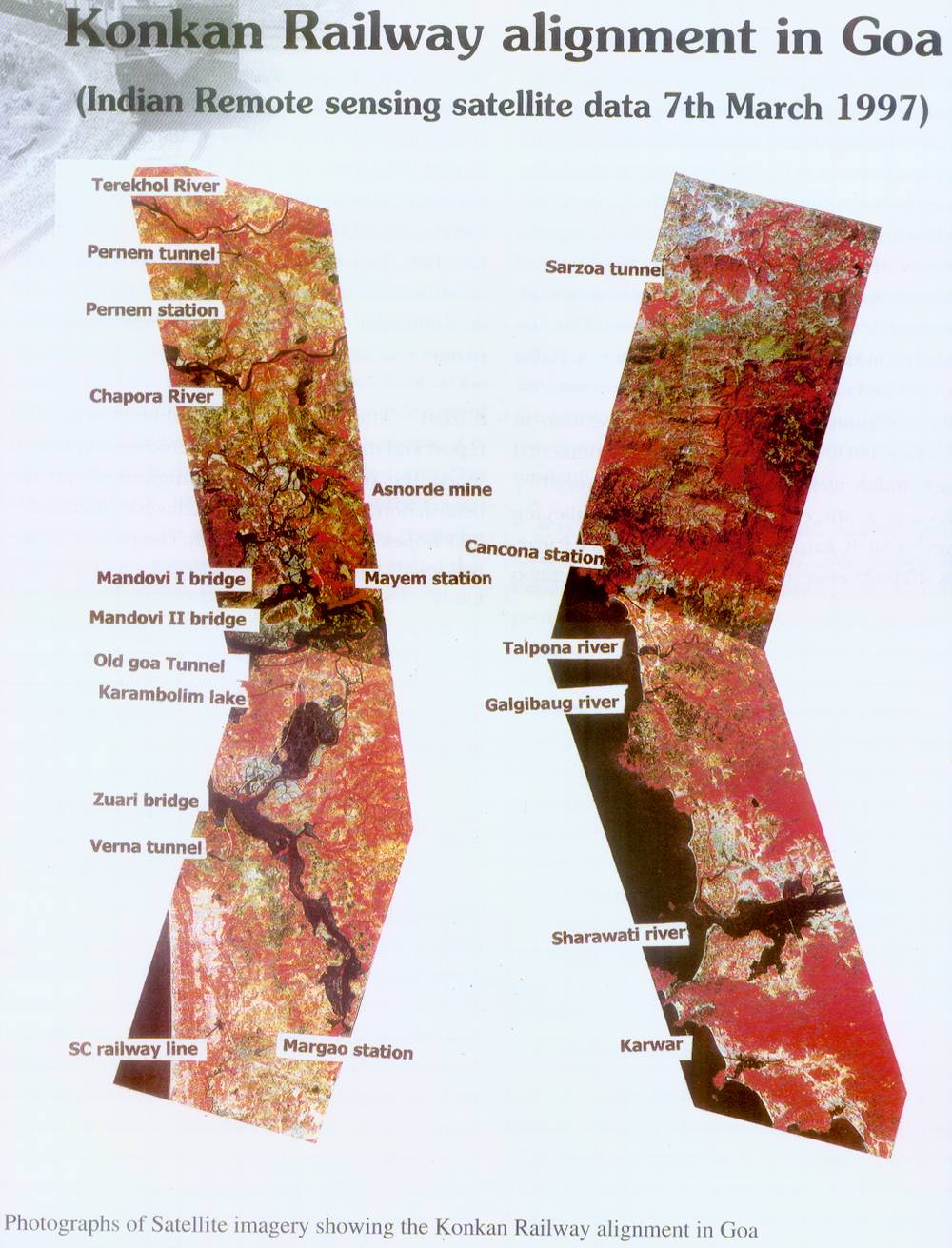 |
KR Alignment in Goa - Indian Remote Sensing Satellite Data - 7th March 1997. Appearing in the book 'A Treatise on the Konkan Railway'. Click to view enlarged version of this map on a new page |