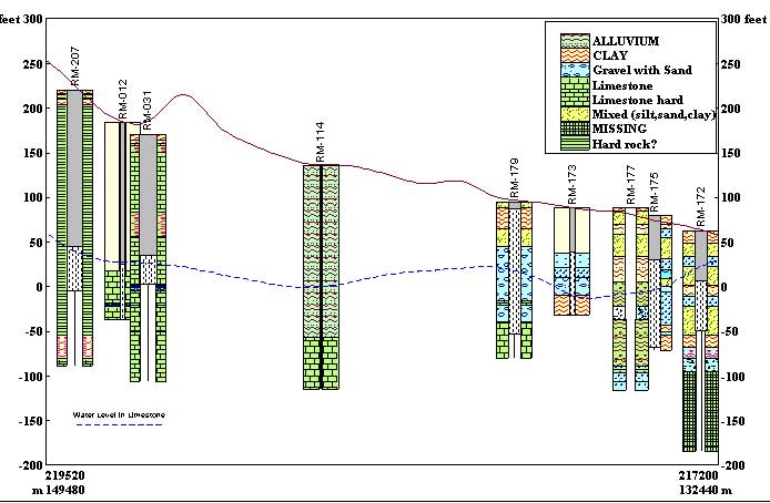
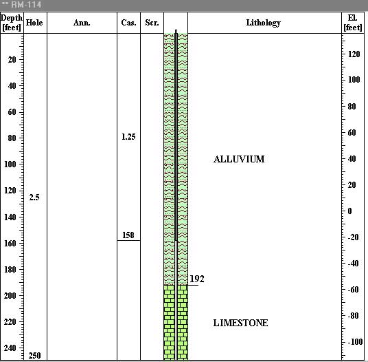
Main limestone aquifer storage under the Clarendon Plains has water quality which is adequate for all uses. It is protected to some extent from chemical and bacteriological contamination by the overlying alluvium (see the well RM-114, for example).
Time series of major water constituents/parameters do not indicate any deterioration of water quality over the last ten or more years. Near the coast, the quality of ground water in both limestone and alluvium is impaired due to overpumping more inland and eventual sea water intrusion.
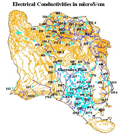
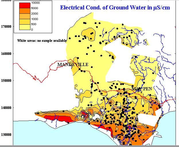
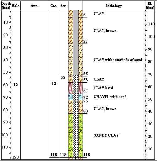
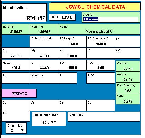
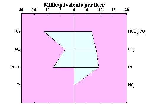
Salinities in the alluvium are often too high for use as a source for domestic supplies and approach the upper limits recommended for irrigation. yet, in many places, the quality of ground water in alluvium is acceptable as shown in the "electrical conductivity" map. Exception to generally acceptable quality is at sites in which a well was improperly constructed with screens set opposite clay layers. See for example the well RM-187, Vernamfield C. Well construction shows screen mostly in clays, resulting in high salinity (see chemical analysis) and "mixed" water as shown in STIFF diagram.
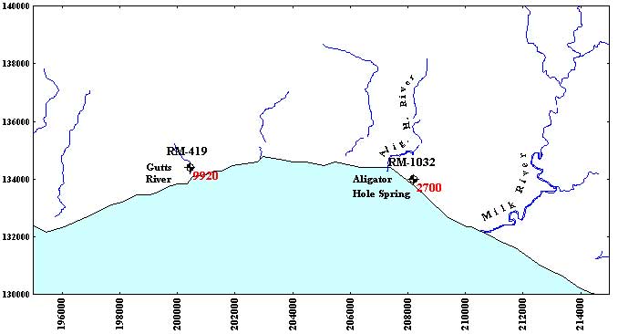
Coastal alluvium and aquiclude partially ponds ground water that is contained in the Manchester Highlands limestone aquifer. The aquifer is in direct hydraulic continuity with the sea, where the alluvium is absent. The coastal springs such as the Gutts River and Aligator Hole Spring exhibit salinities generally in excess of 2500 microSiemens/cm. This is too high for use as sources for domestic supply or irrigation. The coastal springs are under tidal influence. High transmissivity of limestone, which exhibits karstic features at least locally, supports the propagation of the tidal influence more inland.
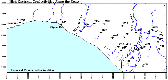
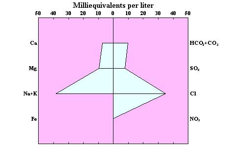
A belt of more than 4 km distant from the coast line exhibits increased salinities. A map shows the location of wells with conductivities higher than 2000 microSiemens/cm. The salinity is due to sea water intrusion and tidal effects, as shown in a Stiff diagram. The latter is a sample from well RM-067, Beauchamp, which exhibits very high electrical conductivity (EC=6,120 microS/cm). In addition to very high sodium and chloride ions, there is also a high content of calcium and bicarbonates. The origin of this water demands an insight into well construction and lithology of the area. Beauchamp is a shallow dug well, only 58 feet deep. Static water level is at about 25 ft. above sea level. Over the entire well depth, the lithology is that of sand and gravel.
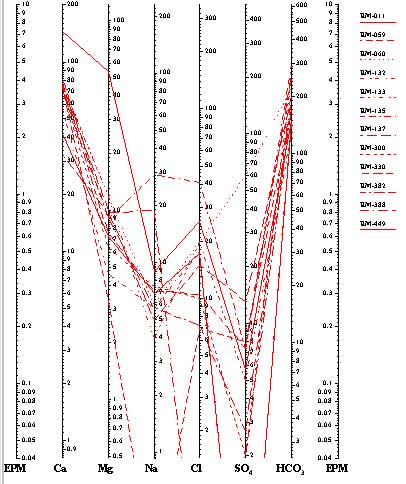
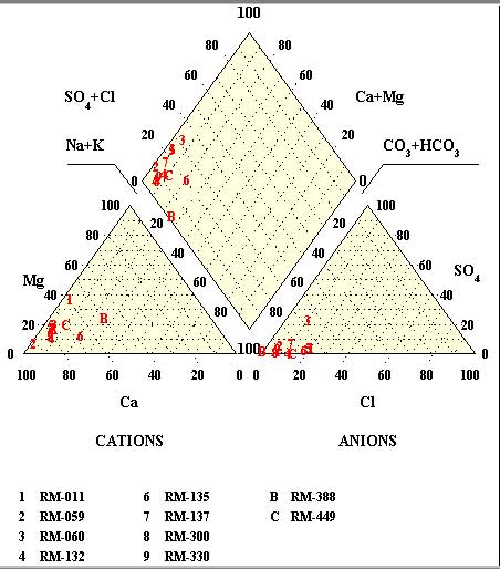
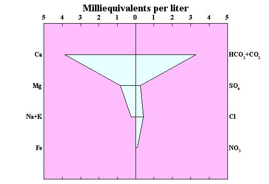
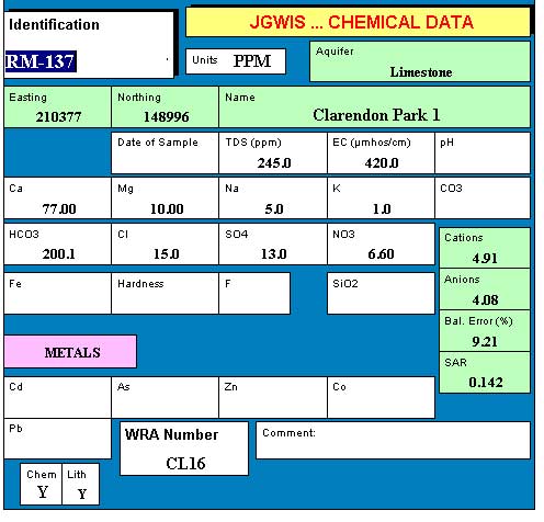
Wells in limestone aquifer between May Pen and Mandeville (Manchester Highlands and western extension of Clarendon Plain) exhibit excellent quality of water. You may see Schoeller diagram with 12 wells shown, Piper diagram with same wells, and one of typical STIFF diagrams. The Schoeller diagram shows rather low salinity, Piper points at the origin and type of water (calcium-bicarbonate), and STIFF identifies the water as purely Ca-HCO3. A data form for the sample from Clarendon Park well displays a typical analysis from limestones.