
Black Mesa is about 45 miles long, and extends into New Mexico and Colorado.
In some places it is seven to eight miles wide.
The top of the mesa is relatively smooth and grassed over with the
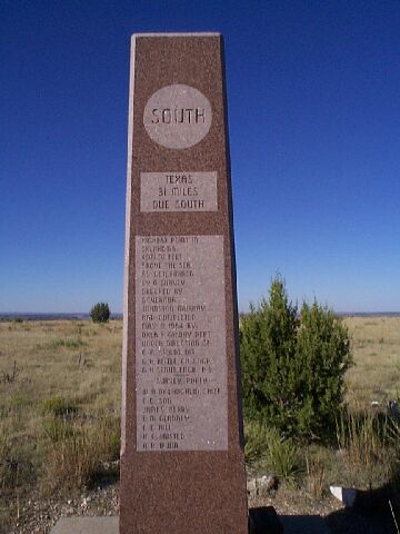
highest point
in Oklahoma 4,972.97 feet above sea level.
The mesa rises 700 feet above the level of the Cimmarron river, which
runs along the south side of it .
A monument on top of the mesa marks Oklahoma's Hightest point. The marker
was donated
by the Jenkin Lloyed Jones family of the Tulsa Tribune.
Click here to see a spectacular southeastern view of the Cimmaron Valley, seen from the top of the mesa.
Click here to see a panoramic view of the mesa.
By Bob Rilling
Note: This is a large image -- about 1.2 MBytes.


 Graphics by Laurie McCannas