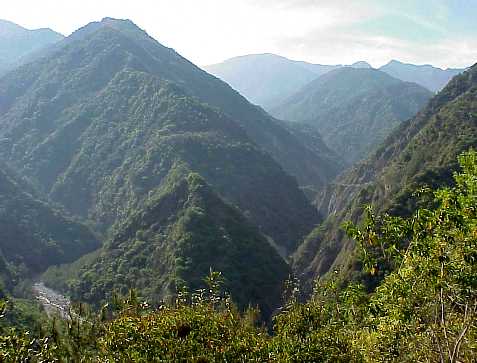
South Cross Island Highway:
Truly a scary experience, especially if the weather is less than perfect, as it often is up in the mountains. This road bisects the island from Taitung to Tainan. Here you will cross 9000 ft cliff hanger goat path roads and pass through tunnels that resemble leaky coal mine shafts. Driving across this road in the fog, I once almost ran head-on into a boulder large enough to bury a VW microbus.
The one saving grace is that there is usually not much traffic on this road, since even the locals are afraid of driving here. The best time to visit this area is fall/winter/early spring to avoid the rainy/landslide season...
This road skirts the south side of Yushan National Park. The most scenic stretch runs from Meishan to Wulu. Areas worth visiting include the following: Kuanshan, Litao, Several Waterfalls, Wulu Hot Springs, and Shinwu Recreational Area.
Note: This area deserves more attention than currently provided here. I plan to add to this page once I find the time/courage to cross this highway again....
|