KARIBA ANGLING SOCIETY
Mashonaland - Darwendale
- Harare/Norton
Dam Fact | Directions
| Species | Facilities
| Map
Dam Facts
| Capacity :- 480 million cubic metres |
Length :- 23 kilometres |
| Greatest Width :- 10 kilometres |
Surface Area :- 8100 hectares |
| Wall Type :- Concrete |
Wall Size :- 28m high 1200m long |
| River System :- Hunyani |
Function :- Water Supply for Harare |
| Built : - 1976 |
|
Top
Directions
Dam Wall area (National Parks) -This
can be reached by either the Bulawayo or Kariba roads.
i)Kariba Road - Turn left at the Nyabira Club junction and continue
down the road for several kilometres until you see the signs indicating
the National Parks Office.
ii)Norton Access - Turn right into Norton at the Garage and then
immediately left into the Lydiate/Darwendale road. Follow the road for
25 kilometres and turn right into the Darwendale turn off. Follow this
for a further 8.5 kilometres, crossing the Hunyani River Bridge (tar ends),
and turn right at the National Parks sign.
Lower reaches - (Hunyani Pulp and Paper)
Turn right after the Garage and follow the road until you reach
the crossroads after the Supermarket on your right. Turn right and proceed
for about 2 kilometres unril just before the Hunyani Pulp factory fence,
there is a tar road on the left. Follow this road to the water around the
ZESA substation.
Top
The Angling Species
available are :-
| Bass |
Green Happy's |
| Barbel |
Bulldog and Churchill |
| Redbreasted Bream |
Tigerfish |
| Greenhead Bream |
Labeos |
| Niloticus Bream |
Bottlenose |
(For fishing notes see Chapter 6
of the fishing booklet which covers most of the species in the dam.)
Top
Facilities
Angling Societies
There is only Hunyani Pulp and Paper on the Harare end of the Dam,
and National Parks on the Dam wall end. Other Venues
Some farmers will allow launching (but ask nicely), and if you know
the way through to Cementation, then it is also possible to launch there
most of the year.
National Parks have a good concrete slipway that is useable most
of the year near the dam wall, and they have picnic areas also.
Notes
There is a lot of Oxygen weed which hide a lot of surprises
so watch where you are going. The dam is full of anthills and the AVERAGE
DEPTH is only 12 foot WHEN FULL so BEWARE
DNPWM do charge for fishing and
boating on the Lake.
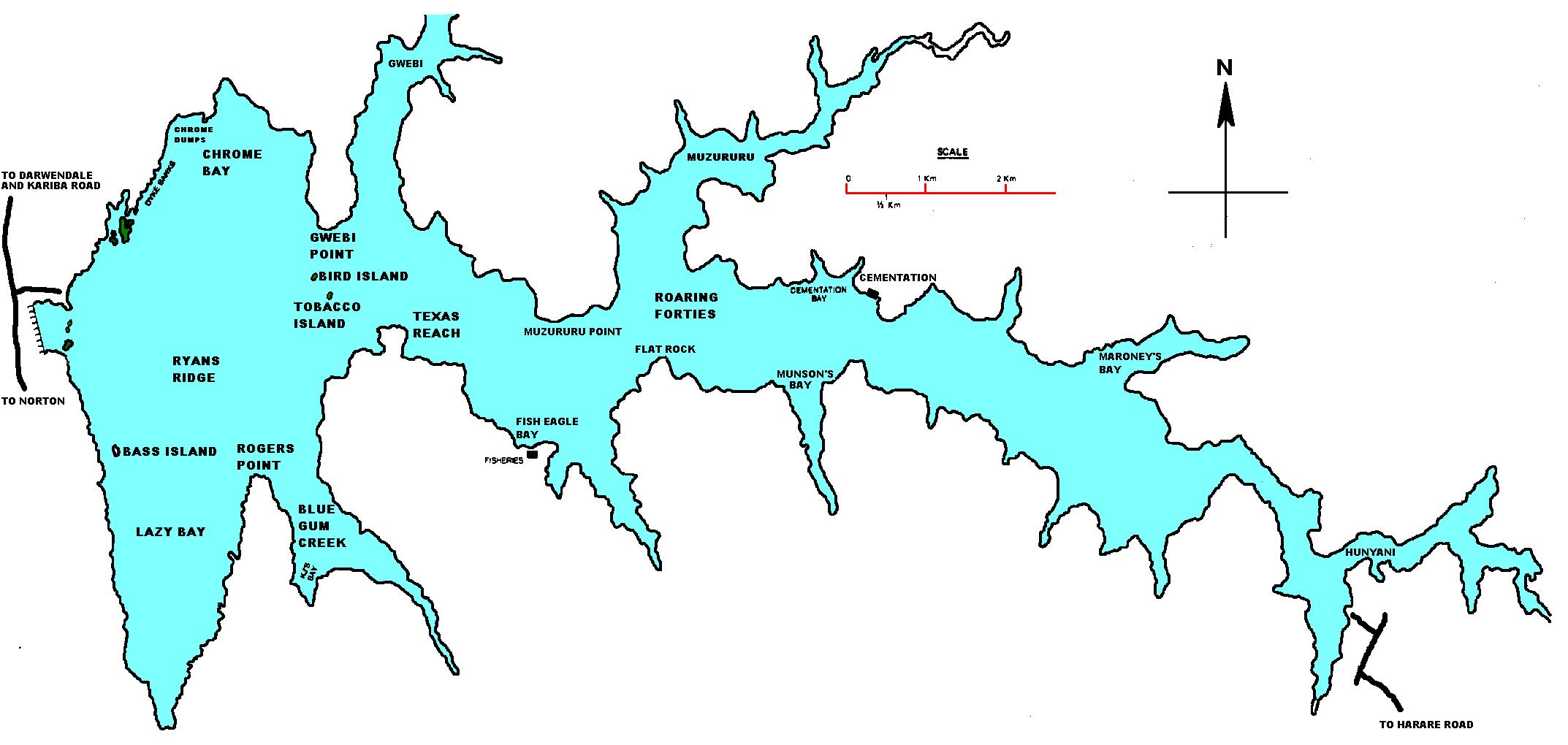
For a larger picture please
click on the map or right click and select "View Image"
OR for
an old set of contour maps (3 part map pic) Click
here
Back to Mashonaland | Matabeleland
| Manicaland | Midlands