KARIBA ANGLING SOCIETY
Darwendale
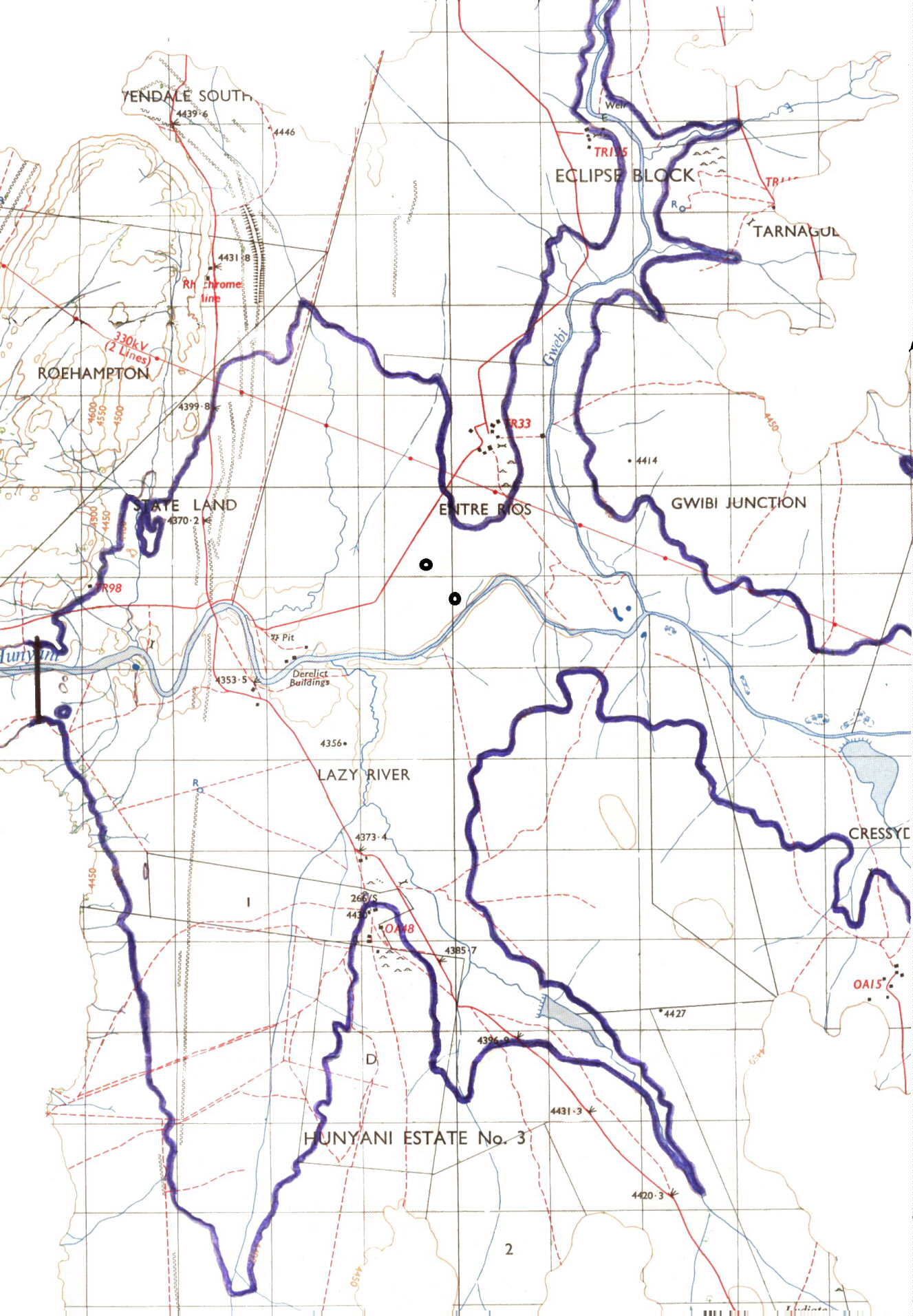
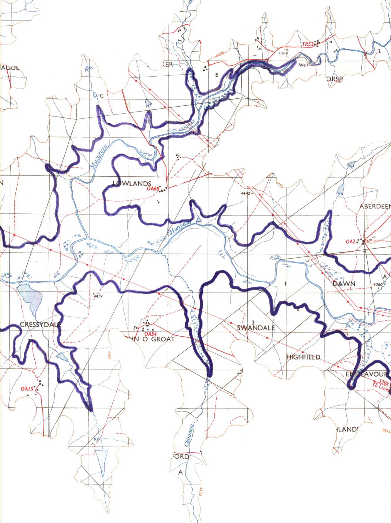
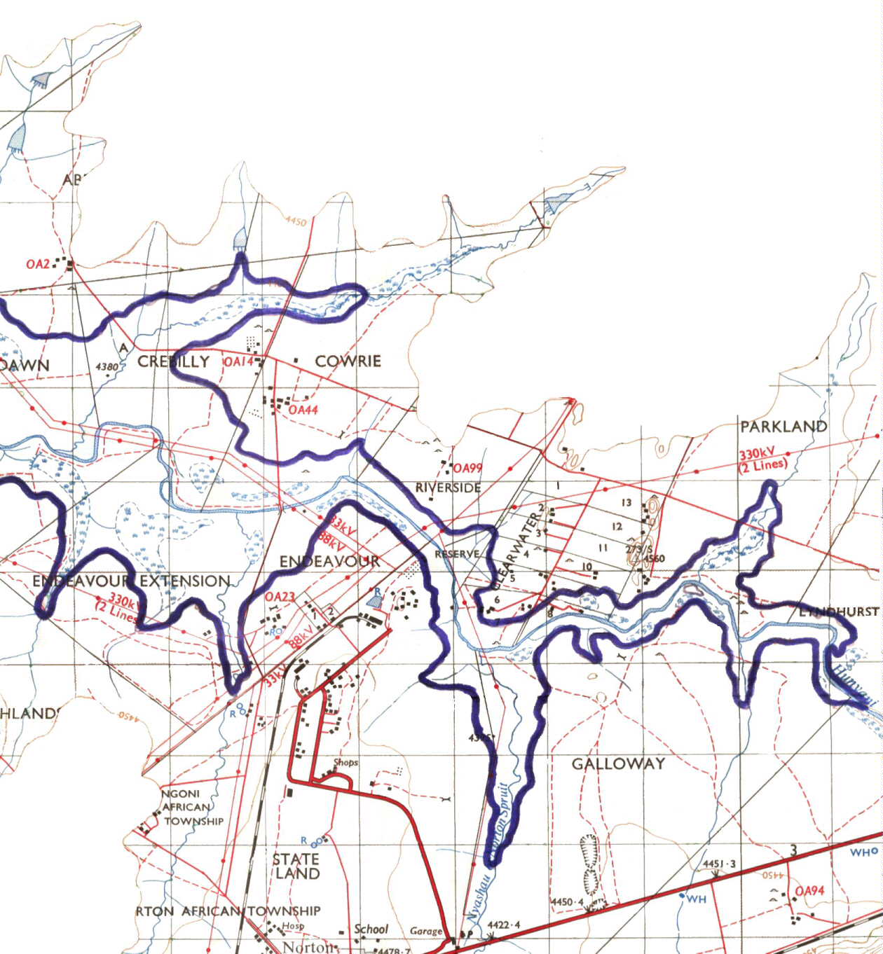
- Old Contour Map
The maps shown here are scanned copies of the original map and the
contours etc were used to work out the dam limits. Many of the powerlines
etc are no longer there, but detail on what is under the water may prove
useful in your endeavours fishing at the dam.
Each map overlaps the other so you need to print out each section
and then cut and paste them together to make a complete map, or just print
the one that you require for the day.
Select each map from
here
 |
 |
 |
Back to Darwendale