The Red Kaganate

Last Page Update:
April 6, 2001


Contact
Copyright Information
Main Page
Structure of the Red Kaganate
Gatherings, Events, . . .
Historic Steppes Tribes
Legends of the Nomads
Flags and other Identifiers
Clothing and Apearance
Food and related Matters
Armour
Archery
Weapons and Combat
Public Forum
Resource Links

Email:
[email protected]

Editor:
Norman J. Finkelshteyn

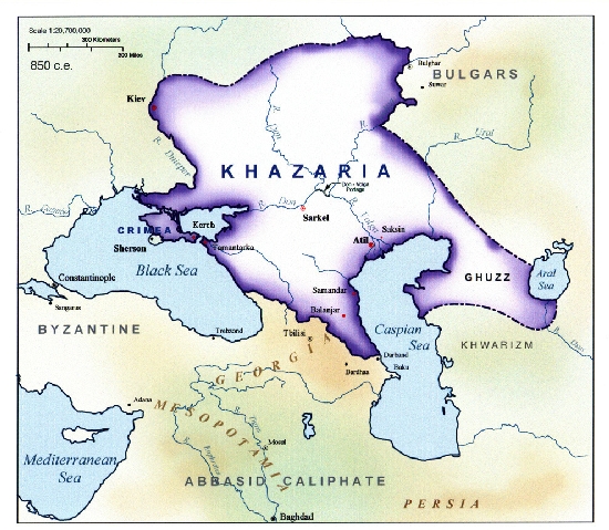
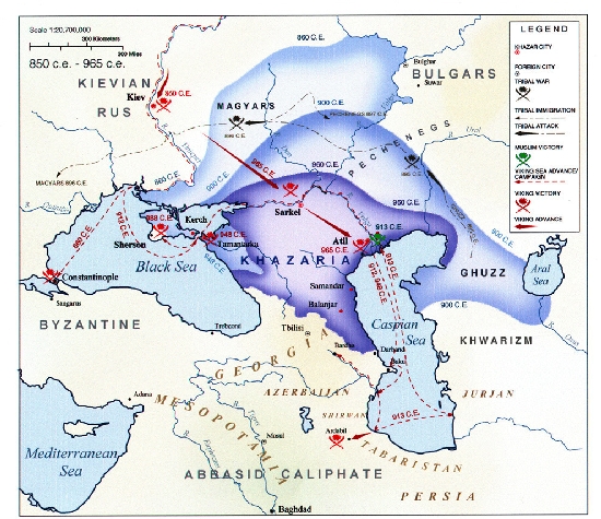
Historical Maps of the Khazar Kaganate
Maps by Richard Burd

Click on each Map for a larger version of that Map.


The Khazar Kaganate at its Height (850 CE)

Before the Khazar Kaganate (350 - 627 CE)

The Rise of the Khazars (600 - 850 CE)

The Decline and Fall of the Khazars (850 - 965 CE)

Richard Burd's site with these maps, related notes, and other map materials is http://www.geocities.com/Athens/Sparta/3976/index.html.

Copyright
Web Site designed and implemented by Silk Road Designs.
Contact us at [email protected]
Copyright 2000 -- All articles and illustrations at this web site are Copyright protected material. Use of these articles and illustrations is subject to appropriate restrictions under United States, International, and local Law.
Where Author is specified, Copyright is retained by Author with express permission for use by "The Red Kaganate" organisation. Where Author is unspecified, Copyright is retained by Norman J. Finkelshteyn.
Hosted by www.Geocities.ws

1