We'll save that trip until we have a float plane.
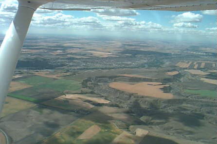
Our daily schedule has changed a little. We're leaving earlier each day, which means we're flying into the sun most of each leg. The best aerial photo opportunities are at the end of each leg, when the sun is in the south or southwest, just over the right wing. On the first half of today's flight, we backtracked from Grande Prairie to Edmonton, following our route north. After Edmonton, we turned southeast instead of going to Calgary. We followed the Red Deer river, which flows into the South Saskatchewan river, past Medicine Hat, and on to Lake Winnipeg.
Just before Medicine Hat we flew near a military restricted area, which to pilots is simply a place on the chart that we are not allowed to fly through, without ever really knowing why. When we landed at Medicine Hat, we learned we had flown past Suffield, the temporary training facility for the British Army for the past 30 years. We were told the base covers more land than the entire British Isles. The Brits apparently like it because the northern portions bear a striking resemblance to Siberia.
Medicine Hat is a beautiful city. The countryside for hundreds of miles is flat prairie, much like the eastern portions of Montana. But Medicine Hat sits on the shores of the South Saskatchewan river, and thus enjoys a welcome break from the monotony of the prairie.
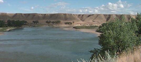
Medicine Hat has set aside most of its river front as parkland, and connected much of it with bike and hiking trails. This is Police Point Park, named for the RCMP detachment stationed here in the early 1900's.
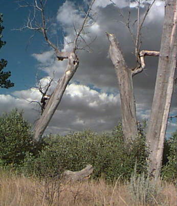
The land below the cliffs is home to cottonwood trees that manage to survive in the sandy soil of the river flats. When they die, they remain standing for years, and do not rot in this arid climate.
In 1988 Calgary, Alberta hosted the Winter Olympics. The symbol of those Games was The World's Largest TeePee, celebrating Canada's large native indian population. When the Games were over, Calgary still had the Calgary Stampede, the Saddledome, and great skiing up the road in Banff. So they gave the The World's Largest TeePee to Medicine Hat. Today the TeePee sits on the bluff as the Trans Canada highway crosses the South Saskatchewan river, offering an impressive sight to the motorists and pilots who approach Medicine Hat from the West.
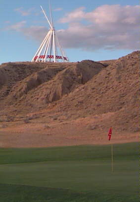
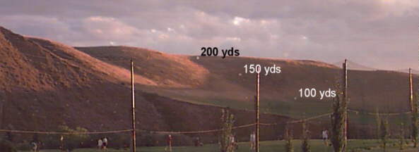
There are three golf courses built in the river valleys. This provides great scenery for the golfers, and avoids pressure to build houses in this beautiful but flood-prone area. Chief Pilot wasn't interested in a round of golf, but he let Co-pilot stop for a beer. Wandering around the corner we stumbled on the most unusual driving range we'd ever seen.