
This part of the trip is our first venture into the mountains. There is a low level route to Watson Lake and Whitehorse that generally follows river beds and railroad tracks, but the Alaska Highway builders could not find solid ground along that route for their roadbed. So they went up and over the mountains, and we're going to follow them.
Forty miles out of Fort Nelson we cross Steamboat, the first of three mountain passes that we'll see on this leg. We drove up to Steamboat yesterday, and from the car the road changes from the straight away into the typical winding mountain road, with frequent curves and steep cliffs off to the side.
From the air it is a little different feeling. The pass is really a gap in a mountain range, and we either have to fly over all the mountains, or fly lower over the road and between the mountains. Today the clouds are 500 feet above the mountains, and there is a 20 knot wind creating turbulence at the tops. So we elect to stay below the clouds, which means flying over the road and between the mountains.
This is the view as we approach the mountains, with the road below the nose appearing to disappear into the endless horizon of the Rocky Mountains. Both Chief Pilot and Co-pilot felt a shot of adrenaline as we approached. 260 miles lay ahead of us before our intermediate stop at Watson Lake, and another 200 miles after that to Whitehorse. We began to miss the prairie of North Dakota.
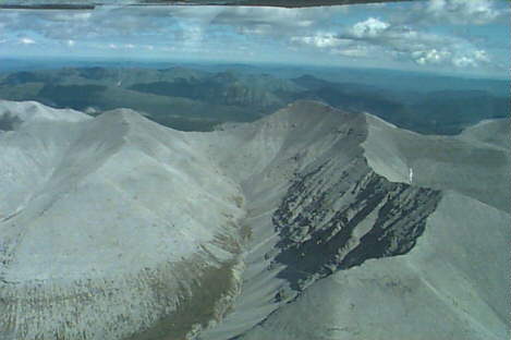
After we make the right turn through the pass at Summit, we find ourselves in a narrow valley, bordered by mountains. The tree line appears to end at about 6000 feet, so the tops of the mountains are bare rock. The outside air temperature is about 45 degrees, so there are only scattered patches of snow on the higher peaks.
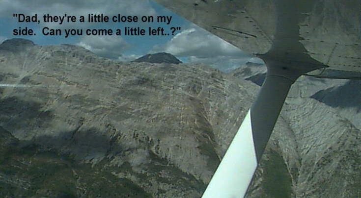
An interesting phenomenon we observed is that the pilot-in-command (the guy in the left seat) tended to take his bearings off the mountains on his left, and the road below. There was a tendency for the PIC to think he was in the middle, when in fact he would stay a little farther away from the mountains on his left than he realized. This obviously put the navigator/photographer (the guy in the right seat) much closer to the mountains on the right. It afforded great photographic opportunities, and kept the navigator from dozing off.
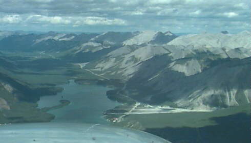
When we weren't crossing the passes, we were generally following the small rivers and streams that drained the mountains, and provided the road builders an adequate roadbed. These river valleys were welcome sights. After getting over a pass, these portions of the Highway looked as welcome to us as a Montana wheat field.
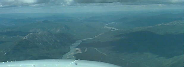
The clouds were thickening as the day progressed. They were still the white puffy cumulus, but they were closer together. By late afternoon, the two forces of wind across the mountains and heated air rising to create and expand the cumulus, gave us a real bumpy ride. It was the first time in our trip the PIC needed both hands on the wheel. In this picture you can see the layer of cumulus ahead of us at about 7500 feet.