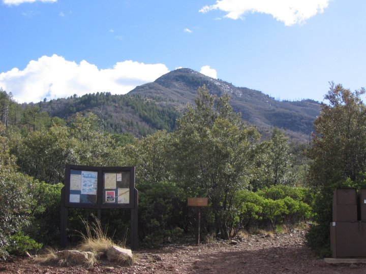
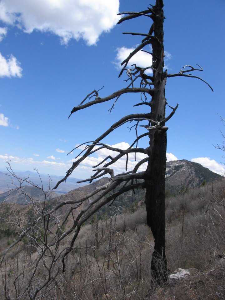
| Starting at 11:20 am, the trail started gently on trail rock, which in my opinion, is the worst part of the trail. The rock is pretty unfriendly on the toes. Coming up the trail you can see evidence of pipes laying around and not to far up is an old water tank. We could hear the many Hummingbirds buzzing through the thick Manzanitas, which seemed to follow us for a while. We passed a natural spring that is tucked into a opening just off the trail. The darkness in the area was just asking for us to come check it out. There are many types of trees and plants to ponder along the way. There is also a small creek that runs right over the trail. Upon decent, this ended up being a nice place to soak tender paws for our dog, Abby. The trail turns to switchbacks as you rise in elevation. We stopped and sat at one of the gorgeous views to eat lunch around 12:50 pm. We ate and relaxed for about 20 minutes, estimating about 45 minutes to the top (boy were we wrong!) We decided to get moving again as the landscape begain to change to pine and forest. There are a couple of abandoned mine holes that are only a couple of yards off the trail so please be careful when exploring. There are lots of large burned trees that are still standing form the fire. As we looked up at them, everything seemed to sway. Before we knew it Miller Peak was just around the bend. A little snow was still |

|
 |
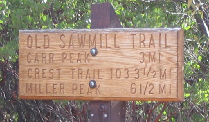 |
| Carr Peak via the Old Sawmill Trail |
 |
 |
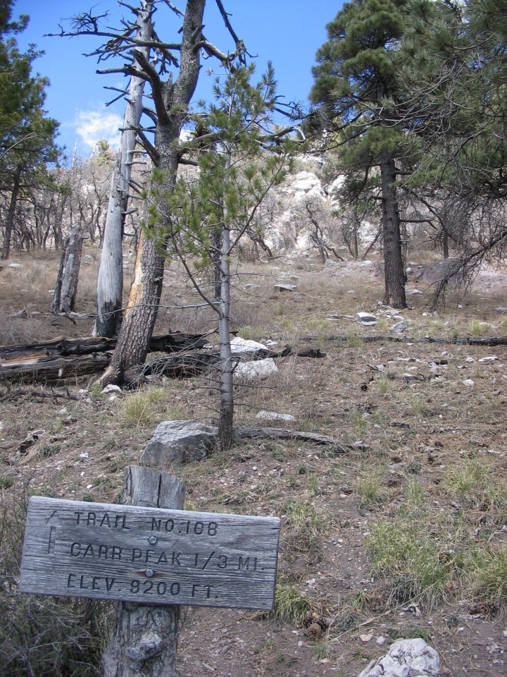 |
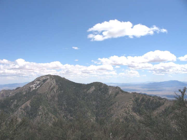
| Even though the trail was a little tuff it is only a third of a mile and the view was calling to us. We made it to the top at 2:05 pm and were rewarded with some of the best views there are. There is a home made log in a glass jar at the top. Lots of interesting signatures. We stayed long enough to take some pictures and call home to see if they could see us at top through binoculars, and believe it or not, they could! But only when we moved :) |
| Date: 11 April 2005 Time: 4 Hrs, 45 Min - Which includes about 45 minutes for breaks, lunch and some off trail exploring. Length: 6.2 Miles Elevation Gain: About 1700 (I forgot to get a reading at the trailhead) Highest Elevation: 9215 at Carr Peak |
| on the peak. The pictures I took, don't do it justice. The view was breathtaking. We stopped to admire the almost 360 degree view before moving on. A little further down the trail is a sign showing us the trail to Carr Peak. From here it was a third of a mile straight to the top. |