From Cordova Pass, we went up into the Sangre de Cristos and Blue Lake...Well, not into Blue Lake. Around it.
To view the panoramas, use the horizontal scroll bar to pan back and forth.
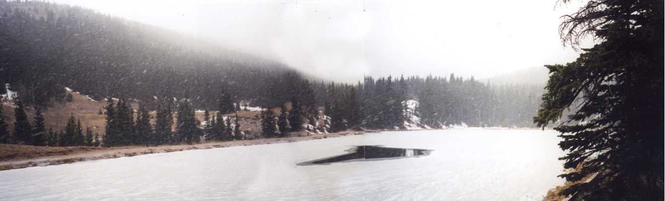
Blue Lake is about 2 miles up a Forest Service road south of Cuchara. It's a very pretty little alpine lake. When we were there, it had been snowing for only an hour or so. No one else was around so we had the lake to ourselves for a hike. Here's a nice panorama of it.
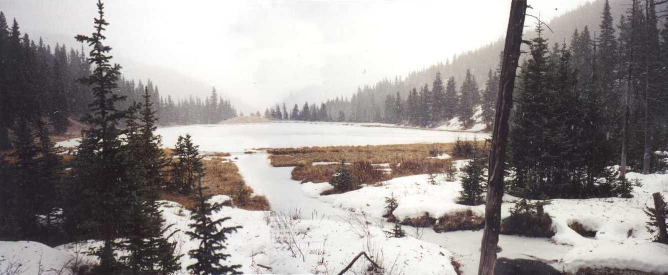
My sister and I did a complete circuit of the lake. This panorama is from the opposite side of the entrance looking roughly east.
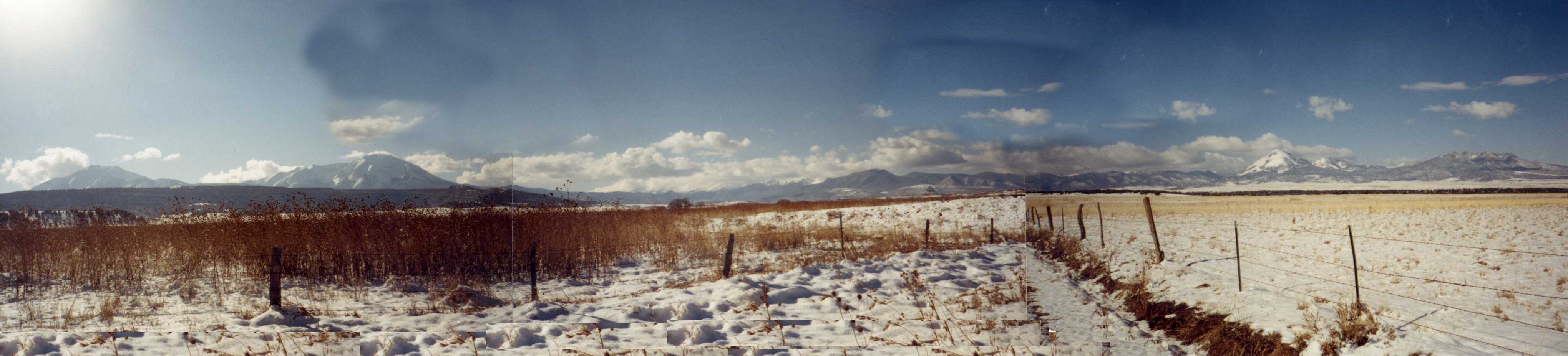
A couple days after the snow, we went out driving on the back roads southeast of La Veta. Here's a nice panaoramic view we snapped. The Spanish Peaks are on the left. The Sangre De Cristo Mountains are in the center, and Mount Mestas (pointed, snow-covered peak) and Silver Mountain are on the far left, with Rough Mountain just peaking up between them.