| Yew Kwang Hooi |
| www.geocities.com/jawsyew |
 |
| Niagara Falls State Park |
 |
 |
 |
| Due to the huge size of the 16 images, patience is a prerequisite. |
| My trip to Niagara Falls State Park, is one of the oldest parks (since 1820) in the States and one of the wonders of the world. |
| Niagara Falls are constituted of 3 falls - the American Fall (nearer in the picture), the Bridal Veil Fall and the distant Horseshoe Fall at the Canadian side. The falls are separated by several islands (main is Goat Island) and rocky geographies of the area. The water that flows over comes from four of the five Great Lakes:- Erie, Huron, Michigan and Superior. From Niagara, the water flows to Lake Ontario, St. Lawrence River and finally into the North Atlantic Ocean. |
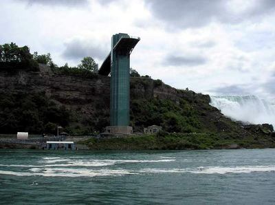
| The observation tower used by visitors at the American side to view the falls. The structure is used by visitor to access the jetty, from which visitors will take ferries to the falls. In the picture is the American Fall. The Horse-shoe Fall is located in a further distance. |
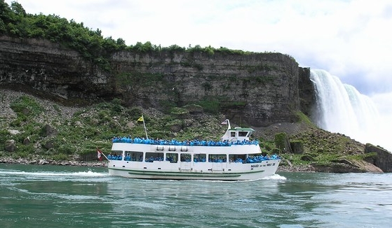
| (Above and below) Ferry passengers are equipped with rain coat such as the one I was wearing. As we approached the mouth of the fall, water caught by the wind drenched every thing that passed by, creating misty environment near the base of the falls. Thus derived the name "Maid of the Mist" ferry ride. The ferry service had started as early as 1846. |
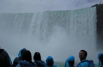
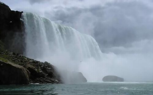
| Spectacular is the word to describe the Canadian Horseshoe Fall. The volume of water falling from close to 177 feet (56 metres) creates enough splash boosted by the wind to drench everyone on the ferry wet. The average depth of water below falls is 170 feet (52 meters), which is as deep as the Niagara Gorge Banks are high. |
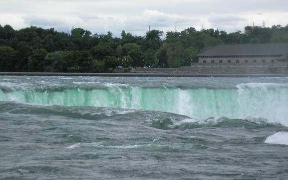
| (Above) This is how the Horse-shoe Fall looks like from above. As the name implies, the edge of the fall forms a curve that resemble a horse shoe. This photo was taken from the Terrapin Point, Goat Island in between Canada and the United States. 91% of the water volume goes through Horseshoe fall whereas the balance goes through the American Fall. The green color of the fall is due to the massive volume of water. Originally, 202 000 cubic feet (6060 cubic meters) per second or 5.5 billion gallons (20.8 billion litres) per hour of water flowed over the falls. Now, half is diverted for power by both countries. |
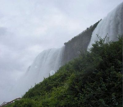
| (Left and below) Another views of the American Fall. Note the tiny and puny visitors on the observation platform as compared to the size and magnificence of the fall. |
| (Left) The American Fall. |
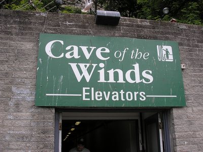
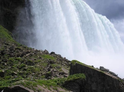
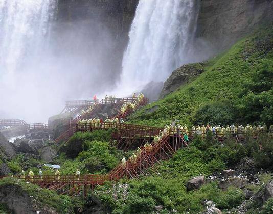
| (Above) After travelling by the escalator down the tunnel chiselled through the solid rocks using chisel and hammer over 50 metres depth and over 2 1/2 years, is the trail to the cave of the winds, well not actually a cave but literally. When the water drops onto the rocks at the bottom, it creates splashes that jump over the wooden platform surface with rubber for extra friction that visitors walk on. |
| (Above) Hurricane Deck - Standing close to the base of the fall, where tonnes of volumes of water fall down on the solid rocks below creates powerful water splashes. It was such an experience standing near to it as the powerful water that splashes on the body gives an imaginary massage effect. Look at the white objects scattered below the platforms. What are they? No, they are not the garbage disposed by humans but sea gulls nesting on the rocky banks, living harmoniously with human visitors who sometimes feed them with bread crumbs. |
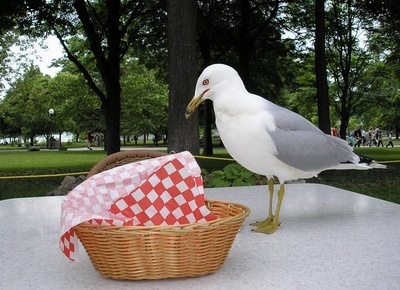
| During lunchtime, an unexpected sea gull decided to be our uninvited guest to feast on leftovers in some visitor's picnic basket. |
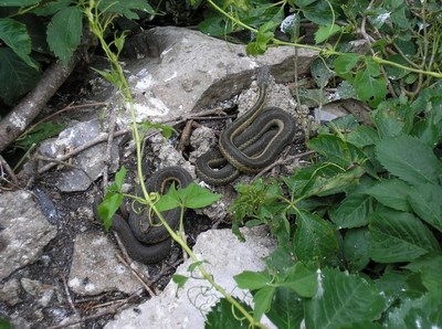
| As I walked down the platform after going through the Cave of Wind, I spotted a few snakes on the rocky bank where the sea gulls nested. Well, guess these folks are paying maternal visit to their feathery neighbour. |
 |
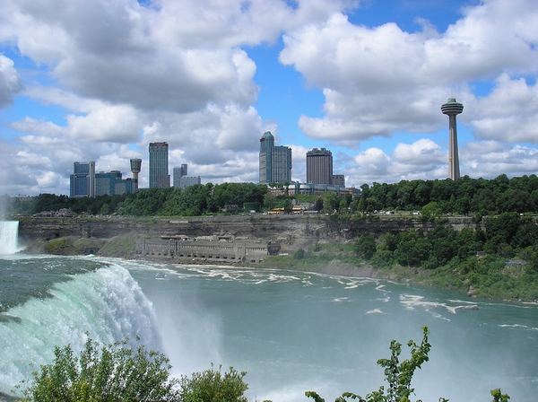
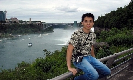
| The fall which begun to form close to 12000 years ago as glaciers formed during the Ice Age sculpted the landscape on its way to the Atlantic Ocean, is today the border between the United States and Canada. The Rainbow bridge in the distance background connects both lands. In the past, this area was populated by the Indians of Iroquioan tribe before the arrival of Europeans in the early 17th century. It was also the site of the Canadian War in 1812. |
 |
 |
 |
 |
 |
 |
 |
| At the opposite bank is Canada. At the base of the fall is a hydroelectric damn. Niagara Falls are constituted of 3 falls - the American Fall (nearer in the picture), the Bridal Veil Fall and the distant Horseshoe Fall at the Canadian side. The falls are separated by several islands (main is Goat Island) and rocky geographies of the area. The water that flows over comes from four of the five Great Lakes:- Erie, Huron, Michigan and Superior. From Niagara, the water flows to Lake Ontario, St. Lawrence River and finally into the North Atlantic Ocean. |
 |
 |
 |
 |
 |