Geography

Hamadan province is located in the western part of the country withan area of more than 19000 square kilometers. It is bounded on the
north by the province of Zanjan, on the south by Lorestan, on the
east by the central province and on the west by Kermanshah and Kurdistan. Hamadan is a beautiful highland covered with huge
mountains and green slopes,
The population of Hamadan province is distributed in the 6 cities of Hamadan (the capital of the province),Malayer, Nahavand,
Twiserkan, Kabudarahang and Assadabad of city dwellers is either
adinistrative or industrial services and in other parts of the province agriculture constitutes the people's main business


Ganjnameh


Alavian Dome


Mausoleum Of  Ibn-e Sina

history

The population of Hamadan province is distributed in the 6 cities of Hamadan (the capital of the province),Malayer, Nahavand, Twiserkan, Kabudarahang and Assadabad of city dwellers is either adinistrative or industrial services and in other parts of the province agriculture constitutes the people's main business. 

Hamadan in the coures of History

Hamadan is one of the oldest cities of not only Iran but of the world. Its historical origins date goes back to several centuries before Christ.

 Hamadan was the summer capital of the Median and was
then called Ekbatan or Hegmataneh, which means a place of assembly.
Hamadan is one of the cradles of Oriental Civilization with legendary backgroun. According to historical records, there was once a castle in this city by the name of Haft Hessar (seven walls) which had a thousand rooms.


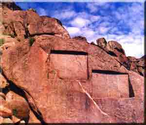
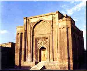
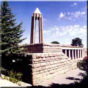
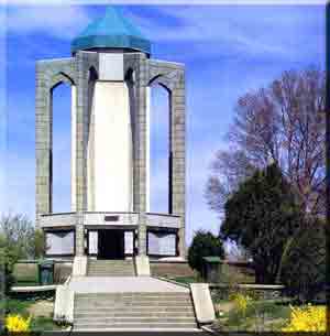
The most important historical monuments

 Mausoleum Of Avi cena, Mausoleum Of Baba Taher

Ganjnameh, Hagmetaneh Hill, Stone lion,

Alisadr Cave and mausoleum Of estru mardkhay.

Mausoleum Of  Baba Taher


Hosted by www.Geocities.ws

1