| So many places that you need to visited while you are here in the Las Vegas area. Mount Potosi N35 58.012, W115 30.126 |
| Great Places To Find in the Las Vegas area |
 |
 |
| Click on flage to return or globe to continue |
| Potosi Mountain can be reached by driving west from Las Vegas Highway 160 (Blue Diamond Road). From down town, drive south on Interstate-15 to the southern end of town and turn west (right) on Highway 160. Drive across the valley floor and start up the canyon into the mountains. Before reaching the summit of the mountain pass, turn south (left) on a graded dirt road towards the Boy Scout Camp. Travel pass the Boy Scout Camp and proceed pass Potosi Spring. Head toward the foothills of the western ridge line. |
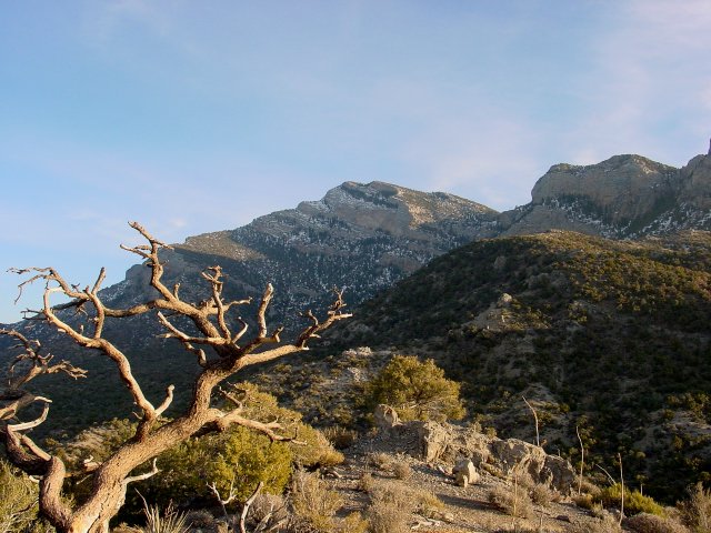
| In the southern part of the Spring Mountain range you will find Mount Potosi, (AKA Double Up Peak and Olcott Peak). The mountain range developed approximatedly 65 million years ago as part of the Keystone Thrust fault that extends north into Canada. The lower elevations (where precipitation is lowest and evaporation is highest), the desert is dominated by widely scattereed creosote ushes yaccas, and a few other desert scrubs. Slightly higher, but sill in the desert zone, the vegetation becomes more :lush" and diverse, and Joshua trees and agave become common. Higher up in the foothills, the desert woodlands start where pine and juniper trees prevail. Historically, lead ore deposits were found high upon a cliff in Potosi by prospecting Mormons living at the mission at Las Vegas in 1856. Early smelting developments were futile, for the lead proved to be uncooperative. In 1861-1863, the Colorado Mining Company set up a larger smelter at Potosi Spring, and silver mining operations were commenced. Potosi townsite was platted 700 feet below the mine by Capt. J.E. Stevens, which was then in northwestern New Mexico.Territory -- 100 miners made Potosi their home. The mine was found to contain a high zinc content and for 14 years zinc mining was conducted on a regular producing basis. A tramway was built to make the trip from mine to smelter easier. Activity slowed after 1920, although between 1925 and 1928 production was again running full bore. Potosi produced over $4,500,000 in lead, silver and zinc. |
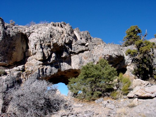
| Windows along the western ridge |
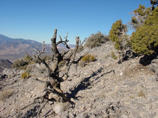
| Towards the peak |
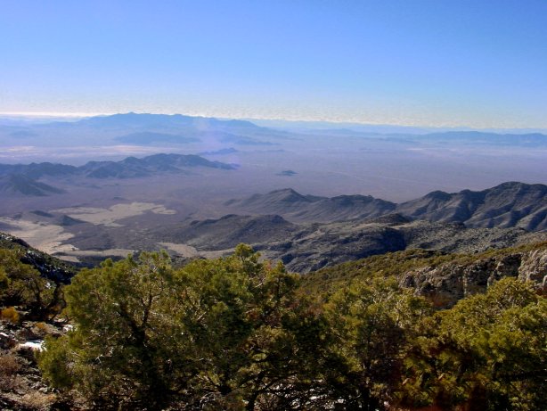
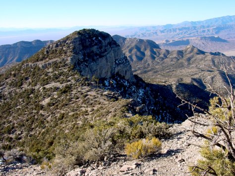
| Eastern view from Mount Potosi |
 |
 |
 |
 |
 |
 |
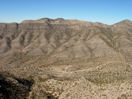
| View from the western ridge of Potosi Spring |
| Hiking up the western ridge line to the peak is rugged in several spots. There are two places with some steep rocks, probably 3rd class that you will need to negotiate on the way to the peak. Snow can be present from November through May. Take care while driving along the dirt roads. There are deer and donkeys ready to stubble across your path. While hiking you may notice the deer and donkey tracks along with cat tracks. Mountain lions are present in the area. Check out the following web sites for information about mountain lions: http://www.desertusa.com/may96/du_mlion.html http://www.dfg.ca.gov/lion/ It is best to hike in a group where mountain lions exist. |