


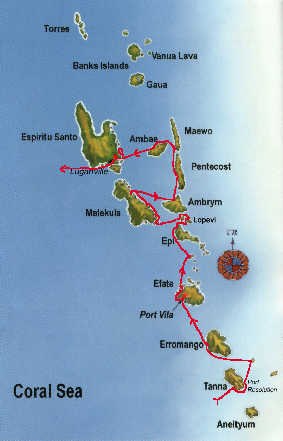
Vanuatu is situated 2500 km north-east of
Sydney (Australia). It is made up of 83 islands in the shape of a "Y", measuring
900 km from northernmost to southernmost point. Its total land mass is
approximately 13000 sqkm. The capital is Port Vila on Efate.
Vanuatu is placed right on the Pacific
Rim of Fire and many of its rugged, mountainous islands are volcanic. Earth
tremors are frequent and several of the islands (especially Tanna, Ambrym and
Lopevi) contain active volcanoes. East of Epi an active underwater volcano makes
the sea boil at times.
Vanuatu was formerly known as "New
Hebrides" and governed by a joint English/French condominium. On the 30th of
July 1980 the country became a Republic, gaining its current name and political
independence. But the french and british influences are still felt in many
areas.
Vanuatu has a population of about 175000
with a majority of Melanesian origin. Two thirds of the population live on the
four main islands Efate, Espiritu Santo, Malekula and Tanna. Vanuatu's
population is quite young with 45% under the age of 15.
A very strong emphasis is placed on
traditional customs to the extend that some villages reject western influence
altogether. But on the other hand, Port Vila has a very modern financial centre
and boosts its status as a tax haven.
The mainstays of Vanuatu's economy are
agriculture with its associated exports (coca, coffee, kava, copra, timber etc) together
with tourism and the financial centre.