St. Paul: Battle Creek Neighborhood
I was raised in St. Paul's Battle Creek neighborhood pretty much all (first 3 years in Oakdale-east suburb) my life. I visit my old neighborhood at least once a month to see family and friends. I currently (Sunday, August 19th of 2007) live in the small rural college "town" of Morris, located 2 1/2 hours (160 miles) a little north east of the Twin Cities. When I was in the cities earlier this summer, I decided to take some pictures of the neighborhood I grew-up...
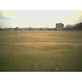
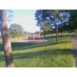
Battle Creek Middle School Playground (7+ total baseball/softball fields)
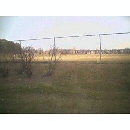
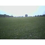
Below is a picture of the same field 1 month after with the recent late summer rain

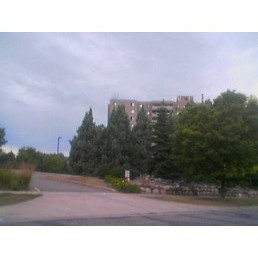
Pathways on the Park-Senior Apartments
The tall grey 13+/-story high-rise (down below) apartment buidling in a couple pictures above is a senior citizen residential complex
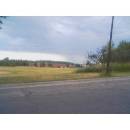
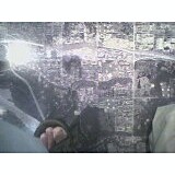
Coming from downtown St. Paul along Shepherd Road towards hwy 61 (going east)...


Suburban Avenue District


Battle Creek Regional Park (map)
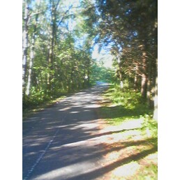
I had a week vacation (Aug 25th-Sept. 2nd of 2007) visiting family and friends back in my hometown. I wanted to begin as many of my days with some exercise, so I took rode my sister's colorful bike on the different trails of Battle Creek Regional Park . On Tuesday, August 28th-there has been some big storms, which a tree fell down and blocked the trail south of Upper Afton Road. I ended up going around it and rode the bike towards the Hwy 61 and Warner Road intersection.
Then on Thursday, August 30th-From Battle Creek Main Park on the corner of Upper Afton Rd. and McKnight Rd....

I took a different trail (Battle Creek Regional Park-East) I never went on before since it was first added years ago north of Battle Creek Park along McKnight Avenue. I love to explore new territories, so I went on this new trail going west torwards Woodbury...

Related Sites:
Explore Minnesota
Minnesota Off-Road Cyclists Home Page
Mississippi National River and Recreation Area, from nps.gov
"consists of 1,840 acres of natural area located just outside a highly developed urban environment. Extensive areas of woods, wetlands, and grassland attract many species of wildlife. Trails offer visitors the opportunity to see: deer, fox, herons, egrets and hawks along with the beauty of the vegetation. Picnic shelters are available with one large pavilion accommodating groups of up to 500 people. The pavilion and picnic shelters are available for reservations."
Reccomended Resources
Battle Creek Elementary-Middle School Years
Cultural
Diversity Make-up, from community data works
Government
Council Ward 7 (Map), from City of St. Paul
District 1
Sun Ray Library
History
EASTVIEW - CONWAY-
BATTLE CREEK - HIGHWOOD, from RCHS arthead
"The first permanent inhabitants were the Kaposia band of Mdewakanton Dakota Indians who lived in a large village near Pig's Eye Lake from circa 1775 until the early nineteenth century. By the 1820's the village had been relocated to near Dayton's Bluff. Later, circa 1838, a small group of French Canadian fur traders established a village at the northwest corner of Pig's Eye Lake, a site now marked by the Pig's Eye Sewage Treatment Plant (established in the 1930's). Although both a sawmill and a school were built at the village of Pig's Eye, the tiny community disappeared during the 1860's as inhabitants moved north into St. Paul.
During much of the nineteenth century the area served simply as a gateway to St. Paul, and was crossed by early roads -- Pig's Eye and St. Paul, Point Douglas and Fort Ripley, Hudson and St. Paul, and the Afton and St. Paul roads. In the 1860's railroad service reached the area as the Chicago, Milwaukee, and St. Paul railroad line was constructed along Point Douglas Road. In the late 1880's a second railroad, the Chicago, Burlington, and Northern, laid tracks through the area and linked it with St. Paul.
The construction of the Chicago, Burlington, and Northern railroad line occurred about the time the area was being annexed in three stages by the city of St. Paul (1872, 1885, and 1887). The new railroad line spurred a brief period of development in the area. In 1886 a syndicate of St. Paul and Boston businessmen formed the Union Land Company and purchased about 1200 acres of land in the Highwood area. They built two small railroad stations about one mile apart. A "commuter suburb" was planned with large rustic lots separated by curving roads which ran along the river bluffs. Although Burlington Heights, as the suburb was called, was linked to downtown St. Paul by rail lines and offered residents the advantages of country living, the development achieved limited success and only a handful of houses were built during the late nineteenth and early twentieth centuries. It was not until well after World War II when roads were improved and automobiles popularized that District 1 was settled extensively. Compared to the rest of the city, the district is still sparsely settled and 56% of its land remains undeveloped.
The Historic Sites Survey of District 1 identified relatively few houses still standing in the district that date from the turn of the century or earlier. Very few recognizable farmhouses were identified. The Survey did discover a few houses along Point Douglas Road which may date from the 1870's or early 1880's and are probably linked to that road's importance as an early route leading south from St. Paul. The most significant discovery in District 1 was about one dozen large, wood frame houses built during the late 1880's which were clearly built soon after the Burlington Heights commuter suburb was platted. About half of these houses are basically intact and many were obviously architect-designed. Several of the most sophisticated Queen Anne and Shingle style houses were designed by St. Paul architect Charles E. Joy, whose own house stands at 882 S. Point Douglas Road (no. 1). Other intact Victorian houses which were constructed as part of the Burlington Heights development stand at 55 E. Howard Avenue, 738 Point Douglas Road, 482 S. Point Douglas Road (no. 2), and 770 S. Brookline Avenue (no. 3). The remainder of District 1 contains bungalows, 1940's and 1950's tract housing concentrated in the northern portions of the district, and 1970's and 1980's split level and ranch style houses concentrated in the southern half of the district. District 1 has a few interesting examples of modern architectural designs."
Housing
-Apartments
Mc Knight Village Apartments
177 Mcknight Rd N
St Paul, MN 55119
(651) 735-5238
(directions
Apartmentratings.com
btaapartments.com
Forrent.com
"Apartments for rent in St. Paul, Minnesota. We offer one and two bedroom homes for rent. Visit McKnight Village and you know you are somewhere special! It's a unique combination of old world charm with all the modern conveniences. Handsome English designed buildings are nestled into the gently rolling landscape. McKnight Village offers a new kind of living with a two story health and recreation clubhouse as the focal point. You'll enjoy comfortable & spacious apartments plus the convenience of your own private club..."
rent.com
Map
*from the Science Museum
Battle Creek Highwood Neighborhood, from Wikimapia (like the map above)
Miscellaneous
St. Paul Neighborhoods, map included
Wikipedia
"A large, middle-class neighborhood on the southeast side of the city, featuring some spectacular views of the Mississippi River and Downtown Saint Paul. Traditionally a bedroom community for 3M, it's become much more diverse in the past 30 years."
Photos
St. Paul Photo Tour
Residential
St. Paul Home Guide
St. Paul Real Estate
-Townhomes
* 2080 Pathways Dr #E2
SAINT PAUL, MN
* $139,900
* 2 br, 1 full ba
*
Affordable One-Level Living! - You (from homes.com)
Return to Goodnews Minnesota: St. Paul Homepage