 Left home 9.30 am. I always leave home late, just late packing, turning off the heater etc.
Probable just reluctance to leave. I went by the Bells Line of Road, a good ride up over the mountains.
An early fast lunch at Mc Dougals in Lithgow, then a back road to Bathurst mixed dirt, good tar and poor tar.
Do not do this road near dusk as the vegetation is very close to the road and that could lead to a close
encounter with animals. This road is 3 km north of Lithgow, sign posted to Lake Lyell, then follow the signs for Tarana, once
there (a pub is the main focus) follow signs for Bathurst. From Bathurst by the Midwestern Highway to Hay.
I stopped over night in Weethalle, a small town just west of West Wyalong.
Weethalle is a one pub town, the pub has no accommodation, no dinner ...
the next towns (Rankins Springs) pub burnt down and is being rebuilt, when they get some more money together.
Lots of small towns are being slowly killed off. The small farms are being combined into larger farms,
larger tractors do the work of many people, less people means less demand on the local town so it shrinks too.
Oh, the large tractors get used for 2 months, costing $100,000+. No other industry would operate this way.
The motel cost $40 + $5 for light breakfast. They don't do much business, are motorcycle friendly,
but the lack of a good pub is a draw back.
Left home 9.30 am. I always leave home late, just late packing, turning off the heater etc.
Probable just reluctance to leave. I went by the Bells Line of Road, a good ride up over the mountains.
An early fast lunch at Mc Dougals in Lithgow, then a back road to Bathurst mixed dirt, good tar and poor tar.
Do not do this road near dusk as the vegetation is very close to the road and that could lead to a close
encounter with animals. This road is 3 km north of Lithgow, sign posted to Lake Lyell, then follow the signs for Tarana, once
there (a pub is the main focus) follow signs for Bathurst. From Bathurst by the Midwestern Highway to Hay.
I stopped over night in Weethalle, a small town just west of West Wyalong.
Weethalle is a one pub town, the pub has no accommodation, no dinner ...
the next towns (Rankins Springs) pub burnt down and is being rebuilt, when they get some more money together.
Lots of small towns are being slowly killed off. The small farms are being combined into larger farms,
larger tractors do the work of many people, less people means less demand on the local town so it shrinks too.
Oh, the large tractors get used for 2 months, costing $100,000+. No other industry would operate this way.
The motel cost $40 + $5 for light breakfast. They don't do much business, are motorcycle friendly,
but the lack of a good pub is a draw back. 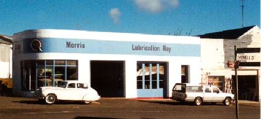 From Hay, through to Renmark then turned off the main Highway for a secondary road to Morgan.
Stay in one of the pubs for $25 + $12 say for food and beer. The other pub is for sale,
I don't think this sends a good message to clients. The for sale pub has few people in it.
From Hay, through to Renmark then turned off the main Highway for a secondary road to Morgan.
Stay in one of the pubs for $25 + $12 say for food and beer. The other pub is for sale,
I don't think this sends a good message to clients. The for sale pub has few people in it.
Leave the next morning for Port Pirie, via the Clare Valley. I pass through Eudunda , an old garage is being restored... BMC has long been out of business, the Morris and Austin brands have long been absent from Australia, yet the garage has been painted with these. The guy inside is happy to talk about the buildings, it having evolved from a watch makers and optician shop.
 He is going to paint the remainder in older signage of the Chevey era.
He calls himself the Austin A40 centre of Australia. And it looks like it.
A few other vehicles are here too, a '26? chevy that he wants to do up as a roustabout ?,
a 'Greengrass' (Heartbeat TV series) truck.
I leave after an hour, passing Marrabel with its' bucking horse statue.
As I pass through Saddleworth a car dumps its oil on the road in front of me,
the car pulls over some 150 metres down the road, I almost fall over in the mess.
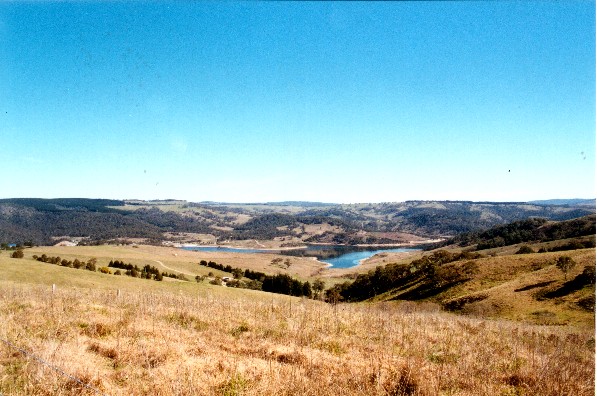
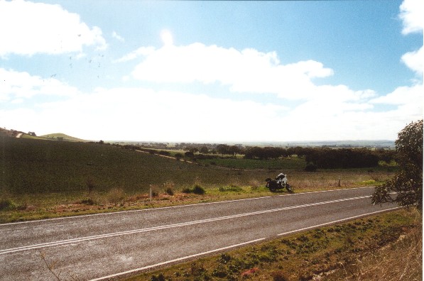
On to Clare a very pretty winery area. On to Wilmington
and Horricks Pass a twisty road over a small mountain range
(other countries would call these hills, here they are mountains compared to the surrounding country).
Down to Port Pirie for an overnight with PJ.
He is going to paint the remainder in older signage of the Chevey era.
He calls himself the Austin A40 centre of Australia. And it looks like it.
A few other vehicles are here too, a '26? chevy that he wants to do up as a roustabout ?,
a 'Greengrass' (Heartbeat TV series) truck.
I leave after an hour, passing Marrabel with its' bucking horse statue.
As I pass through Saddleworth a car dumps its oil on the road in front of me,
the car pulls over some 150 metres down the road, I almost fall over in the mess.
On to Clare a very pretty winery area. On to Wilmington
and Horricks Pass a twisty road over a small mountain range
(other countries would call these hills, here they are mountains compared to the surrounding country).
Down to Port Pirie for an overnight with PJ.  Mc Ardel arrives late, due to from wheel bearing failure.
I notice some oil spots on the rear of the panniers but don't find where they come from.
Off the next day to Ceduna, I take two Degrees of Confluence (the Degree Confluence Project; http://www.confluence.org/index.php),
the basic idea is to have a collage of pictures of the earths surface
taken from the earths' surface at each point that the integer latitude and longitude cross.
I make two of these today, fairly easy to find. The first is NorthWest of Kimba 33S 136E,
with the number of tracks around here I had trouble selecting the tracks I wanted.
Mc Ardel arrives late, due to from wheel bearing failure.
I notice some oil spots on the rear of the panniers but don't find where they come from.
Off the next day to Ceduna, I take two Degrees of Confluence (the Degree Confluence Project; http://www.confluence.org/index.php),
the basic idea is to have a collage of pictures of the earths surface
taken from the earths' surface at each point that the integer latitude and longitude cross.
I make two of these today, fairly easy to find. The first is NorthWest of Kimba 33S 136E,
with the number of tracks around here I had trouble selecting the tracks I wanted.
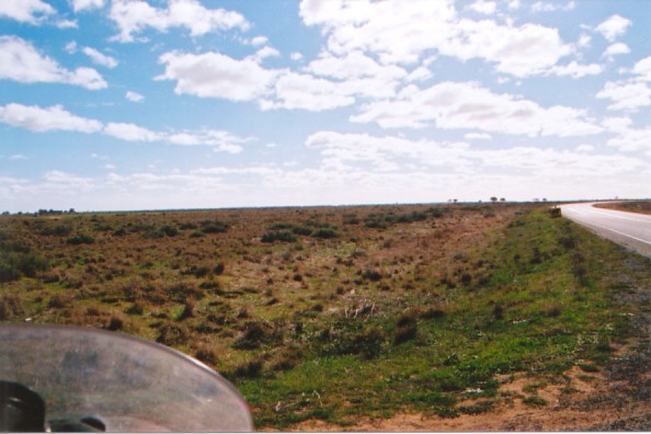
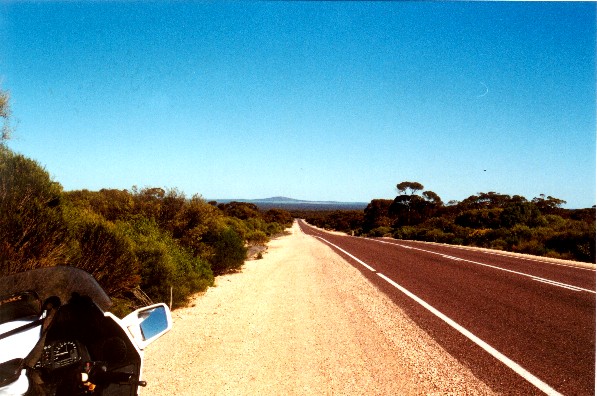 This is sandy country, the ridges are yellow sand with redder and harder packed sand on the flats.
Some whitish rock out crops occur here and there.
The tracks are all dirt but in good condition with out much sand or corriguation (USA = washboard).
Found it and took a different track back through the Pinkawillinie Conservation Park, a
change from the farm land I came through.
The second one 33S 135E is just off the tar road from Port Kenny to Pygery on the edge of a salt lake.
It is in the middle of some low scrub, making an uninteresting photo but it is typical of the native vegetation.
This is sandy country, the ridges are yellow sand with redder and harder packed sand on the flats.
Some whitish rock out crops occur here and there.
The tracks are all dirt but in good condition with out much sand or corriguation (USA = washboard).
Found it and took a different track back through the Pinkawillinie Conservation Park, a
change from the farm land I came through.
The second one 33S 135E is just off the tar road from Port Kenny to Pygery on the edge of a salt lake.
It is in the middle of some low scrub, making an uninteresting photo but it is typical of the native vegetation. 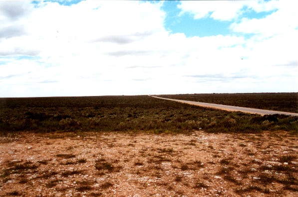 Over night at Ceduna, I notice more oil, this time towards the front of the bike, I finally remember the car with the oil spill and link the two facts together!
The next day I back track to the third confluence point NorthEast of Ceduna 32S 134 E, finding the property owner and his wife mustering the sheep down the road. He tells me that I am on a camel pad of the 1800s and that an afghan owned the property to the early 1900s. The actual confluence is some 20 meters off the camel pad, that the north east corner of a field. Back to the tar and the nullabour, it is still the same or at least as close as I care to remember from my 1990 trip across it.