Robert Louis Stevenson State Park
Distance: 10.6 miles round-trip/6 hours Level: Strenuous
Elevation Change: 2,100 feet Rating: * * * *
Directions: From Highway 29/128 in Calistoga, turn north on Highway 29 and drive eight miles (through the town of Calistoga) to the signed trailhead. Park in the pullouts on either side of the road. The trail begins on the left side of the road.
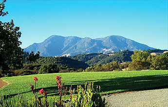
Normally a trail that is 80 percent fire road would not interest me in the slightest. But the spectacular view from the top of Mount St. Helena makes the climb on its wide, exposed road completely worthwhile. And unlike other Bay Area peaks bearing world-class vistas like Mount Diablo and Mount Tamalpais, Mount St. Helena has no public automobile access to its summit. Its view must be earned with some effort.
For the best possible trip, pick a cool, clear day in late autumn, winter, or spring�forget the hot days of summer. Then pack along the finest picnic lunch you can put together, drive to the trailhead, and start climbing.
At its start, the trail is called the Stevenson Memorial Trail, named for author Robert Louis Stevenson. He and his wife honeymooned at an abandoned mine site along this trail in the summer of 1880. The first mile consists of well graded single-track through a densely wooded canyon. Except for some road noise from the highway below, this stretch is a delightful stroll past giant madrones, bay laurels, Douglas firs, and black oaks. The switchbacks are plentiful, making the ascent easy. Enjoy the good trail and the shade, because both will come to an end in short order.
Three-quarters of a mile from the start is a stone monument marking the spot where the Stevensons honeymooned. Lacking the finances for a fancier vacation, the Stevensons camped here for a month in an old cabin, using hay for bedding. During their rustic holiday, Stevenson took extensive notes on both the mountain landscape and the couple's camping experience. These scribblings later became the basis for his book The Silverado Squatters. Mount St. Helena was the model for Spyglass Hill in Treasure Island.
At the monument site, hikers say farewell to the shade and single-track. Shortly beyond it the trail joins Mount St. Helena Fire Road. Turn left on the road (one of only two junctions on the entire route). Take a look around id note the terrain change. You're surrounded by big knobcone pines and manzanitas now, on a wide, exposed track with views of the Napa Valley.
Keep climbing. At a major switchback at 1.6 miles, you reach Bubble Rock, where rock climbers strut their stuff. The grade is surprisingly moderate, and the miles go by quickly (provided you aren't hiking on a hot day). Visual rewards are doled out long before you reach the summit; 1 you gain open vistas of Napa Valley, the Vaca Mountains, Lake Berryessa, Hand the volcanic rock of the Palisades at several points along the road.
The route's second major junction shows up at 3.1 miles, along the ridgeline of Mount St. Helena. The road to the left leads to South Peak, a lesser summit at 4,003 feet. Continue straight for the mountain's higher summit, but not without first oohing and aahing over the vista from this saddle. This is your most expansive view so far.
Save your film, because now it's less than two miles to Mount St. Helena's summit at 4,343 feet. When you reach the top, pay no attention to the buildings and microwave equipment. Instead stroll around and take in the amazing 360-degree scenery. There's Lake Berryessa and the Sierra Nevada to the east. To the southeast lies Mount Diablo, 60 miles away. Most impressive of all�and this is the part that gives the whole trip an A-plus grade�is the clear-day view of Mount Shasta to the north, nearly 200 miles distant. Often Mount Lassen is visible as well, with 7,056-foot Snow Mountain in the northern foreground. Pull out a map of Northern California, a pair of binoculars, and your picnic lunch.
You may notice some odd-shaped rocks under your feet on the northwest side of the wide summit. If you have visited Devils Postpile National Monument in the Eastern Sierra, you'll recognize them�they're the five-sided tops of lava columns. Although Mount St. Helena is composed of volcanic rock, it's not a volcano. It's part of a large, ancient lava flow.
One more tip on climbing Mount St. Helena: Every winter, usually during the coldest
days in December or January, the peak receives a thorough dusting of snow. If you can keep your eye on the winter weather and take off on a moment's notice, you could have the exhilarating experience of climbing mighty Mount St. Helena when it is snow-covered.
Options
Another favorite trail at Robert Louis Stevenson State Park begins at this same trailhead and explores the nearby volcanic tablelands. Take the Table Rock Trail from the opposite side of the parking lot. You'll climb through a series of switchbacks and then cross Garnett Creek. At 2.2 miles you reach Table Rock, a 200-foot-high, sheer volcanic cliff. Turn around here for a 4.4-mile round-trip, or take the Palisades Trail fork that you passed 100 yards before Table Rock. This rugged trail skirts the base of the fascinating volcanic formation known as the Palisades. Hike as far as you please, then retrace your steps. Some hikers follow Palisades Trail 3.9 miles to Oat Hill Mine Trail, then take that trail 4.5 miles downhill to the town of Calistoga, where they have a car shuttle waiting. Even with a shuttle, this is a long, 11-mile trip with some gruelingly steep downhill sections. Your knees may not appreciate it.
Trip Notes
There is no fee. Dogs are not allowed. Bikes are allowed only on fire roads. Trail maps are available at Bothe-Napa Valley State Park. For more information, contact Robert Louis Stevenson State Park c/o Bothe-Napa Valley State Park, 3801 St. Helena Highway North, Calistoga, CA 94515, 707/942-4575 or 707/938-1519, website: www.napanet.net/~bothe.