Ko Wairoro te Awa, Ko Takauera te Taniwha, Ko Te Ra te Tangata,
Ko Te Aranga Hou Te Marae
The central location of the lake is captured in the whakatauaki:
"Te Pu o Te Wheke."
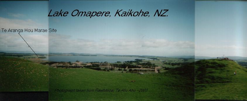
On the western shore of this lake lies a marae site - known by legislating bodies as 'Omapere x".
History of Te Aranga Hou Marae Reservation
The early history of this Marae Reservation is rather sketchy as the early records, minute books etcs were lost in a house fire, but what is known is as follows.
The reservation is surrounded by the following mountains:
Putahi, Maunga Taraire, Maunga Karoro, Whakariki, Whakarongorua, Okaihau, Puketi and Te Ahu Ahu.
And by the rivers:
Te Awamutu, Waitanumia, Ngaruawahia, Whakahoki, Te Rui o te Toka or Te Kauha.
Some of the Hapu:
Te Popoto, Uri Taniwha, Te Uri-o-Hua and others (which are many).
Part of the land came from a 4 acre section partioned off by Te Ruhi Anihana and 10 others, previously known as Omapere 1B2A. The other part came from Omapere Z - it was previously known to the Maori Land Court as an eeling reserve. This combined block was called Omapere X.
Next Page