General Reference Maps
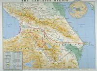
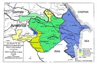
The map of the Caucasus
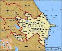
Azerbaijan map from Encyclopaedia Britannica
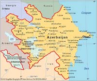
Autonomous entities and towns of Azerbaijan.
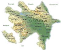
Topographic map of Azerbaijan
List of Maps |
The map of the Caucasus |
Azerbaijan map from Encyclopaedia Britannica |
Autonomous entities and towns of Azerbaijan. |
Topographic map of Azerbaijan |
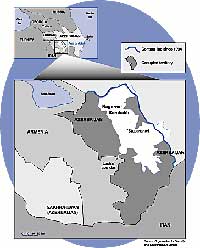
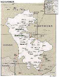 Map of the former Mountainous Karabakh Autonomous Region (MKAR) |
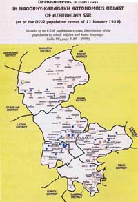 Ethnic composition map of the former MKAR |
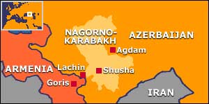 Small reference map from BBC |
 Map showing the consequences of war. |
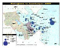 Map showing the refugee and IDP settlements in Azerbaijan. |
 Map of the occupied territories and the line of contact from OSCE |
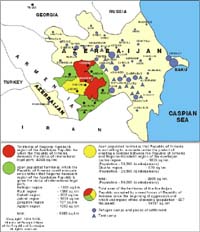
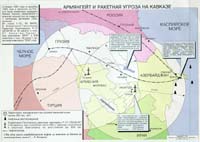 Armenian missile threat in the Caucasus. |
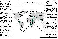 Countries with highest IDP population per capita. |
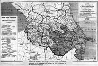 Map of the Azerbaijan Democratic Republic (ADR) and the Caucasus in 1919. |
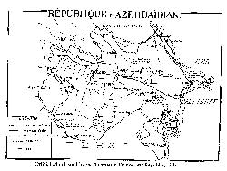 Official map of the ADR. 1919. |
 Map of the ADR (1918-1920) issued in 1920 (colour. ed.). From Karabakh.org |
Another war or further negotiations?
Express YOUR opinion!
| Home | Resources | News | Maps | Links | Voting | Contact | Search |